Tuesday 21 September 2021 – Fuck me, what rain! Oh, and wind!
Much of what follows is a long moan about the utterly, cataclysmically shitty weather we had to stumble through today. So you can avoid several paragraphs of my moaning by watching the route and photos on Relive. But you’ll get a lovely dose of schadenfreude if you read on instead.
There had been a few straws in the wind about possible rain today, and so I looked at the various weather forecasts available to try to understand how the day would play out. The UK Met Office suggested heavy showers with possible thunder; the Spanish website suggested by the Cami360 folk forecast grey skies with some rain.
They were both wrong; and I’m never going to trust the Spanish site again. Based on its more sanguine forecast and the choice of available dry socks I decided to go out in the running shoes which had proved so comfortable for walking in during the first five days of the trail.
This turned out to be an unwise choice.
Our pick up time at the hotel was 0830, for a lift back to Cala Morell, where we would start a 20km walk of easy grade – two stages of the trail, 9 and 10 – leading back into Ciutadella, where we were staying. In our visualisation the day before, we thought we could have a nice easy walk to the outskirts of the city, where we could see lots of restaurants and bars, and stop for a Nice Lunch before tottering back to the hotel to sleep it off.
This turned out to be wrong on almost every level.
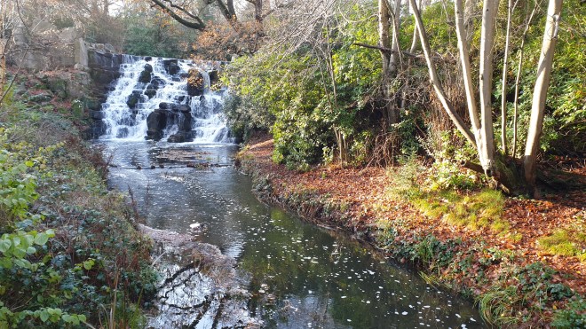
Deposited at the Cala Morell necropolis, we thought we might as well check out the one cave we hadn’t seen the day before; and very impressive it was, too.

Then we moseyed on to the start of the day’s first stage and set off along what looked like a reasonable path – maybe a bit rocky, but surely not too bad.

There was something of a sharp shower of rain, but it passed soon enough, and we carried on our way, amid some great light and bidding farewell to Cala Morell.


There was even a rainbow, nicely framing a stone hut, to wish us on our way.

I noticed a slightly ominous-looking cloud formation that clearly was carrying rain, but thought that the wind would carry it away from us.

Reader, I was wrong.

From this point, it basically hurled it down with rain for the next four hours. Occasionally, the rain’s ghastliness was amplified by gale force winds, the only redeeming feature of which was that these came from approximately behind us (over the course of the day we met several groups coming the other way along the trail who had therefore to walk into hissing rain and lashing gales; our combined misery was such that we didn’t even spare the energy to acknowledge each other’s existence). The mix was leavened by the odd occasional flash of lightning and crack of thunder, much of it quite loud.
The rain was bad enough. We had shower-proof jackets with us, which weren’t rated for a category 5 rainstorm. The occasional periods of gale force wind made things worse. But what really made progress not only miserable but even somewhat unsafe was the surface. The rocks became slick, the ground turned to slippery mud, and the general misery of the weather was compounded by the general fear of taking a tumble on the rocks. (I did slip and fall once, but “only” into a mud bath; it could have been much more serious.)
Yes, there were sights along the way:

stone huts, presumably used for storing food for farm animals;

caper bushes amid the rather bleak landscape;

a load of rocks with a cross on top (which, later reading showed, commemorates the wreck of General Chanzy’s steam boat in 1910 with only one survivor, but at the time I could frankly have cared neither one jot nor one tittle about);

a sight of the lighthouse which signalled the end of the first stage (dear God! is there another one to do as well?);

and some sheep, sensibly heading for shelter in the lee of a wall near the track.
But mainly, there was the rain, which by this stage had turned the path into a small river.

(I have video proof of this, but my soul rebels at the task of uploading it somewhere to share with you; just use your imagination, OK? And stop laughing, will you? It’s not funny. No, it’s not.)
By the time we got to the end of the first stage

the road leading to the lighthouse had become a river in flood. Jane had suggested that we go and take a look at the lighthouse, but I demurred as politely as I knew how at the time, which was to say “Fuck off”.
The ghastly bloody mud-and-rocks path carried on past a few other sights.


We think this was a Naveta, something the Talaoitic-era folk used as a burial chamber, and which had possibly been modified to use for animal feed. But it was clear that The Authorities didn’t want anyone exploring it, as any possible entrance hole was blocked; it was also (had I mentioned this?) raining, which lessened my interest in further research.
By this stage, I had completely lost interest in taking photos as we went along, or indeed in anything other than simply getting into Ciutadella and outside a stiff drink, but Jane, bless her, took some shots of one or two things as we went by:

another stone hut;

a rather impressive rock arch, Pont d’en Gil;

and the outposts of civilisation, at which the heart leapt, for two reasons – there were only three miles to go, and it would be on lovely smooth tarmac. It would also, according to our original plan lead us past several possible refreshment stops, but since we were soaked to the skin and (certainly in my case) frozen to the marrow, this seemed a less tempting proposition than it had the previous evening.
Also: we had reached the “beach communities” outside Ciutadella, similar in principle, if you’ve ever been there, to Palma Nova on Mallorca or the cheap end of Paphos on Cyprus.


The restaurants and bars were (a) not very tempting and (b) unsurprisingly quiet.
The rain had obviously taken the local drains by surprise.

Eventually, the walk led us to some coves and inlets close to the city, such as Cala en Brut,


(which, incidentally, was the scene of further evidence of how unexpectedly heavy the rain had been, even if it was now easing to the point where I was prepared once more to take photos

I call this “wet stonewalling” and the policeman didn’t want me to take any photos. So I reassured him by gesture and smile that I hadn’t.)
Playa de sa Farola

(you can see, in the distance, the ferry which brought us to the island a couple of years ago and started this whole thing off)
and Cala en Busquets.

And then we were right at the outskirts of the city itself

and then could cop an eyeful of the great view over the old town.

This was the end of the stage, and so all we had to do was to get ourselves to our hotel and hose off the accumulated mud, blood and weariness of the day. We had covered 12.83 miles, or very nearly 21km, in five-and-three-quarter hours, which, given the conditions and the fact that neither of us sustained any serious injury was pretty damn’ impressive. Yes it was.
Having shed the worst of the day’s detritus, we headed out to find some lunch and had some tapas at a place called, rather unnervingly, Es Pou; but it was nice food, good coffee and lovely gin. Of course, by this stage, the weather had changed.

and long may the sunshine last (although I’m not too optimistic about tomorrow). When we got back to the hotel, there was a lovely vignette of a balcony across from ours where a bunch of Spanish ladies were gathered having a good old gas among their rain-soaked clothing as it dried around them.

And thus the day came to an end.
- 12.83 miles, or 20.66 km covered
- 223 metres ascent, none of it actually steep, but all of it wet
Cumulative distance is therefore some 72 miles in seven days. We’ve now covered the top half of the island and come half way round, from Mahón in the east to Ciutadella in the west. Tomorrow we start on the southern half – a series of longer but less arduous days. Officially our next stage is just 13km and the forecast is for some rain, but not, we hope, the biblical floods we saw today. I’ll finish with the answer from the Cami360 team when we asked them about tomorrow’s weather: “The weather for tomorrow is similar to today with showers and localized storms. We hope that not like today”.
Amen to that.
Please come back then and find out how the day developed.