Tag Archives: Surrey

Day 5 – Cami To The Garden, Maud

Cami-flage Day 5 – Tuesday 15th September 2020

I shan’t bore you with the weather comparison between Surrey and Menorca today – suffice it to say that the two were pretty much comparable, with the sun shining in both places and Mahon (30°C) simply being warmer by 4°.  So the conditions were set fine for a fine walk around Virginia Water Lake with a sideways shuffle into the Valley Gardens (the justification for today’s headline).

Here’s an outline of the walk, which lies just north of the A30 and the Wentworth estate (the golfers among you will know where that is, of course). Being largely beside a lake it’s rather unsurprisingly rather flat

but full of lovely greenery and scenery.  The basic walk around the perimeter of the lake is some 4½ miles, and we expanded it by around the mile necessary to match the Menorca equivalent by wandering into the neighbouring Valley Gardens.

Along the path one sees a variety of things from majestic trees right down to rather engaging  things you can make from them.

Shortly after the start of the walk, there’s a pond called Wick Pond, which is normally very pretty, but today it was lifeless and covered in algae.  However, there was one attractive thing about it.

We may be halfway through September, but Summer is not yet dead (though Autumn is on its way – see later).

The next landmark is the famous Totem Pole, not an item you normally expect to find in Surrey.  But there it is, and there was nothing for it but to show it to our gin bottle.

Incidentally, the chap at the top looks rather as if he is scared of heights.

Walking along towards and into the lovely Heather Garden, one could see the first stirrings of approaching Autumn.

and the colours can be wonderful.

The Heather Garden is always a pleasure to visit at any time of year.  You can always find pleasant scenes.

(We can’t decide whether to call the above Dougal or The Very Hungry Caterpillar.)

We mooched about afterwards in a wooded area on the way back to the waterside

and I tried my hand at a true photographic cliché.

after which we made our way around the far end of the lake where it would have been rude not to stop for tea and cake.

Just before the café the path crosses a five-arch bridge, which you can’t see at the time, since you’re actually on it.  But you can get a nice view of it from the later path and this seemed a good excuse to get the gin bottle out again.

On the home stretch, there’s another item which one wouldn’t normally expect to find by a Surrey lake – Roman ruins.

Leptis Magna was a 2nd century Byzantine city.  Bits of its ruins were transported to Surrey in the 1800s. Whatever, it made a good backdrop for yet another gin bottle photo.

The final landmark came as a bit of a shock.  Again, somewhat counterintuitively as you walk alongside a lake, there’s a fairly substantial waterfall called, somewhat less counterintuitively, the Cascade.  It’s normally very photogenic, as you can see from a photo I took there about a year ago.
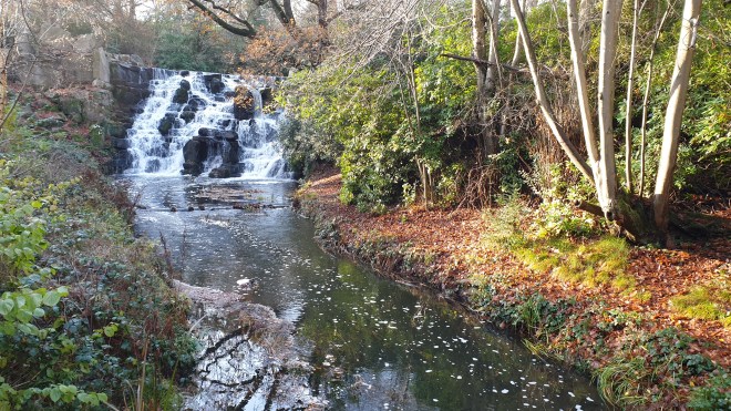
But today…..

It looks as if something fairly horrible has happened – trees have been cut down, perhaps because of storm damage earlier in the year, and the water supply is either inadequate or has been cut off whilst work is carried out.  In any case, it’s a sad scene.

It was a shame we couldn’t end our walk with a great scene, but the rest of it was very pleasant – a nice walk in splendid scenery in agreeable weather, plus ice cream, tea and cake.  What, as they say, is not to like?

And so ended the walk on day 5 of our Menorca substitute holiday.  We will be back in the neighbourhood again tomorrow, walking around Windsor Great Park; a somewhat longer walk after which, as a reward, we will have a Nice Lunch.  We’re looking forward to it and hope that we can virtually enjoy your company, too.  See you tomorrow!


Day 4 – Cami-knickers

Cami-flage Day 4Monday 14th September 2020

The obligatory weather comparison showed very little to choose between Surrey and Menorca; in either case we would be walking in the heat of the day.

We had some domestic admin to handle (to do with a septic tank – better not to ask, really) before we could go walking. Today’s walk was shorter than some, but more intense than others, involving climbing a couple of hills.

So it was just after 12.00 when we mad dogs went out into the midday sun, starting from a car park, engagingly called “Walking Bottom” (the rather tenuous justification for the title of this post).

The track leads from the car park, down into the rather pretty village of Peaslake.

Normally, Peaslake is absolutely awash with cyclists, as it’s in the Surrey Hills, and thus attractive to the MAMIL road cyclists; and also at the foot of Pitch Hill, hence a magnet for the grunge of the cycling world, mountain bikers. But today, the village was quiet and pleasant.

The downhill track into the village transforms swiftly into an uphill climb out of it.

(that’s me down the path, using the need to take a photo as an excuse to have a breather).  Once up the climb, the track takes the form of the sort of woodland and heathland trails that are familiar to anyone who has walked in this part of Surrey – and, I hope, to you, dear reader, as you will have been following these posts closely, of course, won’t you?  Good.

We passed a couple of ponds

neither of which were bounteously supplied with water, and one even looked entirely dry, a consequence of a very dry Spring and Summer round these ‘ere parts.

The next part of the track leads into what the Fancy-Free Walks website describes as a “delicious veldt”.  Indeed, when we first did this walk (several years ago, now), that’s exactly what it was.  It’s a bit overgrown now…

…but has some lovely clumps of heather and some interesting-looking fungi.

An inexorable climb for another couple of kilometres brought us to the top of the first hill, Holmbury Hill.  You’ll have seen the gin bottle photo from day 2, of course.  The views are quite spectacular.

but there were people there, so we moved on to a place a little further down where there is an access path for those of different ability and a rather nice little seating circle.  I whizzed the drone up and took a photo or two.

and then we headed down the path to the bottom of Holmbury Hill

to the start of the ascent up the next hill, Pitch Hill, which is marked by the rather fabulous buildings of the Duke of Kent School.

We thought it would be nice to exhibit our gin bottle here, so despite the signs saying that photography was prohibited, we took a quick snap.

and then moved on to the track, which goes up

and up, and up

and up and up and up and up. And up.

until eventually we got to the top of Pitch Hill.  The view repaid the effort.

and we took a couple of photos of the gin bottle as well, using the handy trig point as a plinth in one case

before heading down.  The route down bifurcates and you can choose the “high road” or the “low road”.  Our opinion is that the low road is more interesting,  Actually, they’re both just wide forestry tracks, but there’s more peripheral scenery on the low road.

And this took us back to the car, some 6.81 miles after we left it (by comparison, the Menorca equivalent would be 6.77, so we’re still ahead of the game).

Like all of the walks we plan, this is a nice one.  It can be quite hard work in places, but the general scenery and the hilltop views are lovely.  Of course the fact that it was a sunny day helped enormously.

Tomorrow’s walk sees us leave the Surrey Hills for a couple of excursions around Windsor Great Park.  We’re looking forward to circumambling Virginia Water Lake tomorrow, so please join us – same Cami-time, same Cami-channel – to see what the day was like.  ‘Bye for now!


Day 3 – Cami by the back door – Chobham Common South

Cami-flage Day 3Sunday 13th September 2020

Real life of a sort intruded on our Menorcan recreation project, but in a good way: we needed to get over to see some friends for lunch and so it was part planning and part fortune that today’s route was a short one – some 6 miles – which meant we could leap out after breakfast, get the walk done and then lunch elsewhere, rather than making lunch or other refreshment part of the walk. So we had chosen a nice local walk over Chobham Common, just the other side of the village from us; the original plan had us stopping for a glass of something in the Red Lion in Chobham, but our subsequent lunch plan means that that will have to wait for another day.

First, the all-important weather comparison between here and Menorca.  I may not carry this meme along too much longer, as the story it tells is quite consistent – it’s hotter there than here

and actually, that’s fine – walking in 20-odd degree temperatures is much nicer than 30-odd degrees.  Whatever, it was a beautiful late Summer/early Autumn morn for our walk.

We’ve lived in these ‘ere parts for nigh on 30 years, and for the first incurious twenty or so we would occasionally treat ourselves to “a walk on the Common”, which we struggled to make longer than five miles before running out of Common to roam across. It gradually became clear that we’d been limiting ourselves to just one part of the common – the part north of the M3 (between Lightwater and the M25 junction). It was only recently that we sought out a route which enabled us to explore the south side of the common, and then it became clear how much larger and more delightful it is than we had realised.

Here’s an outline of today’s walk, 6 and a half miles around the periphery of the south side of the common. The M3 runs across the top in this picture.


As yesterday, the fact that it was a weekend bore heavily on the popularity of the car park.

This is despite the efforts of the local council, who have made the entrance quite a tricky thing to negotiate in anything larger than a go-kart.

(The blocks were originally set there to close the car park during early lockdown, but I wish they’d moved them a little further apart once this had eased.)

Anyway, once on to the walk, the early parts have scenery similar to the north side which is so familiar to us

but this soon changes to a different kind of terrain.

One of the things that marks this walk out is its variety.  Where the north side is largely open heathland, the south side (as you will see if you can bear to keep reading) has a huge variation in surroundings.

A bit further on, the trail heads down and one begins to get some kind of idea how big the south side actually is.

(It’s actually quite difficult to convey in a single photo – but the common stretches from left to right horizons and suddenly seems quite imposing.)  In the distance you can see the latest building efforts going on to drag Woking into the modern age.

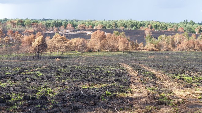
And every so often you can see evidence of the fires the regularly sweep the common in summer.  Here you can see that regrowth is under way.

(Fires on the common are regular occurrences, but the north side was badly hit by a huge fire in summer 2020

and here you can see the demarcation line where the fire services stopped it in its tracks.)

Sorry, back to the mainstream of today’s symposium.  The trail leads by the fringes of Gracious Pond, once (up to the 1800s) a 50-acre pond, but now drained and a closed sanctuary and nature reserve

and the terrain changes again, into woodland.

with mystery objects such as this moss-laden “fairy ring”

and occasional shelters – we’re not quite sure of the provenance of these; are they official or have schoolkids been out on a field trip or something?

and occasional groups of horse riders might be glimpsed through the trees.

The track then continues on to a secret delight of the common

Fishpool – a really lovely body of water – we will return for a more detailed (I hesitate to say in-depth) look later in the Cami-flage endeavour.  This seemed like a perfect scene to show our gin bottle.

The roads hereabouts play host to some lovely houses, like this one

and it becomes clear that Chobham is home to some serious horsey business.

Much of this is based around Chobham Park Farm

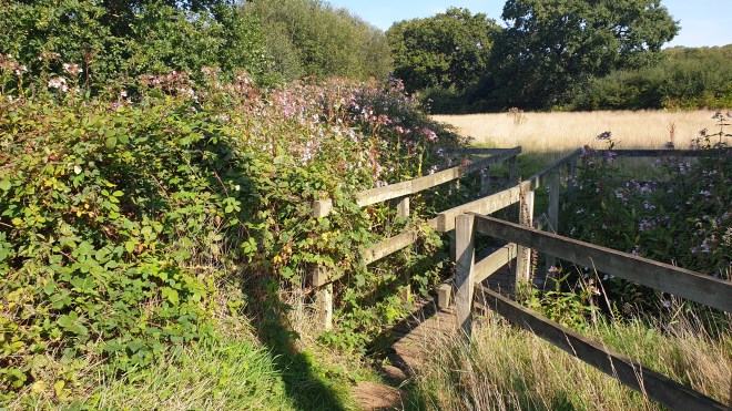
where they have many fields and horses, and also something of an issue with Himalayan Balsam, which they need to sort out pronto, before it gets even more established.

The track carries on through woodland, past some truly wonderful properties

and eventually debouches on the northern fringes of Chobham village, where you can find a village green and the Four Horseshoes, a decent gastropub.

The buildings in these parts of the village are very attractive.  Just beside the pub is a (posh) restaurant called Stovells,

and there are some really attractive cottages further up the road towards Sunningdale.

At this point, it’s entirely possible to miss the trail, unless you know about the footpath, which leaves the road just beyond this fence

and leads into another little world of tracks and heathland

The track then crosses Staple Hill road and goes up the rather oddly-named Chickabiddy Hill

and back into the more familiar open healthland

before heading back to the car park where we started.

This is a lovely walk, showing off the range and variety of Chobham Common.  On a day like today, sunny and warm, it’s a delight to walk around.  We covered 6.34 miles today, thus exceeding the Menorca equivalent, which was 5.94.  So we are, as it were, ahead of ourselves on the overall distance travelled (so far, over 28.5 miles).

Tomorrow sees a walk that is little longer but somewhat more challenging, up Holmbury and Pitch Hills.  So please join us as we pant our way up and down parts of the Surrey Hills.  See you there!