Tag Archives: Surrey

Day 8 – Cami in, the water’s lovely!

Cami-flage Day 8 Friday 18th September 2020

Because today’s walk was along local paths, we had the luxury of a leisurely start; so different from our normal holidays, when it seems we have to be up early to be getting on with whatever has been set up for the day. So in our very comfortable and eerily familiar holiday hotel room, drinking the Right Sort Of Tea, we could think about the forthcoming walks and set about important planning activities, i.e. booking pub lunch spots. Just as well we did, as we discovered one pub wouldn’t be open on the day we passed it.

We were also able to check on the weather outlook, both for Surrey and Menorca. Today promised to be sunny in Surrey and cloudy in Menorca (though eight degrees warmer there) and generally speaking the prospects for our part of the UK are more conducive to enjoying the walks. We’ve been lucky so far; let’s hope our luck holds.

Plans laid, breakfast and coffee consumed, we set out on today’s walk. Because it’s close to my home, and close to my heart, this is a long post, but I hope you’ll bear with me for this one.

On this map, the village of Chobham is the cluster of habitations toppish leftish.

We have a pubic footpath going through our front yard (long story, blame the people who owned the place before us) and we really can start the walk from our front door. The path is basically fine, but gets a bit overgrown in places in the summer

and shorts are not a wise clothing choice for this nettle-strewn section. The path goes through a wholesale nursery called Daydawn
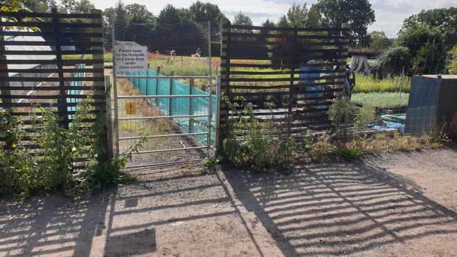
which I’m glad to say is recovering after really suffering during the pandemic lockdown. They now have areas with plants waiting to be delivered to other nurseries

but there are also remnants showing how bad it got during the lockdown, which was disastrously timed for the plant industry.

The path then goes through an area called Deep Pool. Here is the eponymous pool, which, despite stern warnings, is not at all deep, largely due to the dry weather we’ve had of late.

By comparison, here’s how it looked after Storm Dennis whistled through in February of this year.

Similarly, just along from the pool is a bridge over the local river Bourne, which looks idyllic on a quiet summer day.

But in the February rains, it was submerged at times. For a long time, the water level was very high, lapping at the bridge spars, as shown in this photo.

The path continues through to Horsell Common, which has borrowed some cattle to mow (moo…?) the lawn.

They can be found at various places in the wide open spaces of the common.

The common is popular among local horse riders

and is generally a nice place to walk, with attractive woodland paths.

This one goes past an example of the shelters which have cropped up on this and Chobham Commons. I don’t know what their provenance is; perhaps the local rangers are practising their forestry skills or something?

Along a bit further, our path took us by a café called Heather Farm, just by some wetlands that are run under the auspices of the Horsell Common Preservation Society. It’s a popular café, but any temptation we might have felt to pop in vanished as we saw the size of the pandemic-mandated queue. “Perhaps later”, we thought.

We crossed the common heading, on well-made paths, for Fairoaks Airport. There are bridges and streams, just made for doggy-paddling on such a lovely summer’s day.

Again, I thought it worth comparing the view from one of the bridges today

with how it looked last February.

As we approach Fairoaks, I’m always amused by a sign that one can just about pick out in the shrubbery

(here is it is, in more detail) .

To quote Michael Flanders, “there’s not much you can do about this. Maybe take your hat off?”

The path goes right by the airport and it’s not unusual to find a couple of plane spotters watching the action, as you are very close to light aircraft going in or out (depending on wind direction). We stopped for some moments to watch the fun as aircraft came in

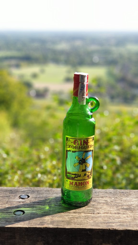
and take a gin bottle shot.

The route took us onto the western end of the airport and Jane reminded me that there’s a café there. Given my strong feelings about not walking past an open café on a hike, we felt it absolutely essential to make the short detour for tea and cake. The facility is basic,

with commensurate pricing, but it’s a reasonable place to have a cuppa on a sunny day,

admire the view of the distant building work in Woking

and take another bottle shot.

We then crossed the road and headed towards Chobham Common, through an area called Stanyards, mainly because of Stanyards Farm

(which has an orchard with some lovely-looking apples ripening)

and Stanyards Cottage. Very handsome buildings they are, too.

The path carries on for some distance, crossing Gracious Pond Road

which is a reminder that we have reached Chobham Common (you’ll have been paying attention to last Sunday’s post, where we mention that Gracious Pond is a disused and now drained pond, won’t you?). And the far point of the walk is the delightful Fishpool, which you’ll also have admired in that post as well, of course you will.

It really is a delightful place, with young moorhens piping as they dabble about and, quite surprisingly, water lilies still open and thriving.

It is, of course, a good environment for another bottle shot.

and we left with one last look at the peaceful and lovely water (hence the title of this post).

The path carries on back towards Gracious Pond Road past another shelter, this one with real living material as part of it,

and a massive ants’ nest.

I really like the paths along this part of the common, which have a different character from the typical woodland paths hereabouts.

The route took us back (via a short, but nonetheless very unrewarding, stretch on a main road) towards Chobham, then branching off on a path

which all of a sudden brought us out into the middle of Fairoaks airfield.

I was hoping for some more aircraft action,

but no luck, so we carried on, past a very unusual sign,

to the next stage of the walk: through the parkland setting of the McLaren Technology Centre (McLaren the Formula 1 racing team and upmarket sports car manufacturer). The Centre is a stunning building, which seemed a good backdrop for a bottle shot.

As you can see, McLaren are big on privacy and one can’t get close enough to the main building for a really good photo. Here’s the best I could manage.

The park is quite nicely landscaped, with lakes and areas with picnic tables for people to, well, picnic at.

After McLaren Park, the route re-enters Horsell Common beside a couple of houses, one of which has, unusually, a totem pole outside it; this looks as though it is creative re-purposing of the remains of a tree…

We carried on to the main path that leads across this main part of Horsell Common. It’s a long, broad path

which is normally a-buzz with people, but which today was very quiet indeed. Perhaps people’s joy at schools going back means that they can’t be bothered to skive off on a Friday afternoon? Who knows? Anyway, the path is world-famous because it leads past a sand pit. Not just any old sand pit, you understand, but the very one where H. G. Wells’s Martians first landed when they made their bid for Planet Earth!

Off to the side of the long path are some steep drops which are a great attraction (on busier days than today) for kids on mountain bikes who love nothing more than to go plummeting off the edge.

Today, the common was very peaceful. We past a handsome stand of trees in lovely light

which gave me the idea to try an artistic shot with ICM (photographer’s jargon for Intentional Camera Movement). It only took a dozen or so attempts to get something that looked approximately how I wanted it to.

and then we headed off on the rest of our route which happened, goodness gracious, to lead us near to Heather Farm, where we were able to get ourselves a final tea-and-cake refuelling before heading the last mile or so home. Today’s mileage was 10.82, well in excess of the 8.11 of the corresponding Menorca outing. We’re now about 5 miles up on the overall required distance.

We feel very lucky to have such great walking countryside right by where we live; being able to reach it quickly for daily exercise certainly helped make lockdown bearable earlier in the year. As you’ll have noted from the other posts in this series, we’re near Windsor Great Park and the Surrey Hills, both lovely areas for walking in. Tomorrow’s walk is an interesting one in the Surrey Hills, involving gunpowder, so I hope you’ll come back to this blog to Read All About It then.

Day 7 – Cami Round The Mountain

Cami-flage Day 7 Thursday 17th September 2020

We’d been looking forward to this walk with a mixture of anticipation and dread, for a variety of reasons.  Firstly, it represents the halfway point of the Cami-Flage project and we had no idea whether we’d still be mobile, far less up for yet another 10-mile walk, at this stage; secondly, it is the most challenging of all of the UK walks we’d planned, and, as I said in yesterday’s post, we are both lighter and fitter than the last time we tried the walk, but there was still a frisson of uncertainty around the day’s exercise, which was to tackle Box Hill (the mountain in today’s title).

Box Hill is probably the best-known area of the Surrey Hills on account of its inclusion as part of the cycle racing at the London 2012 Olympics.  It’s a hugely popular area with cyclists and walkers alike, but the cyclists stay mainly on the road and the walkers mainly on tracks so there’s not a lot of conflict.

What there is a lot of, is up and down, as you can see from the profile on the bottom of the picture above and you will also understand from reading on.  Given my aversion to walking up steep hills in searing heat, then, I was glad to see that once again Surrey had better weather for the purpose of the day than Menorca.

The Saturday Walkers Club route that we followed officially starts from Westhumble Station.  However, bitter experience tells that there is scant parking there, as it’s a tiny station (see later).  So we started at the cyclists’  and bikers’ caff nearby, called Ryka’s.  It’s a perfectly good caff, and  place to park and visit the loo, but one has to be careful of its closing time (see later).  Walking from Ryka’s towards the station takes you through a very colourful underpass

past some nice houses to the station itself.

There was actually some parking available today, and we also noticed that the station’s name has changed. It’s now Box Hill and Westhumble.

Crossing the road above the station takes you to a path, through a field

and to the foot of the first (of many) uphill stretches.

The path goes through something engagingly called the Druid’s Grove, although the sign telling us this has now disappeared, possibly consigned to the darkness, I don’t know. Anyway, we pressed on uphill and the path took us past some remarkable yew trees – huge, old and still alive.

(I have some work to do to try to assemble multiple photos into a single gestalt, but I hope the above gives some idea.)  After the last of the yews, the path takes another uphill turn

which leads into sunlit uplands with a nice view, the sort of thing that is somewhat enhanced by having a gin bottle in it.

The trail then goes past a Big House called Norbury House; after a short while, you can dive off to another viewpoint, which, again, provided us with a chance to air our gin bottle.

The path then continues beside a sawmill.  We were quite surprised to see that an enterprising soul had set up a coffee stall there and seemed to be doing reasonable business.

We didn’t stop for coffee, because we knew that in the village of Mickleham, quite nearby, was a pub (we normally walk past it on this route, so I was overjoyed that today we would have a chance to stop and sample the beer).  It’s a walk down into Mickleham and then across to the pub, the King William IV.

Pandemic restrictions means that it currently operates only outside, but we were allocated a spot and decided that a sandwich would help the beer go down well, so declared a lunch break.

After a nice pint (well, a quart, actually), we moved on. The next bit is, would you believe it, uphill.

and leads to a level path with one of my favourite views that includes roofs and chimneys

before plunging uphill yet again.

This is the start of quite a long but not too demanding uphill path through woods, and it held something of a shock for us.

A huge and once beautiful beech tree had clearly suffered some significant damage, presumably in one of the various storms since we last passed this way (just over three years ago, for a variety of reasons).

The path leads on and up and then reaches a wide open area called the Gallops.

It’s called that because it’s been used to train racehorses, and one gets the firm impression that riders still use it today.

At the far end, we dived off left into the woods for a steepish downhill plunge to a path where we met yet another surprise – a lady out taking her parrot for a walk.

Our track then joined a National Trust track called the Box Hill Hike, and we stayed with it for quite a distance as it went up

then down

then up

(the steeper bit, natch)

heading, via some lovely views

to the highest point of the walk which is by a residential neighbourhood which is rather dull to walk through

albeit leavened by this outbreak of levity.

After the high point we went, rather unsurprisingly, down, and eventually quite steeply so

as the path joined up with the North Downs Way for a spell

before going, would you believe it, steeply uphill again.

The compensation for panting up the steps was a nice view over Brockham,

a perfect opportunity, as ever, for the participation of our gin bottle.

The path (this is beginning to sound like something by Gerard Hoffnung) goes down again before turning steeply uphill

and up the final, most testing part, which is basically up the steep side of the Box Hill escarpment.

It may not look very steep in the photo.  Do Not Be Deceived.  I think we were both quite pleased that we were able to get to the top of this without stopping (Jane) or blacking out (me). The reward is a spectacular view from Salomon’s Monument, enhanced, as all the others, by our gin bottle.

The next important landmark on the track is the Box Hill Café,

at which point something like tragedy struck.  It should be writ into law that one cannot pass a café on a hike without stopping for tea and cake.  But we suddenly realised that time had moved on, as it does, and if we weren’t reasonably swift about things, our car would get locked in to the Ryka caff car park.

So, cakeless and unfortified by Earl Grey’s best infusion, we sped past the fort

and headed down the hill, yomping past the view across to Denbies Wine Estate (that’s part of next Wednesday’s entertainment, stay tuned)

and of our starting point down by the roundabout

and hurried back to our start.  We discovered that our mileage (10.63) was a bit down on the Menorca equivalent (11.74), but our elevation gained, at around 600 metres, was roughly double its equivalent, so I hope we’ll be forgiven by posterity; in any case, we’re still some 2¼ miles up overall compared to the Cami route round Menorca at the same stage.

We have now effectively walked from one end of Menorca (Mahon) to the other (Ciutadella) and, I have to say, we’re still quite fresh.  All that time exercising during the pandemic lockdown period has paid off.

Tomorrow, we have a 9-mile stretch to cover, but we have the luxury of being able to start from our own front door.  There’s no pub, but there is a café (which serves beer as well as tea and cake) so we have a refreshment stop to look forward to as part of the day’s activities.  Please drop by to see how we get on – see you later!


Day 6 – Cami No Royal

Cami-flage Day 6 Wednesday 16th September 2020

Once again, the major difference in weather between Surrey and Menorca was simply a 6-degree difference in temperature, with both otherwise having the prospect of a sunny day. Frankly, walking in 24°C is a nicer prospect than 30°C, so I feel we’re on the plus side of the equation at the moment.

Here’s the outline of today’s walk, which was around the Royal Estate of Windsor Great Park. The Queen is not in at the Castle today, hence the title of this post.

As you can see, because you’ve been paying attention, haven’t you, this is in very much the same neck of the woods as yesterday’s walk, though we tried to minimise overlap.

We started from the Saville Gardens, which has a recently rebuilt and good-looking visitor centre (and shop, of course!)

and headed north into the Great Park, stopping at Cow Pond for a photo.

A pair of Egyptian Geese were fossicking around among the water lilies.

There’s a very photogenic bridge at the top end of the pond

which seemed a perfect opportunity for the first shot of gin for today.

Moving further north into the park (note to readers – don’t bother to try to find a short cut out through the rhododendrons at the top end of the pond, just be sensible and go back to where you came in. You’re welcome) brings you to Bishopsgate, one of the main entrances to the park, near the Royal Lodge, a set of official buildings in the park’s rather fetching Official Pink colour

and the path then heads out across the park in a westerly direction. We noted some more fine fungi, it being that time of year

and eventually arrived at the classic view of Windsor Castle, down the two miles of the Long Walk.

It seemed a good idea to exploit this for a second gin bottle shot.

(Interestingly, bicycles are not currently allowed into this part of the park, although they have been permitted at other times. It’s a deer sanctuary and I wonder if that’s got something to do with it).

As you look at the castle, behind you is the statue of George III,

and over to the side of it is a wooded area, where we found some of the deer; this is a group of the adolescent males, hangin’ out and chillin’ until one of them can take on Sir who’s busy looking after all the lady deer in another part of the park.

To enter or leave the deer park involves going through some fairly imposing gates. I rather like the consideration given to horse riding in the park – on the right hand side of the road is a release button on a post, at shoulder height for a rider, making it easy to press to open the gates for entry and exit.

Moving on westwards, as you head for the edge of the park, you come across The Village, which has sinister overtones for anyone who remembers The Prisoner but in every other way is a pleasant collection of buildings which house people and businesses to do with running the park and the Crown Estates – that’s all the bits of the country owned by the Queen.

It has an attractive pond

and, among other things, a Weeping Birch, which appears to be about to leap upon passing tourists.

The village green is also very picturesque

but, more to the point, also features a post office and village shop.

Which sells ice creams. Which it would be rude not to sample, wouldn’t it?

Also around there is another pond, with a wonderful weeping willow

and further reminders that Autumn is on its way.

Turning left brings you to Sandpit Gate, which has a gatehouse in the Official Pink colour.

It also has buildings in a part labelled as a Private Area. If there were any doubt what this actually meant, a chap in an official-looking Land Rover stopped by us as we looked in and made throat-slitting gestures, so we moved on after taking a couple of snaps.

The road then took us past Queen’s Ride, which offers a long look down towards the Castle

and is overseen by a statue of Her Maj which dates from her Golden Jubilee: 50 years on the throne in 2002, which gives a good idea of her famous dedication to duty.

I had planned a route going thence past Great Meadow Pond, as the map seemed to tell us that there were paths leading that way, and it’s a part of the Park that I’ve never visited. The reason for this became clear as we looked for the route: it would actually take us into another Private Area, so we thought we’d be good citizens and headed back to Duke’s Lane, which is a road leading South and back towards Virginia Water Lake. It’s pleasant enough, particularly on the sort of nice sunny day we had, but is long and somewhat short of variety. There was some excitement as we spotted a tree being held up by guy ropes, for example, which shows you how little there is to feast one’s eyes upon.

After a mile or so of Duke’s Lane, one can dive off left along a track, which is actually a good idea for people on foot; the alternative is to exit the park and then have a very unrewarding mile or so along a main road with no footpath. However, the track, which is intended mainly for horse riders to disport themselves along, is also long and somewhat short of variety.

although there was one fine fungus to be seen.

It transpired that having to go along the last half of this track was an error; officer i/c navigation (that would be me, then) wasn’t paying attention and we should have left the riding track and walked along the side of Virginia Water Lake at one point. However, we weren’t tempted to go back and find the right track because we were (a) headed in basically the right direction and (b) imminently due to arrive at the Blacknest Gate exit of the Park in order to have a Nice Lunch, which, having walked 7½ miles at this point, we felt we deserved. And we duly got it at this splendid restaurant.

Bluebells was once in Sunningdale and we thought it had shut down; it turns out that it had moved, and it is every bit as good in its new location as it had been. Thoroughly recommended.

After lunch, we tottered back into the Park, passing some lovely hydrangeas

on the way towards Smith’s Lawn, which is a vast area of beautifully-maintained turf whose main purpose is to support the playing of Polo; the Guards Club runs the matches there.

Our luck was in – there was some Polo being played! So we watched for a bit (without actually understanding what was going on, but being impressed by the horsemanship and the thundering of hooves)

and I used it as the excuse for another gin bottle shot.

The final leg of the journey was to circumambulate the Obelisk Pond, which is just south of the Saville Gardens. Using a route we have rarely walked before, we discovered a lovely scene of a bridge across the end of the pond

crossing which offered a good view of the eponymous obelisk,

and enabled a final gin bottle shot before getting back to the car. This bottle is a well-travelled entity.

So, we are nearly half way through the 13 days of walking. Today we covered 10.47 miles and so far we have walked over 50 miles, which is over three miles more than we would have covered by this stage had we been walking round Menorca. Tomorrow is going to be something of a test of our fitness and stamina as we take on an 11-mile walk that we have found quite challenging in the past. In theory, we are both lighter and fitter than we were when we last took it on; tune in tomorrow to see whether the practice matches up to the theory!