Tag Archives: Surrey

Day 11 – Cami again? A second Leith Hill Dose

Cami-flage Day 11 Monday 21st September 2020

After yesterday’s mournful maunderings about aches and pains, we both felt reasonably chipper today and keen to get on with the day’s walk; buoyed, perhaps by the continuing schadenfreude generated by the weather comparison between Surrey and Menorca, which featured both a nicer walking temperature and agreeably less chance of rain.

Our destination today was, for the second time (hence the title), Leith Hill, the highest point in Surrey, but this time approached from a different direction.

The start of the walk is top right, North Holmwood, which is south of Dorking (just off the image to the top); the major road shown is the A24, which we would therefore have to cross twice. The profile is basically up then down; hardly a surprise when the mid point is the highest point in the county.

However, this walk underlined the vagaries of unreliable memory, especially my unreliable memory. We had done this walk before, on only one occasion – records show that this was October 2016, so four years ago.  The only memory I had of the walk was the final gently uphill trail to Leith Hill Tower, which would have been the first time I’d visited there.  So, I thought we’d have a basically gentle-ish uphill walk there, followed by a gentle downhill walk back. The reality, although true in principle, is somewhat different in practice, and I had no memory at all of most of the scenes we passed.  Jane, however, remembered most aspects of the walk and described them to me in advance of us reaching them; this, of course, meant very little to me – except for a handful of scenes, when Jane’s reminder brought the memory back to me.

Some of the aspects I had forgotten involved some really quite steep ascents. Four years ago, I would have been quite a bit heavier and much less fit; I certainly found uphill work very unrewarding until really very recently.  So perhaps my brain had excised the unpleasant memories?  I eventually remembered some of the pleasant ones, but the uphill stuff seemed all new to me today.

Anyway, enough of this prattle about….sorry, what was I talking about?

The weather for today’s walk was absolutely superb; temperature about 20°C and sunshine.  But there was something about the quality of the light which made the day so pleasant.  I guess it was late Summer/early Autumn light, but it reminded both of us of the sort of light we’d experience on a trip abroad. So the whole day had an extra air of holiday about it, which is nice, since the whole idea of this fortnight was to be a holiday.

From the car park, the walk starts along a path which is nice whichever way you look along it

and it led past some trees with truly spectacular Virginia Creeper entwined.

(Further intimations of approaching Autumn….).  Sheep meadows

are followed by woodland – and the first of several sharpish uphill segments.

This walk, like many we have done in Surrey, comes from Fancy-Free Walks.  Jane brings the directions with her and reads them out as we go along so we both know what happens next.  She mentioned that the path went by a low bar, and I foolishly thought we might be able to stop in for a drink in an interesting dive.  But no….

We thought the very least we could do was to put our gin bottle on the low bar.
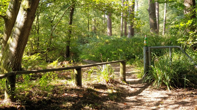
As we carried on, there was some lovely light coming through the trees.

Then we reached the one bit of the walk that I remembered from four years ago, the gentle rise to Leith Hill Tower.

When we got to the top, we discovered that the café was open, so we stopped for tea and cake and I got the drone out for a quick whizz.


Refreshed, we started down again, really quite steeply at first

but then levelling out a bit as we went into an area called Duke’s Warren, which has some great views, suitably enhanced, of course, by the presence of our gin bottle.

There’s some very fine heath land

and then the trail descends into Coldharbour, which at 750 feet is the highest community in the south of England. It has a chequered history.  According to the Fancy-Free Walks guide, “Coldharbour must be one of the most romantic isolated villages of the Surrey hills. For many years it was looked on with fear by inhabitants of the lowland towns as a refuge for smugglers who would keep their caches of contraband in safe underground sites and would deal ruthlessly with any outsider who interfered.”

All that’s as may be, but the important feature of Coldharbour for us today was

the pub, where we planned to take lunch.  The Plough brews its own beers – I can recommend Crooked Furrow, for example – and we had there the best fish’n’chips I can remember having  anywhere; it really was very good indeed.

Suitably refuelled, we continued downhill, where we got a final view of the village

before heading once again into woodland.

passing a place where they clearly had swingers’ parties

and emerging into open countryside at Anstiebury Farm, where the views continue to be quite spectacular.

There’s more open countryside

before the track goes back into the woods, where one can see the most extraordinary holly tree.

Quite how it has grown this way is not clear – maybe someone has trained it that way over the years – but it’s very striking.

The trail joins a road past some very fine buildings

before reaching South Holmwood, which has a beautiful church and churchyard.

The path carries on in its varied way, between meadows and woods;  it passes one very fine property called Mill House, which has wonderful chimneys

a fascinating tree platform in the garden

and (it being the time of year it is) a spectacular acer.

Now in the final stages of the walk, we approached North Holmwood once again via some splendid views

which we thought appropriate for a final gin bottle shot of the day – and it was joined by a friend it picked up in the pub at lunchtime.

There’s a final descent to a cinder track that leads back to the car park and the completion of an altogether delightful walk.  I can’t imagine why we’ve only done it once before, as it has much to recommend it.

We completed 11.13 miles on the walk, nearly two miles more than that demanded by the Menorca equivalent; so we find ourselves some seven miles ahead of the Cami-360 game.  We have now completed over 102 miles and there are two walks to go.  We both completed the walk today without any of the aches and pains of yesterday; we used different footwear, which might have some bearing on it; and it’s more strenuous than the Ockham Common walk – perhaps having to go up hill and down dale is easier for my back than a flat walk, or perhaps we’ve just passed The Wall and we’re good for many more miles.  Whatever, we’re looking forward to a walk at the very other end of the Surrey Hills tomorrow and fondly hope that you’ll join us to find out more.

Day 10 – Ock-Cami

Cami-flage Day 10 Sunday 20th September 2020

Today’s walk was a short one – in Menorca we would only have been asked to cover just over 7 miles, and there is a handy equivalent not too far from us covering Ockham (hence the title) and Wisley Commons. It may be short, but it has several interesting and unusual features – read on to find out more.

The weather comparison between Surrey and Menorca is getting quite interesting.

It may be warmer Over There In The Foreign, but today and for the next couple of days we get the sun – and better temperatures for walking around, actually. Schadenfreude’R’us. Here’s hoping the gods of weather don’t take their revenge too swiftly….

Here’s an overview of the walk.

The roundabout in the middle top of the picture is Junction 10 of the M25, where it meets the A3. The walk straddles the A3 but stays south-west of the M25.

We started from the Ockham Bites caff, which advertises itself as selling award-winning Bacon Buttties; so we promised ourselves one for when we returned at the end of the walk.

The walk starts out over Chatley Heath, which is attractive enough,

and was even more so earlier in the year when the heather was actually in flower. We soon reached the first landmark, which is the Chatley Heath Semaphore Tower, a unique remnant from the Napoleonic era, the only surviving semaphore tower in Britain. It was once a cutting-edge building at the forefront of technology and design, a vital link in a signalling chain that transmitted messages from Admiralty House in London to Portsmouth Docks in just a few minutes. But in recent years water ingress has been threatening the structural integrity of the tower to an alarming degree. When we visited recently, it was shrouded in tarpaulins as repair work was carried out; today, whilst it was clear that there was plenty of work going on, at least we could see most of this unusual building.

The path then moves into woodland, amongst which can be found several huge Redwood trees.

(you can just see Jane bottom right, which gives an idea of scale). As the trail moves on, the Teddy Bears’ Picnic line comes to mind: “If you go down to the woods today, you’re sure of a big surprise.” Between the trees you can start to make out an unusual object

and, getting closer, you see a mausoleum, which is certainly a surprise finding to anyone covering the route for the first time.

This (according to an engraved plaque) houses the mortal remains of Bernhard Samuelson (1820-1903), his wife and daughter. It’s a striking and unusual thing to find in Surrey woodland.

The woodland trail continues, via a couple of left-and-right shimmies, past a grove of Hornbeam trees

and debouches on to a road. A couple of hundred yards along that you dive off and emerge blinking into a large field (harvested, of course, this being Autumn); in the distance, you can see another mystery object.

As you get nearer, the object turns out to be an air traffic beacon – specifically, a VHF Omni-Range radio navigation aid.

To get to it, you have to cross the airstrip of the now-disused Wisley Airfield on a path between barriers. It’s a former wartime airfield; originally a grass airstrip, requisitioned in 1942 for WWII, the runway was converted to tarmac in 1952 and used to test aircraft built at Weybridge by Vickers. Flying ceased in 1973. The owners have recently been trying to get permission to build on it – so far unsuccessfully.

In case you’re interested, here’s what this area looks like from the point of view of a pilot using a chart to find a route:

OCK is the beacon, the circle is a compass rose to identify radial direction for navigation purposes. DME signifies Distance Measuring Equipment, so it also enables an aircraft using it to establish its range from the VOR. WISLEY has an X in its circle to show it’s paved but not in use (as you can see from the photo; in fact it gets used a lot – illicitly – by kids on motorbikes and the owners have stacked up piles of earth, tyres and other detritus periodically along it to try to discourage them). You can see Fairoaks on this chart (because you’ve been paying attention, you’ll know that that’s Chobham’s local airfield) and the edge of Heathrow’s Air Traffic Control zone, too.

Back to the mainstream of this post…..the path carries on past the beacon and then scurries along the side of fields all the way down the length of the Wisley airstrip, which is about a mile; you can see the airstrip on the Overview image above.

Across the fields, in the distance you can see the building work going on in Woking.

We took a short detour once we’d followed the track and re-emerged at the far end of the Wisley airfield. During this and previous Summers, we’ve had a wonderful crop of blackberries from bushes at this end of the airstrip, so we (meaning Jane) thought it would be interesting to see if there were any still worth picking. The answer was “not really”.

There were berries aplenty, but a one-two punch of heavy rain followed by an extended hot dry spell had ruined almost all of those that had ripened.

The trail leads beside the A3 before going under it to the north side; someone has major designs on it and if that’s the council, maybe improvement work will follow? Otherwise they’re just designs, and very colourful, too.

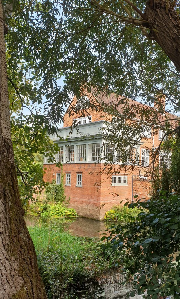
Once over the A3 and past the very posh Wisley Golf Club, a tiny detour enabled us to go and marvel at Ockham Mill, a wonderful building.

It’s one of a group of lovely buildings clustered around the mill pond, such as this

(I wish they’d cut back all that damn’ greenery so that passers-by can get decent photos of the place; can’t imagine why they don’t do this. Anyway, a gin bottle shot seemed a good idea.)

The path leads beside field’s where the farmer’s have clearly had problem’s in the past with dog’s (and punctuation).

The main crop appeared to be a variety of cabbages. I was very taken with a couple of ideas the farmers had used to keep pigeons off the crop.

In the background one can see the Glasshouses which are at the far end of the RHS Wisley Gardens.

The path actually goes alongside the gardens and one can catch glimpses through into them,

and a bottle shot seemed to be a good idea at this point.

At one place, our path intersected another going between different sections of the RHS gardens. Unsurprisingly, the RHS are not too keen on people using this crossroads just to wander into the Gardens without paying.

(I wonder how long it would have taken for their security people to find a senior citizen in a white hat and blue checked shirt in their 240 acres had I taken this opportunity to sidle in. But I’m far too honest to consider doing that. No, really. Anyway, Jane is an RHS Member…)

After the Gardens, the path goes through more woodland, which looked lovely in the late Summer afternoon light.

It soon becomes clear that, despite the sylvan beauty, one is near to several major roads, not least the M25: the traffic rushes by only a few yards away at one point and the traffic noise can be quite intense.

We then turned for home on the final stretch of today’s route, a broad made-up path that led past Pond Farm, where the Surrey Wildlife have a base and which takes its name from, well, a pond.

There’s a lot less water in it than there was earlier in the year, rather like Deep Pool. You’ll know all about Deep Pool because you read the earlier post, didn’t you? Didn’t you?

Eventually, we reached the steepest climb on the trail, which was the bridge over the A3 to get back to the car.

and we couldn’t resist a final bottle shot for the day.

Back at Ockham Bites, we treated ourselves to a bacon butty, which was OK, but the Award Winning Chef was clearly off duty today. The tea was nice, though, and the whole thing was most welcome because, despite today’s being a short walk, we were both feeling a little the worse for wear. Jane (who personfully carries the daypack we use to transport water and gin bottles, blackberry containers, power banks and other odds and ends) found her shoulders were aching and that there’s a spot of trouble with a tendon in one foot; my back was aching and I felt generally tired. So, in both cases, we felt a lot less fresh than we had at the end of, for example, the longer and more strenuous walk that we did yesterday. Perhaps Day 10 is where Walkers hit the wall? It will be interesting to see how we get on tomorrow, on a longer and more testing walk, which takes us back to the highest point in Surrey, although via a different route than our previous visit.

Today we covered 7.57 miles, a smidge more than the 7.18 of the Menorca equivalent, so we continue to be ahead of the game. We have covered over 90 miles so far and tomorrow will see our mileage hit three figures, so come back then and see how we got on.

Day 9 – Cami Mill: Gunpowder Plot

Cami-flage Day 9Saturday 19th September 2020

Because it suits my nefarious purposes, I will share the weather comparison between Surrey and Menorca today

mainly through schadenfreude, as you can see. So, we had a great weather outlook for a walk starting near Albury in Surrey.  Today’s walk can be found on the Explore Surrey section of Alltrails, which is part of a collection set up by Surrey County Council.  And it’s a great walk as you’ll see if you read on.  Here’s its overview.

The conurbation, OK village, bottom left is Shalford and the route runs through Chilworth which is slightly to the right of it.  The timing of the day was actually determined by the Chilworth factor, as the one pub on the route, the Percy Arms in Chilworth, could only offer us a table at 2.30pm, so once again we found ourselves starting the walk shortly after midday and, like mad dogs, going out in the midday sun.

As you can see from the route profile, the first thing to do is to go up.  The landmark to visit is a church, St. Martha’s on the Hill, which is world famous in Surrey.  It normally operates only infrequently

but, sadly, we noted that it has been shut down because of the pandemic.  I’m actually amazed that, pandemic aside, enough people are prepared to clamber up to it on Sunday mornings, because the route up is pretty damn’ steep.

But the church is charming, and the view is stupendously good.

You can see Chilworth, our lunch destination,

and a gin bottle shot seemed the right thing to do.

After a few minutes at the church, we went down again, past wartime defences

on to a path which is one of my favourites of any of the walks we do in Surrey, through mainly beech woodland beside the Tillngbourne river.

At the end of the path, we passed Waterloo Pond

into an area of attractive buildings

which seemed a natural backdrop for another gin bottle shot.

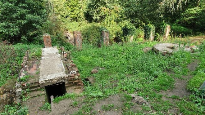
The next part of the walk is one of the highlights of all the walks we do in these ‘ere parts – the Tillingbourne Gunpowder Mills Heritage Trail (giving us the excuse for the title of this post.  I realise I’m straining things a bit, but cut me some slack here, OK?)  I can’t put my finger on why I love this trail, but I do.  We had done this walk recently, and an important part of the trail was barred because of work being done.  We were delighted to see that the trail was fully open.

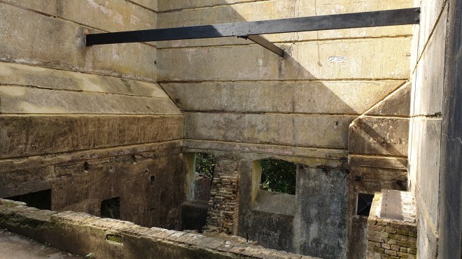
You pass the remains of several buildings where the gunpowder was manufactured

In the last of these pictures, which are of the buildings where the ingredients (saltpetre, charcoal and sulphur) were mixed, you can see bracing metalwork between the walls, which we guess is the work that was being done; I’m glad that this means the buildings are secured.  Further along the trail are examples of the huge millstones used to grind the powders

(seen here with gin bottle)

and you can also see, in the picture below, the round bedstone which was used as the base for grinding.

A stream runs alongside

and there are also ponds which make the whole place very attractive; and there are boards around which tell the story of the gunpowder mills, the use of which spanned from 1650 to 1920.  All in all, the Heritage Trail is a great place to visit.

The next stop was a short way along a path into Chilworth, where we lunched at the Percy Arms.

This is quite an operation, being pub, restaurant, B&B and butchers, with a takeaway service as well as eat-in.  The menu has a distinct South African slant to it (as does the wine list), which means that the portions are hearty; we had a very enjoyable lunch there.  As well as a lot of indoors, and a decking terrace, the place has a big garden which features a great canopy

which in Oman would be called a Majlis – a great idea to ensure that people can sit out even in weather less clement than today’s.

After lunch, our ongoing route took us through Chilworth, where you can just make out St. Martha’s in the distance

through some very horsey territory, including one horse who tried to persuade us he was a zebra

but we didn’t fall for it. The route goes through fields by a stream which is the basis for water cress beds in neighbouring fields.

up a track with some very spooky hazel trees

across a railway

(which gives opportunities for some fun)

past a bus shelter which doubles as a library

and some magnificent chimney work

before debouching into Albury Park.

One might be forgiven for thinking we were nearly done, but the path goes on a long way through the countryside near Albury

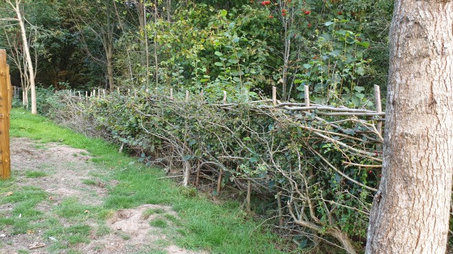
by some wonderful traditional hedging work done by the Surrey Hedgelaying Group

to one of the other unexpected pleasures of the route – Sherbourne Catholic Apostolic Church.

The path carries on, past the biggest log pile <Jeremy Clarkson voice ON> in the WORLD <Jeremy Clarkson voice OFF>

past some more lovely bucolic countryside

up a very steep path

and past some more countryside, at the top of which one can see Newlands Corner (my favourite hill to cycle up if I fancy a challenge)

before depositing us back at our car park, some 10.64 miles after we started.  That’s short of the Menorcan equivalent distance, but only by 0.15 miles, which is virtually a rounding error.  Our cumulative distance so far is 83.78 miles, nearly five miles further than we would have walked by this stage had we been in Menorca.  And (whisper it) we’ve had better weather for walking.

Tomorrow’s weather promises to be warmer than today’s so it’s probably just as well that the walk in prospect is shorter.  It has one or two unusual features in it, though, so I hope you feel minded to come back and find out about it.  Maybe see you then…..