Tuesday 17 May 2022 – We had an early start today; once again, the only times we have to get up early is when we’re “relaxing” on holiday. Anyway, come 8am, we were on the road that would lead us eventually to Petra, but which had several stops on the way. Almost all of these stops seemed to involve mosaics, so I hope you like mosaics.
The first stop was in the town of Madaba, the “City of Mosaics”, to visit St. George’s, a Greek Orthodox church. The reason that so many people visit it is that it is the home of a very famous mosaic, the oldest surviving original cartographic depiction of the Holy Land, dating from the 6th century AD. The mosaic was rediscovered in 1884, during the construction of a new Greek Orthodox church, St. George’s, on the site of its ancient predecessor. Outside (and replicated on cards in the on-site retail opportunity) is a large display explaining what the remaining areas of the mosaic are.

The map mosaic itself is very difficult to convey photographically, because it is so large. I took a couple of snaps, of course I did, but I also tried to give an idea via video.
It is amazing that there are still areas of the mosaic that are still hiding under tiling work that has been laid on top of it, for some bizarre reason.

As well as this historic ancient mosaic, the church has an incredible array of modern mosaics, made in the Madaba School of Mosaics (these days called the Madaba Institute for Mosaic Art and Restoration), which can be found on every available display surface.

They are very intricate and beautifully made.

On searching for the etymology of the word “mosaic”, I learned that it has its roots in the Latin for the Muses. It’s also true that Mosaic (capital M) means “pertaining to Moses”, which is relevant for our next stop, which was at Mount Nebo, the site from which Moses was allowed to see the Promised Land, and where he then died. It is obviously a site of great historical and religious significance, but the Moses Memorial church there (originally built in the 4th century AD and restored by the Franciscans in 1932 to working monastery status) is quite a plain building, and not ornate at all.

Since this is where Moses could see the Holy Land, you might expect there to be a decent view. You’d be right.
It’s a popular spot for people to look from, and marked by a representation of Moses’ staff.

On display outside the church are a couple of the mosaics from the original building

but it’s inside the church where the real action is, mosaic-wise. The most impressive is a 6th Century mosaic in the Diakonikon Baptistry in the church, pictured as captured on a non-Diako Nikon camera.

There are many, many, wonderful and intricate mosaics there. Some have the shapes often found in stained glass, and there is also some real stained glass cunningly shaped to look like a mosaic.

I’d love to go into more detail, but honestly there is so much there it would become dull if I were to share all the photos I took.
We went back into Madaba and visited the Madaba Arts and Handicraft Centre. We got a very interesting insight from a chap there who explained about how both old and modern mosaics were made. There were several people at work creating mosaics – the centre is a co-operative which provides training to budding mosaicists, many of whom have special needs.


As well as what anyone would understand to be mosaic work (with pieces of stone down to about 2mm in size), the centre also has work that is “micromosaic” – creating art with pieces of stone so tiny that they can only be worked through a magnifying glass; or indeed with dots of powdered stone “paint” – pointillisme in stone. The resultant work is remarkable.
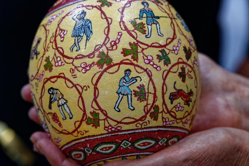
Ostrich eggs are common bases for this kind of artwork, and the chap was such a good salesman that Jane failed to escape without buying an example. The co-operative does good work in supporting disadvantaged people, mainly women, and has the financial support of Queen Noor of Jordan, so we’re pleased that the money is going to support a good cause. No, really.
So that was peak mosaic, and we left to continue our journey towards Petra. En route, we passed an unusual roundabout decoration.

We have been unable to understand why this choice of decor has been made but we’ve seen more than one example.
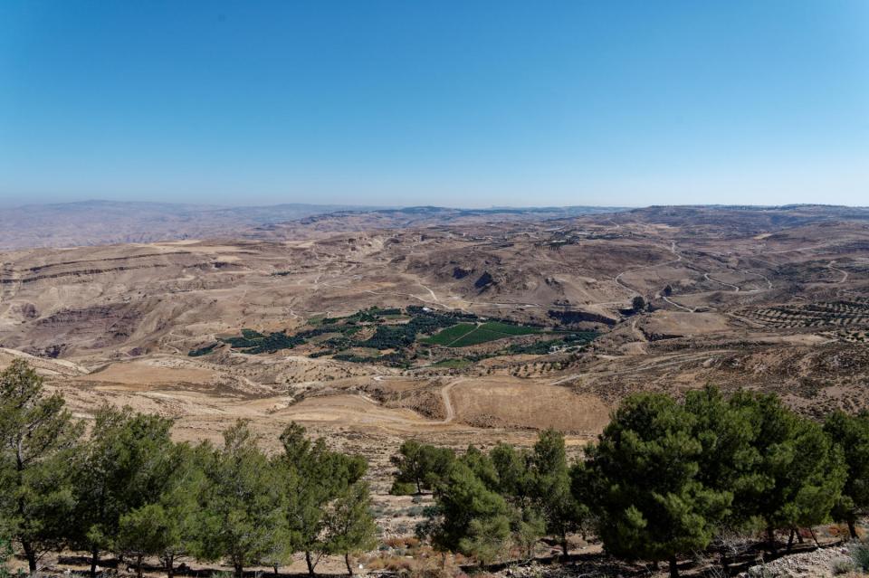
Saeed drove us along the King’s Highway*, a scenic and historic route so-called because it once linked the realms of three kings – Ammonite, Moabite and Edomite. It’s preferable to the Desert Highway, which is straighter, faster and has fewer speed bumps, but is dull.

By contrast, the route that Saeed took us had some wonderful scenery,


an unusual new marketing look to a fast-rising supermarket chain,

some more fantastic views,


a remarkable, if ramshackle, tea stop-cum-retail-opportunity run by yet another welcoming Jordanian (pictured below with Saeed),


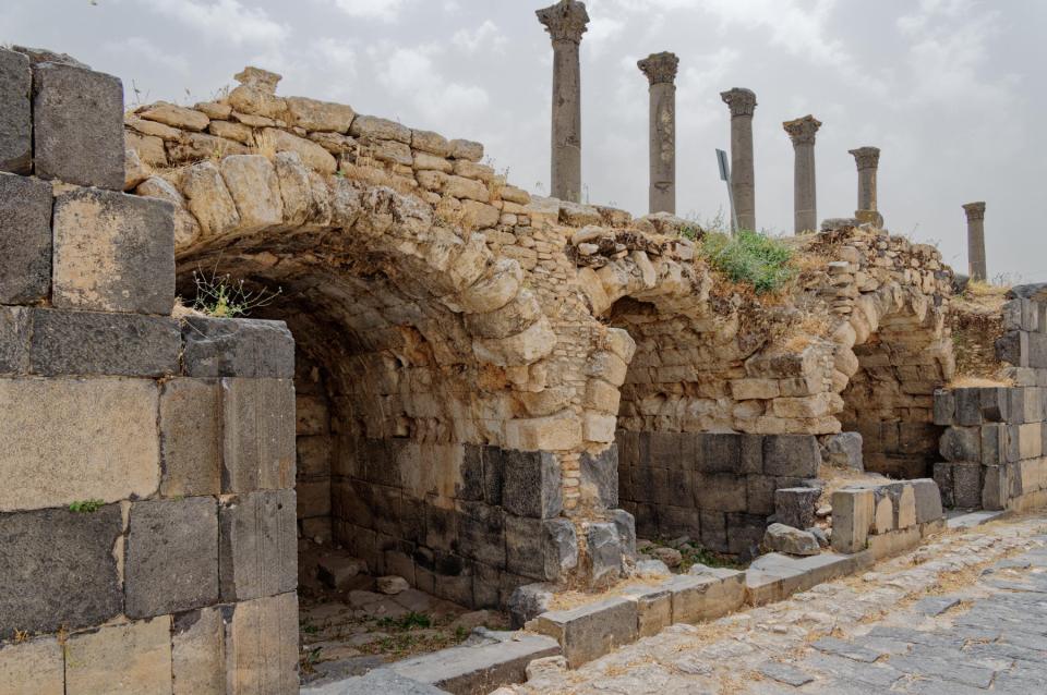
and stopping for a visit to Kerak (or Karak) Castle, a 12th-century Crusader castle which also had a significant strategic role up to the Ottoman period in the 19th century. It was badly damaged in a siege and has really only partially been restored. It has a looming presence over the surrounding countryside.

It looks impressive from the outside and is huge and rambling on the inside, but lacks information boards and other things to help understand its story. You can understand its strategic importance, given that rule 1 of such a place is to have a commanding view over the countryside so you can spot any unwanted marauding going on by your enemies.


but the site itself, while it has several impressively castle-y lumps of masonry


didn’t have a story to tell, or at least not one that came over to us.
The town of Kerak would actually be a wonderful photo site – all tiny narrow streets, chaotic traffic and colourful shops. We didn’t get a chance to see it beyond one rather optimistic piece of marketing.

Shortly after this we stopped for lunch at an unusual restaurant-cum-retail-opportunity called Midway Castle

where we had a taste of the National Dish of Jordan – mansaf (slow-cooked lamb with rice, flatbread and a special yoghurt sauce). Yes, I have a picture of it. No, I’m not going to share it with you. Then we pressed on, again largely avoiding the Desert Highway, which meant we saw camels

sheep and goats,

more impressive scenery

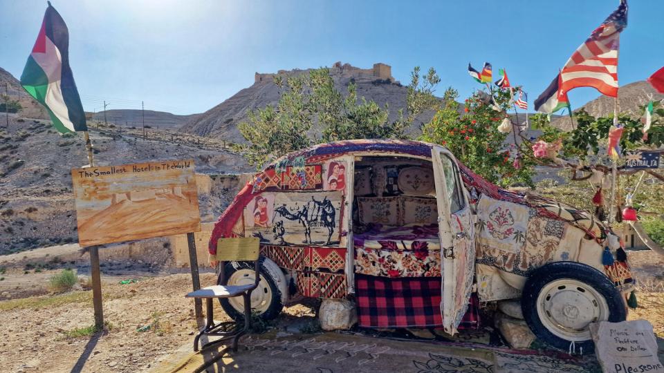
and the “Smallest Hotel in the World”.
We also passed by Shobak Castle

but didn’t go in, as we didn’t need a loo break. Our final stop, as we hit the outskirts of Wadi Musa (the “Valley of Moses”, where Petra can be found) was at the spring that is the source of the water running through the valley, and may be the place where Moses struck the rock with his staff and water came forth for his thirsty Israelites:


It’s remarkably low key for something that bears the name of Moses. People can stop by and fill their containers with water

underneath the writing taken from the Koran that says something along the lines of “From water, all life begins.”
And so our journey ended at the Mövenpick, Petra. We immediately had a meeting with Ali, a representative of the organisation that provides tourist guides for Petra, because we had decisions to make. Unfortunately, The Powers That Be have decided to close a hiking route that we had planned to take (from Little Petra to Petra Monastery) in a couple of days’ time, so we had to work out what our alternative was going to be. Oddly enough, “sitting in the bar and drinking gin” didn’t seem to be the right thing for me to suggest, so we’ve got two hikes set up for tomorrow and Thursday, both of which involve quite a lot of walking and climbing of stuff. And because we want to beat (a) the tourist hordes and (b) the heat of the day, we have to get under way at 0630 tomorrow. O, the joys of being a tourist!
But, assuming we survive, the coming days should be absolutely wonderful, despite a 5am alarm call. So do please stay tuned to see how things turned out.
* “Along the King’s Great Highway, he drives his merry load / at 90 miles per hour in the middle of the road.” With thanks to Flanders and Swann


 If you look carefully, you can see a cross between the two arches, betraying Christian influences.


 seen here with the alarm sensor that Jane triggered when gesturing to a detail on the coffin. But the minders let us off with a mild beating and we went on our way.*