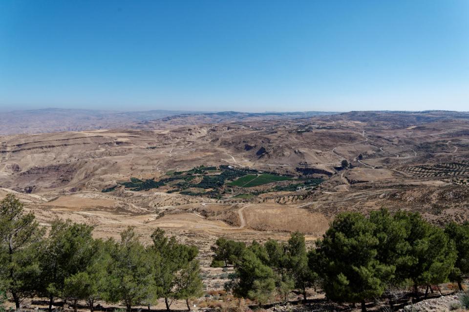
Sunday 10 May 2026 – A sunny start to the day: so out on to the hotel restaurant’s veranda to take in the view.

Then our group congregated and, as yesterday, trooped down the road to be collected by Mostafa in his bus, and we set off towards the southern coastal side of Istanbul for our first visit of the day, which was to Yedikule Fortress. As you might infer from the name, this is part of Constantinople’s formidable fortifications. Built in 1458 by Ottoman Sultan Mehmed II after he conquered the city, the seven-tower complex was created by adding three new towers and fully enclosing a section of the ancient walls of Constantinople. Those walls were built in the 5th century AD during the reign of Roman Emperor Theodosius II. At this point I have to confess that I knew nothing of these walls, so much of the day was spent raising my consciousness about them.
First, though, the fortress. It is the subject of a substantial restoration project whose banner gives a good overview of its shape.

The bottom three circles are the three extra towers; the run of the wall is across the top of the diagram and the two square blocks represent a triumphal entry gate, called the Golden Gate, which was built in the 6th century. This is what the Gate looks like from inside the courtyard of the fortress.

You can clearly see that at one stage there was a massive central arch through which one would triumphally arrive. Over the years it has been successively bricked up to be smaller and smaller, but it must have been hugely imposing in its day. Over the arch are flagstones with holes in them.

and these holes were a puzzle until someone figured out that they were mounting blocks for metal letters. Some further clever thinking deduced what these letters probably were

and thus reconstructed what the text was – “HAEC LOCA THEODOSIUS DECORAT POST FATA TYRANNI”, “Theodosius decorated these places after the downfall of the tyrant.”
From the other side, the Golden Gate looks like this.

You can see the outline of the original triumphal arch in the centre, and the successively smaller portals inside it. Behind you as you look at the gate from this side is the Little Golden Gate.

This presumably gave extra pith and moment to any processional entry, and, more importantly, was part of a second wall built in support of the main walls into which the Yedikule fortress was incorporated. More on the walls later.
Yedikule became a place of imprisonment and execution. In front of the Little Gate, for example, is a well, down which the bodies would be thrown to be washed away into the Sea of Marmara. There is another well, used for the same purpose, inside one of the towers, which was also used for imprisonment.

You can see joists and the holes for them which indicate that there were several floors off which were cells in which prisoners could be kept. If they died or were to be executed, the central well was for disposal of the bodies.
Looking carefully round the fortress, one can see a few subversive Christian relics which presumably escaped Ottoman notice:


Even a Roman eagle survived.

We climbed up inside the Golden Gate and were presented with a great view over the courtyard of the fortress

and, incidentally, an oversight of the huge queue of shipping waiting to be allowed up the Bosphorus.
The viewpoint at the top of the gate allowed us to get some idea of how the walls were designed.

To the left you can see the main walls. From there, a terrace leads to a second wall, then another terrace and then a ditch, which was the moat, itself defended by a crenelated wall. It’s interesting to see that the locals use the moat these days as market gardens or allotments.

This very daunting double-walled construction was built during the reign of Theodosius II, and hence it’s called the Theodosian Walls. They ran some 4 miles, north from the Sea of Marmara up to the Golden Horn inlet, thus forming a massive land wall which, together with the existing sea walls, formed a protective cordon around the city that successfully defended the whole of the Constantinople peninsula from incursion by land or sea for over a thousand years. Eventually, in the 15th century, the Ottomans found a weak point where a river ran through the Theodosian Walls and used it as one of the tactics to be able to invade the city.
The walls, therefore, were critical to the enduring success of Constantinople as the centre of power for the region. The Land Walls was (were?) a huge construction project. The main walls were 4.5 – 6m thick and 12m high. Their construction included bands of bricks, a technique which strengthens the construction and, importantly for this region, makes it more resistant to earthquakes. The technique was also used in constructions in Britain, such as the Roman walls of Colchester, London and St. Albans.

Not that swallows care a jot for this architectural feat – they just use the wall for nests, and we could see and hear them whizzing about shouting at each other and catching insects – a joyful phenomenon.
96 towers were included along the length of the wall. We could see some of them from our viewpoint at the top of the Golden Gate,

and indeed, after we left the Yedikule fortress and travelled northwards beside the walls, we could see the amazing extent of these walls. Some sections were in disrepair, some have had some repair and/or restoration work done and some have been almost excessively reconstructed.


Our wallside drive took us almost to the northernmost extent of the walls, within a kilometre or so of the Golden Horn. In order to get near our next destination, we had a traffic interaction which is pretty typical of Istanbul. First, Mostafa had to squeeze us past a crane

and then

he did a splendid job of (a) navigating the bus along an extremely narrow road without damaging bus, cars or buildings, and (b) facing down any drivers who had the temerity to want to come in the opposite direction. Whilst all this was going on, a chap by the roadside was calmly filleting and selling fish from a makeshift stall.

Once Mostafa had found a place where we could safely debus, we walked a little way to visit the Tekfur Sarayı museum, which is housed behind the remaining façade of a 13th-century palace built for the son of a Byzantine Emperor. The place had fallen into extreme disrepair, and reconstruction work enabled it to be opened as a museum as late as 2021. It’s a handsome façade.

If you look the place up on Google Maps, it labels it in English as the “Palace of the Porphyrogenitus”. Some sources translate Porphyrogenitus as merely “Sovereign”, but it literally means “Born to the Purple”, indicating a child born to a reigning emperor.
The place served as a palace in the final years of the Byzantine Empire, but suffered severe damage due its proximity to the walls during the Ottoman conquest in the 15th century. In subsequent times it served multiple purposes: housing for the Sultan’s menagerie; a brothel; and, in the early 18th century, a pottery workshop producing ceramic tiles in a style similar to that of İznik tiles, but influenced by European designs and colours. The museum has exhibits on a couple of floors and one floor is given over to this tiling work, with some striking and colourful displays.


There are some decent views of parts of the city – or would have been had the visibility not suffered from Istanbul’s rather typical haziness – and we also had fun watching a pigeon market, where roller pigeons were being bought and sold.

On the ground floor of the museum is a marvellous model of the Theodosian Walls, as viewed from the south, the Sea of Marmara end.

You can see the Yedikule fortress here in the context of the walls, and the model is a faithful recreation of their extent.
After the museum visit, it was time for lunch, so we walked back up to a road where Mostafa was able to pick us up more easily, and headed to the Fatih neighbourhood of Istanbul.
The restaurant was a bit of a distance from where Mostafa could get the bus, and so we walked through the neighbourhood, which, like so many in Istanbul, has a very colourful and diverse array of shops.


The lunch was at a Maltese restaurant called Esnaf Lokantasi, very much a family-run locals’ eatery. The main courses were served from pots at the counter

and very delicious and filling they were, too, with offerings such as stuffed peppers, moussaka, meatballs and so on. For those of us who wanted a bathroom break, Seçkin gently suggested that the toilets by the local mosque would be more gemütlich, and so some of us went back down the street to the Fatih Mosque

beside which were some decent loos. This mosque is culturally quite significant, something which I think Jim and Seçkin missed a trick in not explaining it to us at the time. It’s known as the Conqueror’s Mosque, named after the Ottoman sultan Mehmed the Conqueror (known in Turkish as Fatih Sultan Mehmed), the conqueror of Constantinople in 1453. A mosque was symbolically constructed here, because it was the site of the Church of the Holy Apostles, which Mehmed demolished, symbolising the ousting of Christianity by Islam. The original mosque was seriously damaged in the 1766 earthquake and rebuilt in 1771 to a different design, which one sees today.
Our last stop of the day was a visit to Kariye Mosque, or the Chora Church. Once again we had a bit of a walk to get from bus to mosque, and it was lovely to see a chap leading his donkey towards the mosque ahead of us.

The mosque itself

was a Byzantine church and has been converted to a mosque. Twice, actually. Much of the fabric of the church dates from the 11th century, and it has suffered earthquake damage followed by rebuilding work, completed in the 14th century. In the 16th century, during the Ottoman era, it was converted into a mosque; it became a museum in 1945, and was turned back into a mosque in 2020 by President Recep Tayyip Erdoğan.
The sad bit starts with this: the church was endowed with some very fine frescoes and mosaics. When it was converted into a mosque, these were covered by a layer of plaster, as Islam prohibits iconic images. The uplifting bit is this: when the mosque was secularised and turned into a museum, restoration work was able to uncover many of the frescoes and mosaics, and these are visible in the building today. They are in a sort of church section; deeper inside is the mosque section (what was the naos – nave – of the church), where, of course, these are not allowed to be visible.
What’s there is quite impressive. It’s actually quite small inside and gets easily crowded, so getting photos wasn’t perfectly straightforward

but here are a few of the ones I took.


The mosque section is, unsurprisingly, much plainer,

although there is one surprise. If you stand in this area and turn round to look behind you, you see, on the wall above the entrance, this:

this is the mosaic of a scene known as “The Dormition of the Virgin”, and the surprising thing is that it’s visible at all, given the Islam proscription of This Kind Of Thing. It’s a lovely mosaic, and wonderful that it is complete and has been allowed to stay visible.
The mosaics in the church part are in many cases incomplete.


so it’s uplifting to see the results of the restoration work, but sad to reflect on the destruction of so much beautiful work. Our visit to the painted monasteries of Romania had shown us how magnificent these works can be, and so our pleasure at seeing the frescoes was mixed with sadness about the damage that had been inflicted.
The music of Stravinsky should be playing in the background here. He wrote his Dumbarton Oaks Concerto (sort of his take on Bach’s Brandenburg Concertos) for the wealthy patrons who created Dumbarton Oaks as a centre for Byzantine studies affiliated with Harvard University, and Dumbarton Oaks played a major role in the launching of the restoration programme for the Chora Church.
And that was it for the day. We were free to find our own dinner, but actually just retired to rest and drink Earl Grey in our room and ponder on what we’d seen for the day. There was one diversion, for an attempt at a specific photographic project, but it failed dramatically. I’ll tell you all about it in the next post, so you’ll just have to contain your souls in patience, won’t you?