Tag Archives: wildfires

Jasper, Much Maligne’d

Saturday 10 September 2022 – In declaring yesterday’s rest day to be the End of Part II of our grand odyssey, it turns out I was a bit previous; we still had a little bit of Rocky Mountain-style business (i.e. lakes, waterfalls, that kind of thing) to attend to. Also, since we had failed to visit Jasper, we thought we should at least go in and see what was the state of affairs there.

Accordingly, we set out towards Jasper. As we drove the short distance in, we saw something a little out of the ordinary:

a helicopter carrying a bucket. There was no smoke visible, but we guessed that this was attending to some wildfire business or other – see later. We also saw a temporary roadside sign on the highway which said “Power out In Jasper. Do Not Stop”, but we ignored that.

We went in to the town, wondering whether there was any power to any of the infrastructure. Having parked the car, we discovered that at least the parking meters had power – of course they bloody would – and spent a few minutes negotiating with one. It looked like we’d chosen the station car park.

There were plenty of cars parked in the car park, but the roads were very quiet for a Saturday morning.

Some of the shops seemed to have the lights on, so we popped in to one of them, a tourist gift-type shop, and pretended to look as if we were going to buy something in order to ask the shopkeeper for his assessment of the situation. He said that most businesses now had their own generators and were open, with the main exception being some hotels and restaurants, which had not re-opened; we made a mental note of this to update Brendan later.

Jasper is an attractive place;

the downtown has some nice buildings and some street art on display, too.

It did seem that many businesses were operational, but there was a variety of generator solutions on display and a pervasive hum

and not every business was open.

However, there were a few people about in the attractive downtown area.

Seeing the Tim Hortons, a Canadian coffee shop chain, we thought we’d try out the experience.

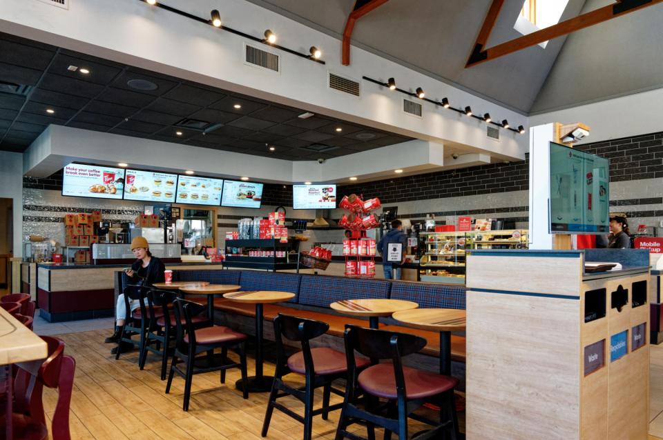
It’s a perfectly decent way of getting a coffee (and any manner of cake), but is workmanlike rather than classy. Whilst we were there, we did see evidence that there really was a town shuttle bus,

despite its non-appearance the previous day. Having reassured ourselves that Jasper was gradually getting back into the swing, we headed back to the car, past a streetcar that was handsome, but looked somewhere between faded and disused.

(We saw it in operation later in the day, so it’s not disused, at any rate.)

Right: onward to the last bit of Rocky Mountain stuff, then. There’s a road out of Jasper which leads past two lakes, Medicine Lake and Maligne Lake; both of which are fed by the Maligne River, which in turn feeds into the Athabasca River. Going along this road brings you first, though, to Maligne Canyon, which was therefore our first stop. As you drive the road towards it, there are signs off to “Sixth Bridge” and “Fifth Bridge”, and this starts to make sense once you see the trail map in the canyon car park,

although not much sense; it has to be said that this trail map is somewhat confusing. We saw a signpost to “Second Bridge”, so we thought we’d better start somewhere. We walked from Second Bridge to Fourth (which did need repainting, actually) and back, and then, because it would have taken too much time to go further, back up to First.

We covered a couple of miles, which was much more than I’d expected – I’d thought it would be something like the Mistaya Falls we’d seen on our Icefield Parkway drive. The idea was the same – a torturously twisted canyon carved out by a fast river – but this was much bigger. I’ve tried to condense the trail from start to Fourth Bridge in a video:

it’s an engaging hike, unsurprisingly quite popular.

Next up: Medicine Lake. As we approached, we passed an area which had clearly been affected by wildfires.

Medicine Lake has a viewpoint at its north end

and close examination of everything on the right bank from that viewpoint showed that it had been severely burnt and fairly recently, as there was little evidence of regrowth. Looking back up the lake from the other end

showed that there had been some fire damage to the other bank, too.

We pressed on to Maligne lake, and it became clear that things were, erm, not clear; the visibility was very poor, and we assume that this is because of smoke from the fire that has affected Jasper so badly.

When visibility is good, Maligne Lake looks to be a wonderful place to visit – see my brother Chris’s blog post that includes their visit here – but there was nothing really to see here, and time was beginning to press, so we headed back to the main road that would take us to Edmonton, our next stop. We spotted the same bald eagle’s nest that Chris had

and also some roadside wildlife in the form of bighorn sheep which were wandering about, eating some of the scenery.

That really did conclude the Rocky Mountain section of our holiday. As we motored on towards Edmonton, the scenery changed. Interestingly, though, there was still the danger of wildfires and smoke – signs by the roadside warned of the possibility; and we even saw a wildfire in progress in the distance

and the knock-on effects of the smoke.

Soon, though, the scenery flattened out and we just motored on relatively flat roads towards Edmonton. The main interest in the drive for me was my gaming the Lane Assist function available on our rental car so that it didn’t realise I only had two fingers on the steering wheel, and trying to move into the overtaking lane before the adaptive cruise control slowed us down. I know how to have fun at the wheel of a car.

There were a couple of possible digressions on the route, but we ended up diverting only to one of them, the intriguingly-named “Beaver Boardwalk” in Hinton. It actually does what it says on the tin; there’s boardwalk and it leads past the evidence of beavers, erm, beavering: a dam;

and a lodge (we think).

The place is quite a nice diversion

but it seems that it needs some TLC – some of the boardwalks were closed, and others needed some attention. It borders on other terrain in the Maxwell Lake area, and this is obviously a place where people can walk and bike around, and where there is significant wildlife. I found it amusing that somewhere that tells you what to do when attacked by a cougar

or a bear

could, erm, bear this name:

So, refuelling aside, our next stop was to be Edmonton. We were a bit disconcerted to see this sign

as we thought we’d left Jasper far behind.*

In Edmonton, we encountered a slight issue that one doesn’t come across so much whilst driving in the UK these days.

Despite these slight visibility problems, and with help from the satnav, we found our hotel, the impressive edifice that is the Fairmont Macdonald (pictures tomorrow). It was past 7pm by this stage and so we forsook any actual unpacking or such domestic admin to head straight down to the restaurant which featured a patio. This was lovely.

We were expertly served by Tyler, who was clearly a seasoned campaigner (emphasis on the “camp”, but assured, courteous and expert), after which we tried for some after-dark photos in the hotel’s garden.

— GEEKY PHOTO ALERT —

The hotel has a nice view over a suspension bridge which is illuminated. There was a low, full moon of a beautifully muted hue, which I tried to capture on both my mobile phone and my Big Camera. The difference between the two is striking:

The top was my mobile phone, the bottom the Nikon. The mobile phone photo is a nicer scene, although it’s much noisier; but unless you need a technically high quality image, the mobile won this round.

— END OF GEEKY BIT —

That was it for the day. We have nothing planned for the morrow, so wandering about will be the order of the day. Come back and see what we found, won’t you?

* English comedian reference. Sorry.

Up Ship Creek in Anchorage

Wednesday 10 August 2022 – Long Read Alert!

Anchorage!  Such a lot packed into a single day! I recommend you get yourself a stiff drink and settle in for a long session if you want to read this at a single sitting.

The main task for the day was to take a Covid test as a pre-requisite for being allowed to join the cruise that starts tomorrow.  We’d tried to pre-empt it yesterday by going to the Egan Congress Center in the optimistic hope that the testing facility might be open.  It wasn’t – we’d arrived too late – but at least we now knew where the testing facility was.  Optimism ruled our hearts once again as we headed there just after 8am today hoping that it might be open.  Again, the Congress Centre appeared to be still closed, so we retired to the hotel for breakfast before trying again just after 9am, by which time it had opened its doors. The testing process was efficient – a QR code to register on-site, test kits ready to hand out, a promise of results by e-mail within 20 minutes and contactless payment to relieve you of the fee – $89 per person, which is a scandalous amount, but if it gets us on to the boat, then that’s a win.

By the time we’d walked the two blocks back to the hotel and got a coffee from the lobby café, the results were in, and we were officially declared free of the Dreaded Lurgy, which should make the blog entries for the next few days a little more interesting than they might otherwise have been.  To add further to our joy, the sun had come out and the day was warming up nicely. We had decided to take a Trolleybus Tour to give us some idea of what Anchorage had to offer, so we wandered off in the general direction of the Visitor Center to see what the deal was.

The Visitor Center features a log cabin, which is quite fetching, particularly when viewed through the Spirit Bridge, a 1985 sculpture by Roger Barr.

You can also see our hotel in the background.  Nearby the Visitor Center is a hot dog stand with some interesting wares.

Had we not just had breakfast, the spicy reindeer dog would have exerted a strong draw, I think. Also by the centre is a statue along a rather common theme in these here parts.

Wherever you look, it seems there are references to bears.  Our hotel’s bar/restaurant is called Bruins, for example, and just outside its doors is the reason why.

Trolleybus tour operators proselytise tirelessly outside the center, happy to explain what was on offer, and they proved as efficient at parting us wirelessly from our dollars as was the Covid Test site. The deal we settled on was the Luxury version of the tour, distinguished from the standard version by occasional stops with the opportunity to get off and take photos. That started at midday and it was just 10.30 when we bought the tickets, so we had an hour and a half to kill. This we did by our normal tactic of Going Off For A Wander.  We had a vague idea of a direction to go in, as we’d seen some pleasant-looking timber houses on the taxi ride in from the airport. Jane accordingly navigated us in the general direction that we thought we might have seen them.

On the way, we passed some quirky street art touches,

the local take on Barcelona’s Sagrada Familia, the Sacred Family Cathedral of Anchorage

and the Veterans Memorial

before reaching the area we’d sought, which did indeed have a very nice selection of timber buildings.

By this stage we were at Delaney Park, a long stretch of green space between 9th and 10th Avenues, which was originally cleared in the early 20th century as a firebreak to stop the wildfires that are part of the warp and weft of life in Alaska from destroying the developing city. From the park, you can see distant mountains.

We passed the First Presbyterian Church

and “556”, an S-160 class steam locomotive built in 1943, one of 2,300 built for the American army and missing the typical steam engine domes because many were used for the war in Europe and Africa, where tunnels and bridges were lower than in the USA.

(Very creative use of rolling stock wheels for seating purposes, I thought.)

Around here, we met a Friendly Native (there seem to be plenty of them hereabouts – it’s a very amiable place) who suggested a couple of things we should have seen, so we tucked them away for future use after we’d finished our trolleybus tour.  As we worked our way back towards the tour meeting place, we passed some striking murals.

The Trolleybus tour was delightfully led by a lady called Donna who was a mine of interesting information, leavened by very good humour.

One of the strongest threads running through her commentary concerned a major event, not only for Alaskans, but with global impact – the 1964 Earthquake. This was absolutely massive – 9.2 on the Richter scale, thus the most powerful earthquake recorded in North American history, and the second most powerful earthquake recorded in world history. Six hundred miles of fault ruptured at once and moved up to 60 ft. Post-quake tsunamis severely affected Whittier, Seward, Kodiak, and other Alaskan communities, as well as people and property in British Columbia, Washington, Oregon, and California. Tsunamis also caused damage in Hawaii and Japan. Evidence of motion directly related to the earthquake was also reported from Florida and Texas. The repercussions even caused church bells in Johannesburg to ring. It is a candidate to be the third most massive shock to the planet after the Chicxulub meteorite which did for the dinosaurs 66 million years ago and the meteorite which exploded over Antarctica 430,000 years ago.

The incredible thing about the Alaskan earthquake is that although property damage was huge, very few people in Anchorage were killed, because it happened on Good Friday – schools and businesses were closed and the areas affected were largely deserted.

The tour route took us to the James Cook monument, where Donna gave a summary of the huge (but not quite earth-shaking) impact that Cook had had on our knowledge of the world in the 18th century;

he discovered and mapped Alaska as he searched for the fabled North Western Passage that, were it found, would open up trade to Asia. The monument site offers views across the water to distant mountains

and to the “Sleeping Lady”, Mount Susitna, which has an Athabascan mythical story attached to it.

From there, we went to Earthquake Park, where the Pacific and American tectonic plates meet, enabling someone to stand with a foot on each.

A short walk into the woods reveals the waves that were caused as the surface moved up and down during the earthquake.

Shortly afterwards we came to the point on the coast which enables a view back over downtown Anchorage

as well as two significant mountains over the water – Denali, also known as Mount McKinley, on the right in this picture

and Mount Foraker on the left.  Denali, at over 20,000 feet, is the highest mountain peak in North America, as well as the third most prominent and third most isolated peak on Earth, after Everest and Aconcagua (in Argentina).

The route back to town took us past Lake Spenard (named for Joe Spenard, a significant player in the development of Alaska in the early 20th century) and the site of a vast number of “float planes”.

Aeroplanes are hugely important in Alaska, as they are often the only way to reach places because building roads is made difficult by the permafrost which is often only feet below the surface in the state. Trying to develop on such land is challenging as the permafrost melts, meaning you’re now trying to build on water.

The lake is near to Anchorage’s international airport, and one can see huge warehouses in the area, which belong to logistics giants such as Fedex and UPS. This comes about because Anchorage has a critical role to play in the air freight business.  Since it’s a maximum of 9 air hours away from the majority of the planet’s major cities, going via Anchorage is often the most efficient way to move cargo.  It’s notable that the airport was at its busiest during the pandemic as delivery operations became more and more important to people who were in lockdown.

And that was our trolleybus tour – fascinating and entertaining.

We’d learned so much – and it was only lunchtime! We headed to the Glacier Brewhouse, a recommendation from the hotel receptionist, which served us a very agreeable lunch, and then, in order to take advantage of the superb weather, went out and about again.

Going along with the recommendations from our Friendly Native, we headed back down to  Delaney Park and struck out west towards the water’s edge.  We’d already seen one Interesting Church (the Presbyterian one) and we soon passed another, the First Baptist Church.

I wonder if there’s a link between being in the far north and building interesting churches – we’d seen a plethora in Iceland also.

We worked our way along the length of the park (which is 14 blocks from end to end) and came to the water.  We’d planned to take a path back along beside the water but there was the inconvenient matter of a railway between us and it.  So we zig-zagged our way back up towards the city in search of the place where the path crosses the track so we could join it. There was a steady stream of interesting and attractive buildings.

Outside the one shown just above, we noticed that the trees are encircled by metal. This is to protect them from moose, which would otherwise simply eat them.

Moose play a more important role in Alaskan life than simply being a road hazard in the winter. They wander quite freely and whilst they’ll eat practically any vegetation, they have a special relationship with willow; not the weeping willow that’s familiar in the UK, but feltleaf or diamond willow.  And there’s a link with the original firebreak role for Delaney Park.  It’s an interesting, but complicated story.

Willow trees shed their leaves every year, and the leaf mould is gradually compacted over the years by the snow, eventually forming a thick layer of a substance called duff, which prevents further growth. When the duff dries out in summer, lightning strikes can cause it to burn, giving rise to the wildfires which are common all over the state.  These clear the duff, allowing for new willow growth which is food for moose, which, in turn are food for the apex predators – wolves and bears. Moose are unusual in that they can eat the bark as well as the leaves of willow, which is why it plays such  a key role as a foodstuff.  But protection round trees is a common sight, as mooses’ appetites aren’t limited just to willow.

Another botanical nugget concerns “fireweed” – what we’d call rosebay willowherb. This can be found growing all over

and according to local lore, each year the height it grows to predicts the depth of the snows in the coming winter.  (Our guide Donna’s family did a project over 15 years of monitoring this, and she asserted that this was true each year they measured it to within an inch or two.)

The final chapter of this extraordinarily content-filled day concerned salmon, a high-profile industry in Alaska. The salmon harvest in Alaska is the largest in North America and represents about 80% of the total wild-caught catch, with harvests from Canada and the Pacific Northwest representing the remainder.  You can see salmon all over the place as artwork

but, more to the point, this is the time of year where they run upriver to spawn and Donna had told us about a place where we could maybe see them in action – the Ship Creek Overlook Park. This was the final stop on our walkabout.  We made our way to the bridge which offered the best viewing possibilities and, sure enough, there they were, in profusion.


But, accompanying this was the (very laid-back) cabaret of people fishing for salmon in the river. There were lots of them

and indeed watching them appears to be a spectator sport, too.

There’s a restaurant built on a bridge over the river

and, just to the side, a place which is famous for its superb fish processing knives

(Ulu is derived from an indigenous people’s word for knife, apparently).

And this completed the walkabout for the day.  We’d covered around nine miles as well as going on the bus tour and our brains were full of all the things we’d learned and the sights we’d seen. For such a small town, Anchorage had given us a marvellous and varied day out, enhanced by some lovely weather.

I’ve just taken a look at the forecast for Seward, which is where we will board our cruise, some 120 miles south of Anchorage.  It looks like it will be raining there, not only when we arrive, but for the whole week, which emphasises how fortunate we have been today.

Tomorrow, then, will be taken up by the transit to Silver Muse and the concomitant fuss about boarding, and getting to know the layout of the ship (particularly where we can find gin). So it will be a couple of days before I report anything, and, given the length of this entry, I should think you’re quite relieved about that.  Anyway, do come back in a couple of days to see how we’ve got on, won’t you?