Tag Archives: Walking Holiday

Cami de Cavalls Day 12 – Ravine Mad

Friday 24 September 2021 – We had an Apartment Morning! Nice Cup Of Tea First Thing!! Toast!!! Marmite!!!! (For Jane, Natural Yogurt! Fruit!!) With such small pleasures is a worthwhile life truly completed.

Then it was time to get going, so we packed our cases and prepared to move out. Jane heard the voice of Maria, one of the Cami360 drivers who had been taking us to and from places, and so we were able to hand over our cases to her so that they could be transported to our next accommodation, at Sant Tomàs, some (officially) 11.56km away. The accommodation was also to be an apartment, which gave us the very real prospect of a Nice Cup Of Tea when we arrived there. For old fogies such as us, this counts as an incentive, and since the trail contained the greatest ascent of the south island stages (241m), we needed all the help we could get.

If you want to see a video summary of the route and some of the photos, it is, as usual, available on Relive.

The trail today was basically through, along, up, down and across various ravines (barrancs, you’ll remember from yesterday, because you were paying attention, weren’t you?). This was clear right from the start as we went through Cala Galdana town.

We passed the town beach

and started up the side of the ravine by the town. This involved steps. Lots of steps.

Once we got to the top of these, we were at the formal end of Cami stage 13 and therefore at the start of, erm, 14. The track was even vaguely reminiscent of something you might find in the Surrey Hills. Generally, from here on in, the going underfoot was largely much nicer than the ceaseless rocky paths we’d had since Cala Morell, some 40 slipping, stumbling and swearing miles ago. Since the day was not scorching hot but very humid, this was welcome. We never actually saw the sun, but it was still sweltering and the easier going was a definite bonus.

We passed Mystery Object #1

and Cala Mitjana, which was actually much more remarkable than Cala Son Vell had been a couple of days ago. The surging waves really pounded in with a deep bass note (which, sadly, the microphone on my phone couldn’t to justice to, hence here’s a still).

On the far side of the cove you can see a Spanish Civil War-era bunker.

Ravine country continued

and we passed Mystery Object #2

which looked like it might have once been a charcoal pit.

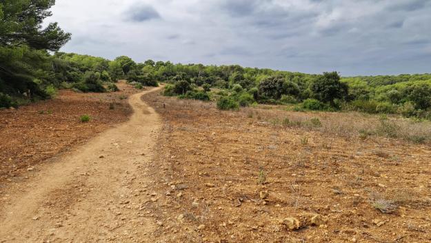
The ravinous (!) nature of the scenery was quite spectacular in places.

We crossed the lower field in this picture as we came down one side of a ravine and before going up the side of the next one.

and wondered, as we passed, what exactly was the crop to be grown in this obviously prepared terrain? Stones?

Anyway, the views were great.

We moved from forest into open country for short while

before passing Mystery Object #3

(yes, I can see it’s a hut, but it’s little larger than a dog kennel, so what’s it for?) The views continued to be quite impressive across the ravines as we crossed them.

and then we came upon post number 187 on the route, which signalled a possible diversion. So we left the formal Cami trail and followed a “Variant for Hiking”.

The blue writing on the wall here says “Cova”, by the way. This took us along a track past various signs telling us about the flora to be seen. I was amused by one

as we live near Chobham Common where gorse has revealed its true colours as a (yellow) pernicious, invasive nuisance which takes ruthless culling to keep under any vestige of control. The locals here will learn this in due course, I predict.

The diversionary trail is through another ravine and past some more great views

but the real interest lies a little further along, where a right turn, again (and very badly) indicated “COVA”, takes you to the Cova des Coloms, the Pigeons’ Cave.


View this post on Instagram


A post shared by Steve Walker (@spwalker2016)

Here are some stills, also.

As you can see, this is quite spectacular.

It’s a karst cave, formed as water dissolves limestone when it percolates through. It’s about 25m high and 110m deep. Research indicates that the prehistoric Talaiotic people on the island used it for burial rituals; you can understand how they might have found this an awe-inspiring place. Delightfully, as its name suggests, pigeons were flying, roosting and cooing all around us.

The diversion to the cave adds about 3.4km to the overall length of the route, but it’s very much a worthwhile digression.

We went back to the Cami track and completed the short distance into Sant Tomàs, passing a nearby beach

until we caught sight of the town itself.

It’s very much a tourist town (like most of the towns we’ve passed on the south coast of the island). We completed the stage

bumping into the lady pictured looking at the sign here. She was staying at the Alfons III in Ciutadella, and, like us, walked from Cala en Bosc to Cala Galdana yesterday, during which time we encountered her a few times. As we walked along today’s route at the start, we met her again, and discovered that she was due to walk a long section today. She shot off into the distance, and so it was rather a surprise to see her at Sant Tomàs, as she still had another 15km to go on the schedule she was walking to. But she’d taken a coastal trail which was flooded (we were warned about this, as was she) and so had to turn back. It was slightly strange to have met her so many times over the last few days. We hope she made it to Cala en Porter OK.

There was one slightly odd moment, soon after we arrived at our accommodation, the Hamilton Court apartments. We needed to buy some water (I don’t like doing this, but the tap water in the apartment really tasted poor) and I noticed that the apartment block has a mini shop. I went in, plonked my bottles of water on the counter and waved my phone at the lady behind the till. Unfortunately, I had come to the first place we’d come across that was cash only – very odd, as literally all other transactions we’ve done here have been contactless via the mobile phone.

The apartment we had? I can’t honestly say I was taken with it. It flattered to deceive. It was huge – larger than the apartment that I lived in for early three years in Sweden – with two bedrooms and two bathrooms, and even its own little garden outside. But there were sufficient drawbacks to make the experience of staying here less than satisfactory: a spectacularly ill-designed main bathroom, large, but with nowhere to put stuff like wash bags; a complete absence of soap or detergent (we had soap with us but this doesn’t help much with the washing up); an uncomfortable bed; and uncomfortable chairs in the lounge. A shame, really; I was glad we had only the one night there.

The rest of the day fell into a familiar pattern:

  1. Cup of tea
  2. Nice Lunch
  3. Siesta
  4. Relax and plan tomorrow (Jane); write this blog (me).

Jane had identified a nearby restaurant, Es Pins, which seemed to offer the sort of lunch we were after and so we went there. It was a lively place – a nice atmosphere, if a bit clattery for my taste, and with an open terrace overlooking the sea. We had a good meal, but made a tactical error in our choice of both starter and main course. My main course was lamb done Menorcan style and it is only because of my religion that I’m not sharing a photo of it with you; it looked like a whole shoulder of lamb. With mangetout. And potatoes. It was delicious. But vast! Jane had sea bass done Menorcan style and that was a generous portion, too – but again delicious.

So we’re basically stuffed to the gills; at the moment, I’m not sure I’ll need feeding at all tomorrow.

Before I talk about tomorrow, let me give you some stats for the day:

  • According to Garmin, we walked 12.30 miles. Relive says 17km, which seems more in line with the official distance plus the diversion to the cave.
  • The amount of ascent today was 371m, again more than the official version, as we had to climb a little to get to the cave. Despite the climbing, the going as quite easy so it was a pleasant walk overall.
  • So we’ve now done 107 Garmin miles overall. I’ll do an analysis after we complete the walking to compare the various versions of the distances we’ve walked. Don’t worry, I’ll squirrel it away in a geeky corner of the blog; you don’t have to read it.

And so to tomorrow. We are due to cover two stages as we walk from here to Cala en Porter, a distance, as I say, of about 15km. Our destination is a hotel as opposed to an apartment, and I discover that it’s a medieval castle built in 1971, which doesn’t have its own website; on Google Maps it’s described as a one-star hotel; another website I found describes it as a 5-star hotel. It has a bar and air conditioning; those at least will be very welcoming, whatever the other surroundings are like. You’ll just have to come back and find out, won’t you?

Cami de Cavalls day 9 – Wet Wet Wet

Tuesday 21 September 2021 – Fuck me, what rain! Oh, and wind!

Much of what follows is a long moan about the utterly, cataclysmically shitty weather we had to stumble through today.  So you can avoid several paragraphs of my moaning by watching the route and photos on Relive. But you’ll get a lovely dose of schadenfreude if you read on instead.

There had been a few straws in the wind about possible rain today, and so I looked at the various weather forecasts available to try to understand how the day would play out.  The UK Met Office suggested heavy showers with possible thunder; the Spanish website suggested by the Cami360 folk forecast grey skies with some rain.

They were both wrong; and I’m never going to trust the Spanish site again. Based on its more sanguine forecast and the choice of available dry socks I decided to go out in the running shoes which had proved so comfortable for walking in during the first five days of the trail.

This turned out to be an unwise choice.

Our pick up time at the hotel was 0830, for a lift back to Cala Morell, where we would start a 20km walk of easy grade – two stages of the trail, 9 and 10 – leading back into Ciutadella, where we were staying.  In our visualisation the day before, we thought we could have a nice easy walk to the outskirts of the city, where we could see lots of restaurants and bars, and stop for a Nice Lunch before tottering back to the hotel to sleep it off.

This turned out to be wrong on almost every level.

Deposited at the Cala Morell necropolis, we thought we might as well check out the one cave we hadn’t seen the day before; and very impressive it was, too.

Then we moseyed on to the start of the day’s first stage and set off along what looked like a reasonable path – maybe a bit rocky, but surely not too bad.

There was something of a sharp shower of rain, but it passed soon enough, and we carried on our way, amid some great light and bidding farewell to Cala Morell.

There was even a rainbow, nicely framing a stone hut, to wish us on our way.

I noticed a slightly ominous-looking cloud formation that clearly was carrying rain, but thought that the wind would carry it away from us.

Reader, I was wrong.

From this point, it basically hurled it down with rain for the next four hours.  Occasionally, the rain’s ghastliness was amplified by gale force winds, the only redeeming feature of which was that these came from approximately behind us (over the course of the day we met several groups coming the other way along the trail who had therefore to walk into hissing rain and lashing gales; our combined misery was such that we didn’t even spare the energy to acknowledge each other’s existence). The mix was leavened by the odd occasional flash of lightning and crack of thunder, much of it quite loud.

The rain was bad enough.  We had shower-proof jackets with us, which weren’t rated for a category 5 rainstorm. The occasional periods of gale force wind made things worse. But what really made progress not only miserable but even somewhat unsafe was the surface.  The rocks became slick, the ground turned to slippery mud, and the general misery of the weather was compounded by the general fear of taking a tumble on the rocks.  (I did slip and fall once, but “only” into a mud bath; it could have been much more serious.)

Yes, there were sights along the way:

stone huts, presumably used for storing food for farm animals;

caper bushes amid the rather bleak landscape;

a load of rocks with a cross on top (which, later reading showed, commemorates the wreck of General Chanzy’s steam boat in 1910 with only one survivor, but at the time I could frankly have cared neither one jot nor one tittle about);

a sight of the lighthouse which signalled the end of the first stage (dear God! is there another one to do as well?);

and some sheep, sensibly heading for shelter in the lee of a wall near the track.

But mainly, there was the rain, which by this stage had turned the path into a small river.

(I have video proof of this, but my soul rebels at the task of uploading it somewhere to share with you; just use your imagination, OK? And stop laughing, will you?  It’s not funny. No, it’s not.)

By the time we got to the end of the first stage

the road leading to the lighthouse had become a river in flood. Jane had suggested that we go and take a look at the lighthouse, but I demurred as politely as I knew how at the time, which was to say “Fuck off”.

The ghastly bloody mud-and-rocks path carried on past a few other sights.

We think this was a Naveta, something the Talaoitic-era folk used as a burial chamber, and which had possibly been modified to use for animal feed.  But it was clear that The Authorities didn’t want anyone exploring it, as any possible entrance hole was blocked; it was also (had I mentioned this?) raining, which lessened my interest in further research.

By this stage, I had completely lost interest in taking photos as we went along, or indeed in  anything other than simply getting into Ciutadella and outside a stiff drink, but Jane, bless her, took some shots of one or two things as we went by:

another stone hut;

a rather impressive rock arch, Pont d’en Gil;

and the outposts of civilisation, at which the heart leapt, for two reasons – there were only three miles to go, and it would be on lovely smooth tarmac. It would also, according to our original plan lead us past several possible refreshment stops, but since we were soaked to the skin and (certainly in my case) frozen to the marrow, this seemed a less tempting proposition than it had the previous evening.

Also: we had reached the “beach communities” outside Ciutadella, similar in principle, if you’ve ever been there, to Palma Nova on Mallorca or the cheap end of Paphos on Cyprus.

The restaurants and bars were (a) not very tempting and (b) unsurprisingly quiet.

The rain had obviously taken the local drains by surprise.

Eventually, the walk led us to some coves and inlets close to the city, such as Cala en Brut,

(which, incidentally, was the scene of further evidence of how unexpectedly heavy the rain had been, even if it was now easing to the point where I was prepared once more to take photos

I call this “wet stonewalling” and the policeman didn’t want me to take any photos.  So I reassured him by gesture and smile that I hadn’t.)

Playa de sa Farola

(you can see, in the distance, the ferry which brought us to the island a couple of years ago and started this whole thing off)

and Cala en Busquets.

And then we were right at the outskirts of the city itself

and then could cop an eyeful of the great view over the old town.

This was the end of the stage, and so all we had to do was to get ourselves to our hotel and hose off the accumulated mud, blood and weariness of the day.  We had covered 12.83 miles, or very nearly 21km, in five-and-three-quarter hours, which, given the conditions and the fact that neither of us sustained any serious injury was pretty damn’ impressive. Yes it was.

Having shed the worst of the day’s detritus, we headed out to find some lunch and had some tapas at a place called, rather unnervingly, Es Pou; but it was nice food, good coffee and lovely gin. Of course, by this stage, the weather had changed.

and long may the sunshine last (although I’m not too optimistic about tomorrow).  When we got back to the hotel, there was a lovely vignette of a balcony across from ours where a bunch of Spanish ladies were gathered having a good old gas among their rain-soaked clothing as it dried around them.

And thus the day came to an end.

  • 12.83 miles, or 20.66 km covered
  • 223 metres ascent, none of it actually steep, but all of it wet

Cumulative distance is therefore some 72 miles in seven days.  We’ve now covered the top half of the island and come half way round, from Mahón in the east to Ciutadella in the west.  Tomorrow we start on the southern half – a series of longer but less arduous days. Officially our next stage is just 13km and the forecast is for some rain, but not, we hope, the biblical floods we saw today. I’ll finish with the answer from the Cami360 team when we asked them about tomorrow’s weather: “The weather for tomorrow is similar to today with showers and localized storms. We hope that not like today”.

Amen to that.

Please come back then and find out how the day developed.


Cami de Cavalls day 8 – An Acropolis? No, a necropolis!

Monday September 20 2021 –  Fuck, I’m tired!  Judging by the way I feel, yesterday’s walk enervated me somewhat, and today’s really finished the job.  We covered two stages of the Cami today, nos. 7 & 8, going from  Es Alocs to Cala Morell, a total official distance of 9.76 + 4.90km, which (I had to use my phone’s calculator for this) is 14.66km.  Add in the 2.2km that we have to do before the official start, and this becomes 16.86km, or a smidge over 10 miles. Up and down (official ascent 350metres). In the lovely, bright sunshine.

You can, as usual, do the tl;dr thing and view the route and some photos on Relive. But this blog post will be much more interesting. No, really.

Actually, on paper this shouldn’t have been too bad, but, as I say, I think the combination of yesterday’s steepness and today’s length has used up all of my surplus energy.  Anyway, here’s the story of the day.

We were up relatively betimes, because we had to find a supermarket and some water to refill our bottles – Menorca’s tap water is not, we are told, top quality, and so we are forced to sacrifice our principles and buy bottled water.  The Loar did a reasonable breakfast – good choice of fruit, poor choice of cereals, but we were able to make ourselves a Nice Cup Of Tea and construct Marmite on toast, so that was OK. I had a schoolboy snigger at one of the signs by the buffet which at first blush I read as “our ferrets”.

I also took the chance to pop up to the roof of the hotel for a photo of Ferreries, since the sun was in a more favourable position than yesterday.

We found water and some more apples for snacking as needed, and David from the Cami360 picked us up promptly at 0900, along with a pair of German ladies who are clearly on the same overall schedule as us, and dropped us off as near to the Cami as he could – as I say, some 2.2km down a rather unrewarding forest track

lay between us and the formal start. Which was uphill. Of course it was.

There was a mixture for a few kilometres of fairly sharp ascents

with decent views from the top

with some sections of the track showing signs of formal maintenance/improvement work.

As we walked along, we heard an odd wailing sound, which turned out to be a young goat

presumably yelling for his/her mother, whom we could see much further away and apparently paying no attention. Well, who wants a needy youngster, eh? Our track took us near this goatlet, who was pretty nifty at avoiding appearing in a photo.

It turned out that I needn’t have worried too much about getting goat photos, as there was a small herd gathered around the track, giving the opportunity for lots of photos for lots of people who were also coming down the track.

Jane heard some munching in the bushes….

There were a lot of people coming down the track as we went up – we’d obviously hit rush hour of people heading to the Es Alocs beach. There were even cyclists and runners among them – definitely the most crowded we’d seen any art of the Cami so far.

We passed a track maintenance gang

(gawd alone knows what the drive to that point was like) and it was clear that this section of the track had had lots of work done on it.

There were, as usual, abrupt changes of scenery as we went along.

including a view of Muntanya Mala, Menorca’s highest cliff (200m tall)

which I’m glad to say we didn’t have to climb. Instead, the trail wandered for about 4.5km through forest

and farmland,

which was pleasant enough but which afforded very few interesting things to share with you – just a couple of cavalls

the odd imposing building (probably a farmhouse)

a construction which we’re told is probably a grain or feed store for animals

and some estivating snails

lots of estivating snails.

We overtook the pair of German ladies and also a group of Spanish people who appear to be walking the track on approximately the same schedule as us.  The Spanish group were quite jovial, especially one chap, who was being very voluble.  Still, I suppose if a group is large enough you’re bound to get one tosser.  (Jane has just informed me that the group doesn’t need to be very large… I dunno what she means…) We gradually left these behind as we reached the end of Stage 7, at a place called Algaiarens, which is a beach, and evidently a popular one, to judge from its car park.

Sadly, it wasn’t popular enough to warrant anything so civilised as a bar or ice cream stall, so we decided to crack on with Stage 8, to take us to our pick up point in Cala Morell.

The track took us past a cove called Cala de ses Fontanelles, which, we’re told, is normally used as a small harbour, but not so much so today.

We passed the Vierge Fontanelles herself, at a nice little barbecue spot

(there she is, bottom left), and started on the remaining track which led – oh, what a surprise – upwards.

But at least we got a nice view of the clear blue water in the cove.

Once we cleared the cove, the track was a rather unrewarding and very stony path leading relentlessly upwards.  The tedium was relieved a little by a cyclist coming by.

He had to get off and carry his bike up some of the rougher bits, but he cycled along most of this section of the path

and this is the terrain he was alternately carrying his bike and cycling along.

I have to ask the rhetorical question – WHY?  I for one can’t see the fun in going cycling somewhere that you know you’ll end up occasionally carrying your bike.  But it’s obviously A Thing and it doesn’t do anyone else any harm, so good luck to him and his ilk.

The path really was unrewarding to walk along, particularly since we were tiring by this stage, and I found I stumbled a lot as my brain couldn’t make the correct connection between my eyes and my feet to avoid tripping over rocks.  Eventually, though, we saw Cala Morell in the distance

and were reasonably soon walking on lovely smooth tarmac down towards the centre of the town, past some handsome buildings,

some unusual street lights, which looked rather like owls from front-on

and a roundabout which hinted at the town’s Talaolithic heritage.

Cala Morell is a strange mixture, having a Neolithic history that goes back centuries (see below) but also a set of very modern buildings which have rendered it into a prime tourist destination.

We walked to the end point of the stage, just so we could say we had done it, and then sought refreshment, which we were both sorely in need of.  A couple of drinks and some patatas bravas at a chiringuito called Baristiu (which, by the way, gave us the above view of the town) injected a little energy back into our tired frames, and so we went to take a look at an amazing example of the town’s historic roots – the late Talaiotic period necropolis, which dates from 500-100 BC, but which was apparently still used for several centuries after the Roman conquest of the island.  We had a few minutes before our pickup and so here are some photos wot I took of the hypogea where people were buried and an overview of the scope of it.

The Cami360 pickup point was, conveniently, just by the necropolis; we were picked up promptly and driven into Ciutadella, where our accommodation was at the Hotel Alfons III. This bills itself as a(nother) family hotel, but seems none the worse for that.  We had the usual Charlotte Hayward conversation on arrival, but otherwise were soon in a decent-sized room which should be a good base for the three days we are staying here – rather nice not to have to pack up and go after a single day.

So, here we are – properly showered, a little rested and not hungry enough to make us want to go out for dinner.  Ciutadella is a lovely city (we visited a couple of years ago) and not only should we have opportunities to reacquaint ourselves with it over the coming days, but also We Will Be Back for a few days of proper relaxation after we’ve finished walking the Cami. If we make it, that is. at the moment, I’m fairly comprehensively knackered, possibly even too tired to go to the hotel bar for a gin. That’s how tired I am.

Here are some stats for the day (which is, of course, the Cami plus a few extra kilometres):

  • Distance walked in total – 11.57 miles
  • Total ascent 426 metres
  • Therefore we’ve travelled damn’ near 60 miles in 6 days

and my Garmin tells me that I expended as many calories on the walk today as yesterday, and yesterday was acknowledged to be a tough day; so I feel my tiredness is to a certain extent justified.

Tomorrow (if we wake up, that is) we will do sections 9 and 10 of the Cami, and thus have walked around the top half of the island.  It will be a long day – 19km/12 miles, around the same distance as day 1 but allegedly easier, and with the possibility of a lunch stop en route.  So I hope we survive it with dignity. Why not come back tomorrow and find out?