Tag Archives: Scenery

Day 2 – Cami-panile: High Tower

Cami-flage Day 2Saturday 12th September 2020

Review of the after-effects of Day 1 revealed no serious injuries from 13 miles’ walking beyond some soreness in Jane’s little toes. She therefore decided to do today’s walk – only some 9 miles – in sandals. Well, Tevas, actually, but they look like sandals to me.

That decision taken, we had to check on the weather comparison between Surrey and Menorca.

From a walking point of view, actually, Surrey wins; those Menorcan temperatures are more suited to sitting in a shady bar with a glass of something cold. An attractive proposition, yes, but not in line with our mission statement.

Here’s what today’s walk looks like.

As you can see, it takes in two hills, Leith and Holmbury. So, off we drove to the start point, Friday Street in the Surrey Hills. At this point it became clear that a combination of lockdown and retirement meant that we’d lost track of the days. Today is a Saturday, which means nothing particular to us; but to normal people, it’s a weekend in a phase where Covid life is beginning to show signs of normality. So there was quite a difference in the state of the car park for yesterday’s walk
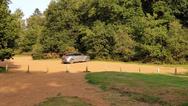
and today’s.

We were, frankly, lucky to find a space. But we did, and set off down the hill in the general direction of Friday Street. There’s a pond

and, very soon after, a pub called the Stephan Langton,

which had been my plan A for a post-constitutional Lunch until I discovered, in the research phase of this exercise, that it was no longer open. Judging by the number of people picnicking nearby, I’d guess that a few of them had had that plan A but hadn’t done their homework.

Given that we’re almost exclusively walking in Surrey, the basic scenery is going to be similar from one day to the next, so I’ll spare you too many photos of woodland, tracks and heaths. But every so often there’s a striking scene, such as these bonkers beech trees (as opposed to conkers chestnuts, ho ho)

and noteworthy buildings, which really are restful on the eye as one passes.

Actually, some of the trails are really rather striking, too, so I will share the occasional one, such as this.

Our first landmark on this route was the High Tower mentioned in my rather tortuous title, the tower at the top of Leith Hill, the highest point in Surrey at 294 m (965 ft) above sea level. Unsurprisingly, then, the path led upwards and upwards. At one point, although we were (a) following instructions from Fancy-Free Walks and (b) retracing a track we’d walked before, we managed to stray, as you can see from the green line showing quite clearly that we’d missed our way.

It didn’t matter – frankly if you keep going uphill in these parts, you’re bound to reach the right place; and actually it was a rather fetching little track we found. Eventually we reached the tower.

It became clear that (a) many other people had had the same idea as us (no surprise, as this is a hugely popular weekend spot) and (b) the little cafe in the base of the tower was open (this was a surprise, as we’d thought that the pandemic would have scuppered That Sort Of Thing, but we’d clearly underestimated the National Trust’s competitive nature). Socially-distanced queuing, of course.

So we were able to do two important things: firstly, have tea and cake (tea of a much better quality than anything we could have expected in The Foreign);

and secondly to take a picture of our Xoriguer gin bottle.

My original thought had been to make the tower a lunch stop, but since I was sure it would be closed we had to declare an emergency tea break to justify sitting down and taking in the lovely views.

If you look carefully, you can see bits of London, like the arch over Wembley Stadium.

No, really – it is there.

From a photographic standpoint, this is the first time I missed having a Proper Camera with a Proper Lens about my person. The phone has done remarkably well, all things considered, but a camera with a decent optical zoom would be better. So I’ll possibly take one on future outings.

Tea and cake having been satisfactorily demolished, we went on our merry way, along the Greensand Way which passes through these parts. As you can see, we only missed our way the once.

We then headed down and down until we caught sight of the next part of the route – the walk up Holmbury Hill, seen in the background here.

The first part of the climb is really very steep indeed.

It’s very difficult to convey in a photograph quite how steep it is. You’ll just have to believe me. But we scrambled up it and made our way to the top of this climb. The route offered a choice – continue to the top of the hill, or head down to the village. For some reason, we carried on up, but before we carried on I made it clear that the recompense for this was to stop at the village pub for some refreshment.

So we made it to the top, where we enjoyed the lovely view…

… as did our gin bottle.

And then we headed down into the very attractive village of Holmbury St. Mary, which was a sort of Victorian experimental creation – see the history part of this description. It’s a fetching place.

with a large church

and, importantly, a pub, the Royal Oak (which brews its own beer, called Felday, the original name of the village). Part of my research had been to establish that it would be open as we passed.

Suitably fortified, we carried on through the agreeable village on to an agreeable track which headed back to the car past some very attractive brickwork.

And thus ended today’s walk, at 9.03 miles just a bit longer than the Menorcan equivalent stage. The weather had been perfect – sunshine, around 20 degrees C – and the walk had been very pleasant. More to the point, we were unscathed and so should be able to take on tomorrow’s more modest challenge – a 6-mile walk, which we’ll do on paths around where we live so that we can go off for lunch with friends afterwards. It’s a lovely walk, around Chobham Common, so I hope you’ll come back and Read All About It tomorrow. Bye for now….

Oman Day 8 – Muscat Ramble

Thursday 28 Feb. We spent the morning with Rashid, who took us to see some of the highlights of Muscat before lunch. We certainly packed it in – Grand Mosque, Opera House, Souq, Sultan’s Palace, National Museum. I took loads of photos, but really feel that I need to get to a PC to tweak them to do the sights justice. Here are a few, and I will come back and update them with improved versions once I can get my hands on decent RAW processing software.

The first item on the itinerary was the Grand Mosque, a gift to the people of Oman from Sultan Qaboos, with the intention of spreading a clear message of inclusive and peaceful Islam. It’s an impressive building, certainly on a par with the Sheikh Zayeed Mosque in Abu Dhabi, Through a knowledgeable and impassioned exposition of information about the mosque, Rashid also showed that he has a serious and thoughtful approach to his Ibadi Islam religion. (Ibadism, a school of Islam pre-dating Sunni and Shia denominations, is dominant in Oman and is noted for its realism, tolerance and preference for solving differences through dignity and reason, rather than confrontation).

I could drown you with photos and information, but I’ll try to include just the bare essentials and will set up a full Flickr page on the mosque in due course.

Right from the first approach, you get the sense that the building is intended to inspire awe and devotion. It combines places of worship (white marble) with places of enquiry, scholarship and administration (pink marble).

As you approach the central hall, there are many impressive views of the buildings.

Before entering the main hall, Rashid showed us that this is also a place of learning and scholarship. An impressive door leads into a library

where people may read, study and learn. There are also imams on the site who will give guidance to anyone who asks for help.

Then we entered the main hall of prayer, which is hugely impressive. It really is difficult to convey this in photos. Here’s an overall impression

and here are some other highlights as you walk around: A vast carpet, hand stitched in Iran by (I think) 43 women over four years, and valued at around 10 million pounds

(interestingly, it has no lines in it to instruct worshippers how to line up – the Abu Dhabi mosque does – but apparently they line up OK anyway. See later for more lines). The detailing all around is very intricate and beautifully done

and there are detailed carvings and mosaics all around the walls. Some are functional – this contains copies of the Quran

some are decorative

Here’s a set of individual Quran chapters laid out in a niche.

and here’s a view of the central dome and massive (Austrian crystal) chandelier.

Outside the main hall of worship are several courtyards where worshippers can find a place when the main hall is full.

In the above photo you can also see carved script running around the walls; the entire Quran is written in the fabric of the buildings – albeit in a highly caligraphic style which is difficult to read, apparently.

The lines you see in these courtyards are lines along which (male only) worshippers stand and kneel to pray. The number of courtyards with these lines in really underlines that the mosque can accommodate a huge number of worshippers, the vast majority of whom will be male.

Females are by no means excluded, oh, no, absolutely not. Here is the hall where women can worship.

As you can see it’s much smaller than the spaces reserved for male worshippers. This is because it is apparently OK for women to pray at home, but men have a duty to attend a mosque to pray if they can. Women pray separately from men in order that the men don’t lose focus on the act of worship by catching sight of a fetching female, albeit one wrapped up in a scarf.

For a fan of architectural photography such as myself, there are many opportunities for striking photos.

We left the mosque with one final view

before heading to our next stop – the Opera House. This is a pretty monumental slab of architecture – modern because recently built (at the behest of the Sultan, who was educated in England and acquired a taste for opera there, poor sap).

Inside is, as you’d expect, very nicely done, with a posh ticket hall leading to the auditorium.

(on the extreme left you can see the security scanner which prompted the nice guard chappie there to relieve me of my Swiss army knife for the duration of our visit, just in case I had considered running amok with it). The auditorium itself is large but not huge – a capacity of 1,100 poor unfortunates – and with a very large royal box (not a surprise, given whose idea the building was).

It’s all very comfortable, with screens in the back of each seat showing the translations which are so critical when trying to make some kind of sense of the ludicrous plots that are unfolding before you.

You may have guessed that I don’t like opera, and you’d be right. It’s the singing that I hate, mainly. In fairness the auditorium is also used for ballet, orchestral, local and international song and theatre productions…

Anyhoo – our next stop was the Souq – Muscat Souq is in an area of the town called Mutrah. Jane was looking for some of the kind of glass receptacles that were used on our camp majlis tables:

and we thought, of course, “Souq and ye shall find”. So we souqht, among the many colourful boutiques:

and were offered many, many opportunities to buy all sorts of things, but mainly Kashmiri cloth and incense; but the requisite glassware was not around, although there were some other nice scenes.

Most places were selling tourist tat, and so our occidental appearance was very much grist to the mill of the local importunate selling technique. We just said “shukran” (meaning literally “thank you” but in this context “no, thank you” and eventually escaped so that we could visit our next stop, the fortifications and Sultan’s palace on the outskirts of Muscat.

The Royal Palace is stylistically a bit off the mainstream in my humble opinion – it looks more like something that Gaudi might have dreamt up.

Overlooking it is Al Mirani Fort, one of a pair of ancient forts guarding Muscat from those marauding Riffs from Nizwa (the other is called Al Jalali and is across the harbour from Al Mirani).

As you look away from the Royal Palace, you see a monumental street with monumental buildings and, at the end of it, the National Museum.

I’m not normally a great one for museums and my back and feet were aching for some respite – lunch, say – but in we went. The museum is not vast but the scope of its exhibits is, covering Oman’s prehistory and history, renaissance, relationships with the world, Islam, heritage, maritime history and the land and the people. There’s an airy central atrium

with lots of exhibition halls going off it. Some things were very striking, such as the relief map of an irrigation system from mother well, through habitations and finally to the plantations

which, if you look closely, is beautifully done in layered wood to show the contours.

Another such relief map illustrates clearly how Muscat nestles among mountains.

We also found an exhibit hall dedicated to the “beehive tombs”

and a selection of very imposing gates such as this one

which was made in 1126 and guarded the entrance to ash-Shibak fort. If you look closely, you can see the UK Royal Coat of Arms among the other calligraphic, floral and animal motifs. It reflects the close ties between Oman and the British East India Company in the time of the Mughals.

After such a sprint round the tourist boxes-to-be-ticked, we were ready for a break, and Rashid took us to the Turkish House for a seafood meal – wonderfully grilled prawns and some sort of snapper, accompanied by calamari, hummus, a spinach salad and some wonderful flatbread – a nice way to round off the day’s touristing.

By the time we’d finished lunch (around 2.30pm) the traffic had really built up, as this was a Thursday and therefore people were heading out for the weekend. So it was a bit of a grind to get back to the hotel, but we made it in time for (complimentary) afternoon tea followed by (complimentary) G&T and an opportunity for me to update the blog. We have one more day in Muscat and you’ll simply have to read the next instalment to find out how that went.

Oman Day 7 – Back to “civilisation” with a bump

Wednesday Feb 27. So this was it – our goodbye to the camps that the Hud Hud Travels team had so splendidly set up and run just for us – sad in a way, but holding out the tingling anticipation, at the end of the day, of:

  • getting online
  • unlimited running hot water
  • unlimited electricity

I may not be as jaundiced about camping as I was earlier in the week, but still my heart leapt at the prospect of all of the above.

However, there was packing to be done and breakfast to be had before we said our goodbyes and headed off for the day’s adventures. These largely centred around a drive over the Hajar mountains, widely touted as the most scenic drive in these ‘ere parts. Touted correctly, too, in my opinion. The road itself is a bit of a bone shaker

(and should not under any circumstances be undertaken in anything but a robust 4×4 – see later) but offers some really spectacular scenery.

You’ll notice in the last of these that there’s a village nestling among the savage scenery. This, and others, are inhabited by people who have lived in the Hajar mountains for generations. For them, life is simple, spelt t-o-u-g-h, but it’s one they know and when the government, in an enlightened attempt to make life better for them, builds an entire village for them

the uptake is quite low, according to Rashid. However, the younger generation are more prepared to move and so eventually social housing projects such as this may well be fully populated, and the problems of delivering water, electricity and life’s other essentials to the remote areas of the Hajar mountains may well diminish.

At the high point of the drive is the Salma plateau. If you want my opinion, it’s a bit up-and-down to be credibly called a plateau

but I suppose everything’s relative. Anyhoo, the most interesting feature of the plateau are the “beehive tombs”, some 28 of which can be found here, with many more in other locations such as Al-Ayn and Al Khtum.

Above are two of the well-preserved ones, but many have decayed. The workmanship on them is quite remarkable.

Jane crawled inside one to see what it was like inside.

As you continue the drive, you can look back and see the ones which have survived over the centuries.

On we drove, enjoying the spectacular mountain scenery.

until we came to a village nestled in the middle of all this rockery!

The question naturally occurred to me – why the actual do people set up a habitation in such remote parts? Rashid’s answer was simple – they found water, and had developed skills in locating sources of water which enabled them to perpetuate this life, tough as it is. This village is called Qorun (I think) and, indeed, is centred around a well.

Above you can see the tanks to which well water is pumped before being loaded on to the water trucks for distribution to the remote parts of the village and other mountain sites, too.

A diversion was provided by a baby donkey, who wondered if we might have some food.

There are wild donkeys in the mountains, but also some which are owned by villagers, along with goats and sheep. If you look in detail at the layout of the village, you can see where the animals are kept.

Theirs are the shelters extending out from caves and hollows higher up the rocks to centre and right of the picture above – but those used to be the actual domiciles of the villagers themselves in times gone by!

After a while we reached the top and crossed over to the point where we could see the coast, and we stopped for lunch in front of yet another stunning view.

(The faint line across the middle is actually the horizon, with the ocean meeting the sky.)

Rashid spent some time explaining elements of the view to us, whilst around us there was a certain amount of wildlife activity. We were inspected by goats

and, delightfully, Egyptian vultures.

(we think we spotted a Turkey vulture as well, but are not entirely sure. It’s amazing that Oman has to import its wildlife from other middle eastern countries, don’t you think?)

Lunch over, we made the descent to the coastal plain. This is where a 4×4 – and an experienced driver like Rashid – becomes essential, as the road is incredibly steep in places – difficult to convey photographically, but here’s my best shots.

We saw a few more features on the way down: a face in the rocks;

the caves where mountain people used to live;

and another government housing project intended to encourage these folk to live in better accommodation which so far languishes mainly empty, since the people refuse to move.

We finally made it down to the coastal plain and spent a few minutes cruising the (lovely, smooth, tarmac) coastal road near a town called Fins looking for gazelles, since this is the coastal end of a reserve called Ras al Shajar. We saw a few, but they’re quite shy, so I have many photos of their back ends as they ran away.

Then Rashid took us to see something that is, on the face of it, a bit strange – a Frankincense tree. It was rather marvellous to see something in real life that I had previously only come across as a biblical reference. So here it is – the only Frankincense tree in northern Oman:

There are, Rashid told us, many in southern Oman, around Salalah, but this is the only one in north Oman. I’m not sure I can understand why people haven’t taken cuttings from it to make other trees (because you can see where cuttings have been taken), but there we are. Rashid also told us about male and female Frankincense. Looking closely at the tree, this is a patch of female

and this of male

They are subtly different in the scent they produce, apparently, but I’m only a bloke so I don’t really understand these things. The tree was in flower, so here’s your chance to see Frankincense flowers.

Our next tourist stop-off (because by this stage I’d begun to feel that we were ticking the boxes – gazelles, tick, Frankincense tree, tick) was Hawiyat Najm, or the Sink-hole park. There’s maybe nothing unusual in yer average sink hole, but this one is slightly unusual in that it’s fed by both fresh water, from the mountains, and salt water, from the sea. Anyway, there are steps down into it and you can go swim in it if you like – after you’ve paid to get in, of course. Like Wadi Bani Khaled, this is very much a tourist spot, but it’s quite striking.

So there we were – all the boxes ticked and it was finally time to go to the hotel which would be our home for the next four nights – the Chedi, in Muscat. This is a seriously posh joint and I’m entirely pleased to report that we were upgraded to one of their Executive Suites, and so have separate bedroom, bathroom, terrace and lounge, which is where I sit and type, for these blogs don’t write themselves, you know. Jane has pointed out that all this luxury seems a bit fake after the gritty reality of life in the mountains or desert. I kind of understand what she’s trying to say, but I’ll grab that unlimited electricity and hot running internet with both hands and be grateful.

Tomorrow, we get to tour the highlights of Muscat, so tune in to the next installment to find out how that went. ‘Bye for now!