Wednesday 6 September 2023 – Here I am, once again addressing myself to the critically important things in life. Yup. I’m blogging from the launderette. We noticed it on the way to a Nice Lunch and so, having stuffed myself, I’ve now stuffed the washing machine.
Today has been a good day, generally – including doing the washing. As my brother knows, getting the washing done when one is away from home for an extended period preys on the mind – these things are important, you know – and so the chance to have clean knickers and socks going forward is as much a contribution to the quality of life as a nice walk.
Which we had, today. If you’re in a bit of a hurry, you can watch the Relive video instead of reading on. Your call.
Still here? Oh, good. OK, then…
Our eccentric, somewhat threadbare and slightly charming hostal in Calzadilla de la Cueza provided an eccentric, somewhat threadbare and slightly charming breakfast (toasted croissant, anyone?) which we supplemented from our stock of Twining’s finest Earl Grey, and then departed some 15 minutes before sunrise; the forecast was for a dry day and temperatures not too hot – upper 20s Centigrade – but a prompt start in the cool seemed a good idea.
By and large, the Camino Francés route is unambiguously signposted. However, the onward journey towards our destination, Sahagún, some 22km away, had several options. The company who have organised all our baggage transfers along the way, walkthecamino.com, have also provided us with a personalised Google Map, showing our route and our hotels. The map for this area looks like this,

with the hotel we had just departed bottom right. Jane had, as ever, done her homework and reckoned that although the most straightforward route was simply walking beside the road, an alternative route through the countryside seemed a more attractive proposition, provided that it wasn’t too unfriendly to a sandals-and-socks approach. So it proved; the official Camino signposts pointed people along the right fork, on the route beside the road; so we struck out on the left fork across country. And were very glad we did so, too.
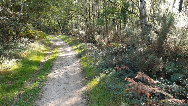
At first, the path provided a scene that wouldn’t have looked out of place on an Autumnal walk in leafy Surrey

but soon returned to more familiar scenes for the area, meaning sunflowers, mainly.

Some of the sunflowers looked extremely dead and ready to harvest


and, given that there’s apparently a 90-120 day cycle from sowing to harvesting, I wonder whether we’ll see some harvesting action later in our walk, as we’d both like to see how it’s done.
We came across a handy stone map, which showed the various routes and reassured us that we weren’t off on a wild goose chase.

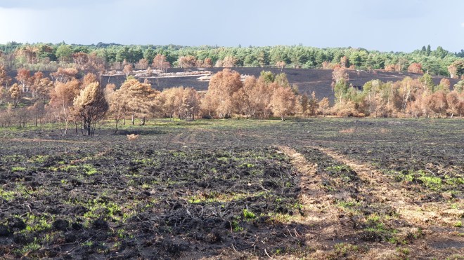
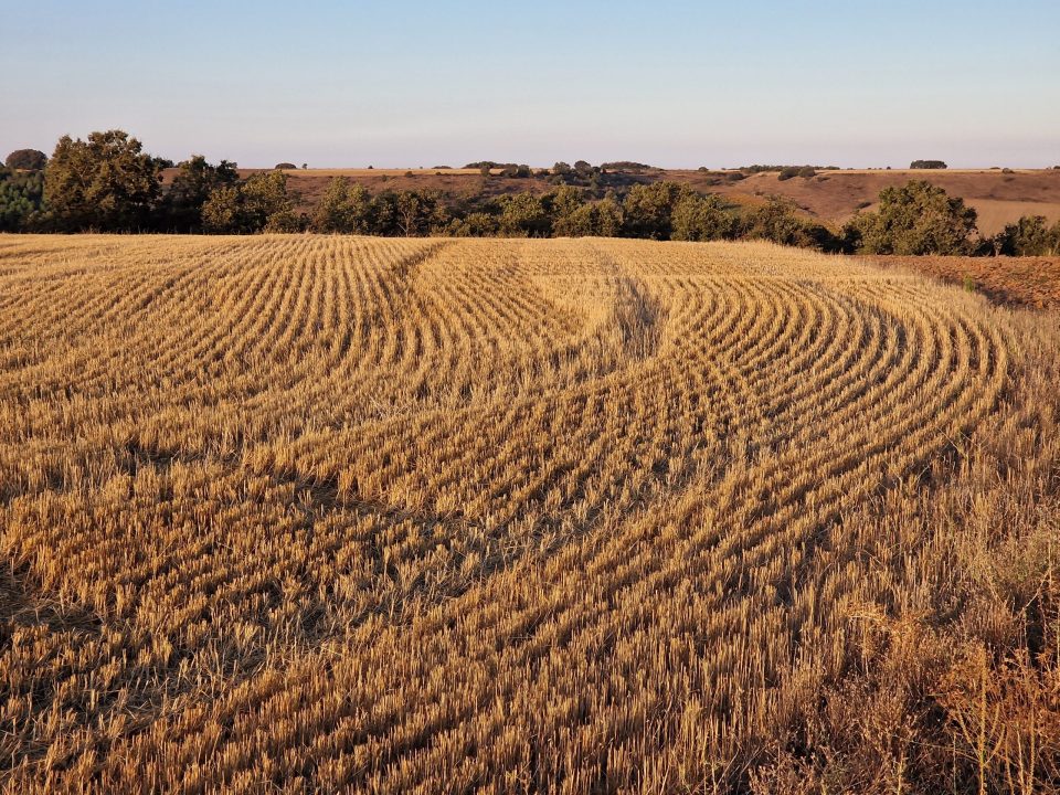
The landscape contrasted sharply with the flat, unvarying scenery that had accompanied yesterday’s walk. We had nice patterns in the harvested fields
and nice views as the path rose and dipped. We saw not a single soul (although we did see a deer).

Before long (well, about 7km) we saw our first coffee stop, in a village called Ledigos,

where, after the caffeine injection, we saw that the route bifurcated again.

We chose the principal path, as it seemed that the pilgrim’s path would simply continue alongside the road. The morning light was lovely as we passed another dovecote

and we very soon reached the next village, Terradillos de los Templarios, at one stage a calling-in place for Knights Templar, but now lacking any of the historical buildings of those days. The only reminder now of those Good Old Days is a rather fine statue.

The significance of the place for us was that it’s recognised as the halfway point along the Camino Francés. We’ve got a long way to go, but Look How Far We’ve Come!
We didn’t stop for a celebratory libation, but instead pressed on, as we still had some distance to cover and the day was warming up.
The various routes now combined and led us on through two more villages on our journey to Sahagún, and both were delightful, each in its own way. En route, we passed an unusual sight.

This is the first large-scale use of solar panels we’ve seen on our time in Spain so far, and we wonder why? There’s so much sun, one would have thought it would be extremely cost-effective to set up solar farms all over. But no, apparently. Maybe just not yet?
We also passed the first evidence of farmers at work.

Bear with me on this; its relevance will become clearer later.
The first village we reached was Moratinos. As we approached, it looked as if it had its own slag heap,

but as we got closer, we noticed what looked like chimneys sticking out of it.

A passing Spanish pilgrim explained that these were bodegas – cellars; there were several entrances around the mound, some in disrepair, but some in good shape.


The word “bodega” is firmly associated in my mind with wine; but there are no vines hereabouts. In front of the mound, there was a sign which explained more. At one time there were vines around and these bodegas were used for the preparing and storing of wine – a perfect environment as, like a wine cellar in France, the temperature is unvarying. However, many owners moved away to work in the cities, and there are no longer many grapevines around. Apparently about three families in the village still make their own wine, but other bodegas are used for storage of food such as ham and cheese, or as party venues; or, sadly, are disused and hence dangerous to enter.
Just outside the bodegas is a refreshment stop,

but we decided to crack on, and turned the corner into a village square which was a delight.


Local ladies have crocheted or knitted many of these flags, but others have apparently been donated by women in Ireland, Portugal and the USA.
Outside the village there’s further evidence of the various versions of the total distance of the Camino, as these two signs were within a few metres of each other.


No matter – we’re over half way there and still enjoying every day.
En route to the next village, San Nicolás del Real Camino, we passed this charming sign.

This is something we’ve talked about with other pilgrims: the first bar in a village is the favourite to get the pilgrim business. This chap was clearly taking pre-emptive steps to give his establishment a chance. The village appeared in a fold of the countryside

(and one of the houses had more bodegas outside it)

and so we deliberately passed by the first bar, outside which was this sign

and went to the second one.

Which was lovely. We had coffee and juice (Jane) and beer (me – I needed the electrolytes) and the manager was very charming and gave us great service.
As we moved on, I realised that the countryside was gradually changing colour, from gold to brown


as more and more fields where the crop has been harvested are ploughed over.

We soon caught sight of Sahagún in the distance,

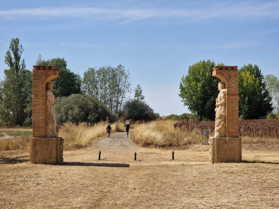
but still had a few kilometres to go to get to our hotel. The path led past an Ermita, the Ermita de La Virgen del Puente

which had outside it a pair of statues.


At about this point the day had become quite hot and we were walking in the sun, so the rest of the journey to our hotel was a bit of a test of patience. I tried not simply to wish that I was there, but to be patient and keep walking, in the certain knowledge that I would get there. I did, but not before tripping over a lump of concrete and skinning my knee. Patience, hah!
We checked into our hotel, the Hostal La Codorniz (so nearly some Cava) and got into one room before they realised their mistake and ushered us into another room (larger, fortunately), which we again vacated soon after for a neighbouring room because of an ominous sound of dripping water coming from behind one of the walls.
Then we went for a walk. Obviously.
Actually, the idea was to go for a Nice Lunch, at a restaurant called El Arco, recommended by a Swedish friend of ours who walked the Camino last year, and who is partly responsible for us doing it this year. When you reach the restaurant, you realise, if you look to your right, why it’s called El Arco.

We did, indeed, have a Nice Lunch, and then walked back to our hotel via some of the various sights in the town.
The arch belongs to the (now ruined) Benedictine Monasterio de Santa Cruz

and the route back led us past the Plaza Mayor,

other principal churches,


as well as many murals.


It’s a bit whistle stop, but it was nice to see the extent and variety of buildings, architecture and artwork in the town.
Stats, then. 24.2km was recorded by Relive today. It should have been a little less, but a small lapse of concentration led us off piste a short way.. However, 413.2km it is, just a smidge under 257 miles, and definitely over half way along.
Tomorrow sees us taking a shorter walk, about 13km to another Calzadilla, this one being of the de los Hermanillos variety. We’ll probably aim for an early start to get the best of the cool, even though temperatures forecast are not oppressively high – upper 20s again – and rain should not figure.
OK, I’ve done the washing now. time to close this entry off. I hope you’ve enjoyed reading about today and will come back soon and read about tomorrow.