Tag Archives: Sunshine

Day 7 – Cami Round The Mountain

Cami-flage Day 7 Thursday 17th September 2020

We’d been looking forward to this walk with a mixture of anticipation and dread, for a variety of reasons.  Firstly, it represents the halfway point of the Cami-Flage project and we had no idea whether we’d still be mobile, far less up for yet another 10-mile walk, at this stage; secondly, it is the most challenging of all of the UK walks we’d planned, and, as I said in yesterday’s post, we are both lighter and fitter than the last time we tried the walk, but there was still a frisson of uncertainty around the day’s exercise, which was to tackle Box Hill (the mountain in today’s title).

Box Hill is probably the best-known area of the Surrey Hills on account of its inclusion as part of the cycle racing at the London 2012 Olympics.  It’s a hugely popular area with cyclists and walkers alike, but the cyclists stay mainly on the road and the walkers mainly on tracks so there’s not a lot of conflict.

What there is a lot of, is up and down, as you can see from the profile on the bottom of the picture above and you will also understand from reading on.  Given my aversion to walking up steep hills in searing heat, then, I was glad to see that once again Surrey had better weather for the purpose of the day than Menorca.

The Saturday Walkers Club route that we followed officially starts from Westhumble Station.  However, bitter experience tells that there is scant parking there, as it’s a tiny station (see later).  So we started at the cyclists’  and bikers’ caff nearby, called Ryka’s.  It’s a perfectly good caff, and  place to park and visit the loo, but one has to be careful of its closing time (see later).  Walking from Ryka’s towards the station takes you through a very colourful underpass

past some nice houses to the station itself.

There was actually some parking available today, and we also noticed that the station’s name has changed. It’s now Box Hill and Westhumble.

Crossing the road above the station takes you to a path, through a field

and to the foot of the first (of many) uphill stretches.

The path goes through something engagingly called the Druid’s Grove, although the sign telling us this has now disappeared, possibly consigned to the darkness, I don’t know. Anyway, we pressed on uphill and the path took us past some remarkable yew trees – huge, old and still alive.

(I have some work to do to try to assemble multiple photos into a single gestalt, but I hope the above gives some idea.)  After the last of the yews, the path takes another uphill turn

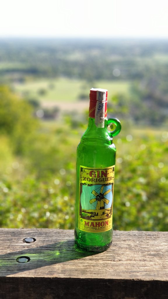
which leads into sunlit uplands with a nice view, the sort of thing that is somewhat enhanced by having a gin bottle in it.

The trail then goes past a Big House called Norbury House; after a short while, you can dive off to another viewpoint, which, again, provided us with a chance to air our gin bottle.

The path then continues beside a sawmill.  We were quite surprised to see that an enterprising soul had set up a coffee stall there and seemed to be doing reasonable business.

We didn’t stop for coffee, because we knew that in the village of Mickleham, quite nearby, was a pub (we normally walk past it on this route, so I was overjoyed that today we would have a chance to stop and sample the beer).  It’s a walk down into Mickleham and then across to the pub, the King William IV.

Pandemic restrictions means that it currently operates only outside, but we were allocated a spot and decided that a sandwich would help the beer go down well, so declared a lunch break.

After a nice pint (well, a quart, actually), we moved on. The next bit is, would you believe it, uphill.

and leads to a level path with one of my favourite views that includes roofs and chimneys
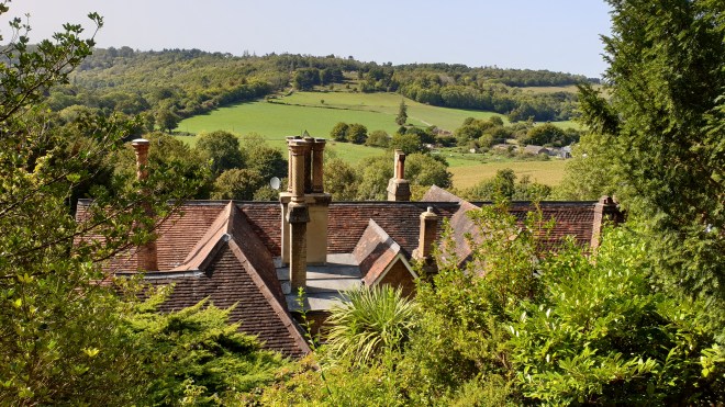
before plunging uphill yet again.

This is the start of quite a long but not too demanding uphill path through woods, and it held something of a shock for us.

A huge and once beautiful beech tree had clearly suffered some significant damage, presumably in one of the various storms since we last passed this way (just over three years ago, for a variety of reasons).

The path leads on and up and then reaches a wide open area called the Gallops.

It’s called that because it’s been used to train racehorses, and one gets the firm impression that riders still use it today.

At the far end, we dived off left into the woods for a steepish downhill plunge to a path where we met yet another surprise – a lady out taking her parrot for a walk.

Our track then joined a National Trust track called the Box Hill Hike, and we stayed with it for quite a distance as it went up

then down

then up

(the steeper bit, natch)

heading, via some lovely views

to the highest point of the walk which is by a residential neighbourhood which is rather dull to walk through

albeit leavened by this outbreak of levity.

After the high point we went, rather unsurprisingly, down, and eventually quite steeply so

as the path joined up with the North Downs Way for a spell

before going, would you believe it, steeply uphill again.

The compensation for panting up the steps was a nice view over Brockham,

a perfect opportunity, as ever, for the participation of our gin bottle.
The path (this is beginning to sound like something by Gerard Hoffnung) goes down again before turning steeply uphill

and up the final, most testing part, which is basically up the steep side of the Box Hill escarpment.

It may not look very steep in the photo.  Do Not Be Deceived.  I think we were both quite pleased that we were able to get to the top of this without stopping (Jane) or blacking out (me). The reward is a spectacular view from Salomon’s Monument, enhanced, as all the others, by our gin bottle.

The next important landmark on the track is the Box Hill Café,

at which point something like tragedy struck.  It should be writ into law that one cannot pass a café on a hike without stopping for tea and cake.  But we suddenly realised that time had moved on, as it does, and if we weren’t reasonably swift about things, our car would get locked in to the Ryka caff car park.

So, cakeless and unfortified by Earl Grey’s best infusion, we sped past the fort

and headed down the hill, yomping past the view across to Denbies Wine Estate (that’s part of next Wednesday’s entertainment, stay tuned)

and of our starting point down by the roundabout

and hurried back to our start.  We discovered that our mileage (10.63) was a bit down on the Menorca equivalent (11.74), but our elevation gained, at around 600 metres, was roughly double its equivalent, so I hope we’ll be forgiven by posterity; in any case, we’re still some 2¼ miles up overall compared to the Cami route round Menorca at the same stage.

We have now effectively walked from one end of Menorca (Mahon) to the other (Ciutadella) and, I have to say, we’re still quite fresh.  All that time exercising during the pandemic lockdown period has paid off.

Tomorrow, we have a 9-mile stretch to cover, but we have the luxury of being able to start from our own front door.  There’s no pub, but there is a café (which serves beer as well as tea and cake) so we have a refreshment stop to look forward to as part of the day’s activities.  Please drop by to see how we get on – see you later!


Day 5 – Cami To The Garden, Maud

Cami-flage Day 5 – Tuesday 15th September 2020

I shan’t bore you with the weather comparison between Surrey and Menorca today – suffice it to say that the two were pretty much comparable, with the sun shining in both places and Mahon (30°C) simply being warmer by 4°.  So the conditions were set fine for a fine walk around Virginia Water Lake with a sideways shuffle into the Valley Gardens (the justification for today’s headline).

Here’s an outline of the walk, which lies just north of the A30 and the Wentworth estate (the golfers among you will know where that is, of course). Being largely beside a lake it’s rather unsurprisingly rather flat

but full of lovely greenery and scenery.  The basic walk around the perimeter of the lake is some 4½ miles, and we expanded it by around the mile necessary to match the Menorca equivalent by wandering into the neighbouring Valley Gardens.

Along the path one sees a variety of things from majestic trees right down to rather engaging  things you can make from them.

Shortly after the start of the walk, there’s a pond called Wick Pond, which is normally very pretty, but today it was lifeless and covered in algae.  However, there was one attractive thing about it.

We may be halfway through September, but Summer is not yet dead (though Autumn is on its way – see later).

The next landmark is the famous Totem Pole, not an item you normally expect to find in Surrey.  But there it is, and there was nothing for it but to show it to our gin bottle.

Incidentally, the chap at the top looks rather as if he is scared of heights.

Walking along towards and into the lovely Heather Garden, one could see the first stirrings of approaching Autumn.

and the colours can be wonderful.

The Heather Garden is always a pleasure to visit at any time of year.  You can always find pleasant scenes.

(We can’t decide whether to call the above Dougal or The Very Hungry Caterpillar.)

We mooched about afterwards in a wooded area on the way back to the waterside

and I tried my hand at a true photographic cliché.

after which we made our way around the far end of the lake where it would have been rude not to stop for tea and cake.

Just before the café the path crosses a five-arch bridge, which you can’t see at the time, since you’re actually on it.  But you can get a nice view of it from the later path and this seemed a good excuse to get the gin bottle out again.

On the home stretch, there’s another item which one wouldn’t normally expect to find by a Surrey lake – Roman ruins.

Leptis Magna was a 2nd century Byzantine city.  Bits of its ruins were transported to Surrey in the 1800s. Whatever, it made a good backdrop for yet another gin bottle photo.

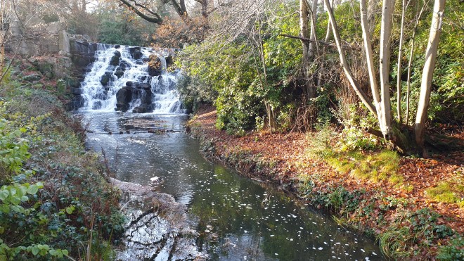
The final landmark came as a bit of a shock.  Again, somewhat counterintuitively as you walk alongside a lake, there’s a fairly substantial waterfall called, somewhat less counterintuitively, the Cascade.  It’s normally very photogenic, as you can see from a photo I took there about a year ago.

But today…..

It looks as if something fairly horrible has happened – trees have been cut down, perhaps because of storm damage earlier in the year, and the water supply is either inadequate or has been cut off whilst work is carried out.  In any case, it’s a sad scene.

It was a shame we couldn’t end our walk with a great scene, but the rest of it was very pleasant – a nice walk in splendid scenery in agreeable weather, plus ice cream, tea and cake.  What, as they say, is not to like?

And so ended the walk on day 5 of our Menorca substitute holiday.  We will be back in the neighbourhood again tomorrow, walking around Windsor Great Park; a somewhat longer walk after which, as a reward, we will have a Nice Lunch.  We’re looking forward to it and hope that we can virtually enjoy your company, too.  See you tomorrow!


Day 4 – Cami-knickers

Cami-flage Day 4Monday 14th September 2020

The obligatory weather comparison showed very little to choose between Surrey and Menorca; in either case we would be walking in the heat of the day.

We had some domestic admin to handle (to do with a septic tank – better not to ask, really) before we could go walking. Today’s walk was shorter than some, but more intense than others, involving climbing a couple of hills.

So it was just after 12.00 when we mad dogs went out into the midday sun, starting from a car park, engagingly called “Walking Bottom” (the rather tenuous justification for the title of this post).

The track leads from the car park, down into the rather pretty village of Peaslake.

Normally, Peaslake is absolutely awash with cyclists, as it’s in the Surrey Hills, and thus attractive to the MAMIL road cyclists; and also at the foot of Pitch Hill, hence a magnet for the grunge of the cycling world, mountain bikers. But today, the village was quiet and pleasant.

The downhill track into the village transforms swiftly into an uphill climb out of it.

(that’s me down the path, using the need to take a photo as an excuse to have a breather).  Once up the climb, the track takes the form of the sort of woodland and heathland trails that are familiar to anyone who has walked in this part of Surrey – and, I hope, to you, dear reader, as you will have been following these posts closely, of course, won’t you?  Good.

We passed a couple of ponds

neither of which were bounteously supplied with water, and one even looked entirely dry, a consequence of a very dry Spring and Summer round these ‘ere parts.

The next part of the track leads into what the Fancy-Free Walks website describes as a “delicious veldt”.  Indeed, when we first did this walk (several years ago, now), that’s exactly what it was.  It’s a bit overgrown now…

…but has some lovely clumps of heather and some interesting-looking fungi.

An inexorable climb for another couple of kilometres brought us to the top of the first hill, Holmbury Hill.  You’ll have seen the gin bottle photo from day 2, of course.  The views are quite spectacular.

but there were people there, so we moved on to a place a little further down where there is an access path for those of different ability and a rather nice little seating circle.  I whizzed the drone up and took a photo or two.

and then we headed down the path to the bottom of Holmbury Hill

to the start of the ascent up the next hill, Pitch Hill, which is marked by the rather fabulous buildings of the Duke of Kent School.

We thought it would be nice to exhibit our gin bottle here, so despite the signs saying that photography was prohibited, we took a quick snap.

and then moved on to the track, which goes up

and up, and up

and up and up and up and up. And up.

until eventually we got to the top of Pitch Hill.  The view repaid the effort.

and we took a couple of photos of the gin bottle as well, using the handy trig point as a plinth in one case

before heading down.  The route down bifurcates and you can choose the “high road” or the “low road”.  Our opinion is that the low road is more interesting,  Actually, they’re both just wide forestry tracks, but there’s more peripheral scenery on the low road.

And this took us back to the car, some 6.81 miles after we left it (by comparison, the Menorca equivalent would be 6.77, so we’re still ahead of the game).

Like all of the walks we plan, this is a nice one.  It can be quite hard work in places, but the general scenery and the hilltop views are lovely.  Of course the fact that it was a sunny day helped enormously.

Tomorrow’s walk sees us leave the Surrey Hills for a couple of excursions around Windsor Great Park.  We’re looking forward to circumambling Virginia Water Lake tomorrow, so please join us – same Cami-time, same Cami-channel – to see what the day was like.  ‘Bye for now!