Thursday 29 September 2022 – Until we finally boarded our flight out of Churchill, the schedule for the day was in a more or less perpetual state of flux, as in no-one knowing what the flux going on. The first spanner in the works was that our flight would now be at midday, much earlier than originally planned. So Mark had to make some last-minute changes, involving finding our group some packed lunches and squeezing today’s excursions into a smaller window. Later on, we found out that the midday flight had been cancelled and we were now going to fly out at (the original time of) 17.45. This meant that Mark, having crammed everything in, now had to find other diversions for us. He managed all of this with aplomb and many phone calls.
Our first port of call was something that I hadn’t very high expectations of – very wrongly, as it turned out. It was a visit to a dog yard. Dogs have long been used to haul sleds and since there was no snow on the ground I couldn’t quite see how it could be made interesting. I hadn’t reckoned with the passion, energy and sheer charisma of “Big Dog” Dave Daley, the owner of the yard

who was accompanied by two of his sled dogs.


Where I had expected a routine presentation about dog sledding, he treated us to a brilliant, impassioned and amusing exposition about the relationship between man and dog, between dog and dog and between man, dog and the race he created and runs every year he can, the Hudson Bay Quest, a 220-mile wilderness race which knocks the more-widely-known 80-mile Iditarod into a cocked hat. In the HBQ, one man, 10 dogs and a sled have to complete the race unsupported except for a half-way stop for a compulsory 6-hour rest (for the dogs, not the men) and a reload of the hay that is needed to create rest dens for the dogs en route. Extraordinarily, this distance can be covered in 40 hours, by someone who knows what he’s doing.
Much of the substance of Dave’s presentation consisted of underlining what “knowing what you’re doing” means when it comes to running a dog team, and this involves having a deep relationship with every dog, knowing its strengths, weaknesses, health and preferences. Some dogs make good lead dogs, but would be no good as “wheel dogs”, the raw muscle power that runs just ahead of the sled, for example. (There are also point dogs and swing dogs, each with a role in the team, and “knowing what you’re doing” involves understanding and exploiting this.) Some dogs prefer to run on the left, some on the right. Some prefer sprints, some are better at marathons. “Knowing what you’re doing” involves being a planner, physiotherapist, psychotherapist, nutritionist, physician, breeder, salesman and trainer. Dave currently has 47 dogs in his yard and every single one of them seemed to be bursting with energy and enthusiasm when it became clear that they would be working that morning,
because after talking about the theory behind running a dog team, we actually got the chance to get a tiny insight into the practice. There was no snow on the ground, but the dogs still need to work to keep them healthy and happy, so outside winter they pull carts; we got the chance to ride the carts whilst they were being pulled – two guests and a driver per cart, with the dogs in teams of five, rather than 10.
The energy and enthusiasm that was bursting out of the dogs increased, if anything, when they were hitched up to a cart – which had to be anchored to a huge boulder to stop them immediately rocketing off into the forest. Jane and I were lucky – Dave picked on us as his passengers, and his team had seemingly impossible amounts of energy waiting to be harnessed.
As you can see from the video, there was a choice of track, but each ride was about 1½km, and so Dave calls the outing on the carts the “Ididamile”, which is rather lovely. It was huge fun being carted along by these bundles of energy – and because Big Dog was our driver, we went faster than the others which necessitated veering off onto a forest path, rather than staying on the main drag, so we didn’t run into the other teams! All in all, it was an absorbing, entertaining and thought-provoking couple of hours.
The next item on the agenda was a visit to Churchill’s museum, but before we did that we called in at the Churchill Post Office to get our passports stamped.

On the door of the Post Office building is, erm, posted a summary of encounters with bears.

So even though we’d had to search high and low for a bear, it seems as though bears are finding people, even this early in Bear Season.
The museum we visited is called the Itsanitaq Museum and is dedicated to Inuit culture, with wonderful collections of carvings and artefacts which are among the finest and oldest in the world, dating from 1700 B.C.
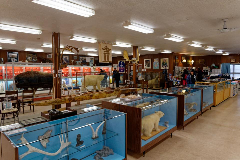
It used to be called the Eskimo Museum, but Eskimo is a term which has fallen out of favour; itsanitaq is an Inuit word meaning “things from the past”. This was explained to us by Lorraine, the lady in charge, who gave us a short introductory spiel,

and included further information about the principal peoples of the area.

Among the exhibits in the museum was an explanation of the script that we found on the Calm Air aeroplane safety leaflet.
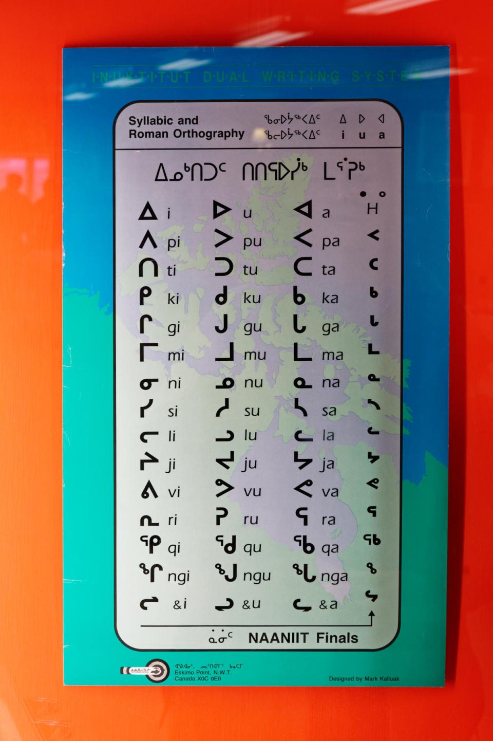
It turns out that the symbols weren’t in themselves a language, but rather a phonetic code enabling the various indigenous languages to be written down. So our safety leaflet was probably in the Cree language, that being the largest of the populations in the area.
We had a lunch stop at the Churchill Northern Studies Center, a non-profit facility that promotes and facilitates research and education about many issues that affect the northern regions, with an emphasis on sustainability and climate change. They provide accommodation and facilities for visiting researchers as well as carrying out their own research and educational programmes.

They allowed us to have our (clearly rather hastily-assembled) packed lunches in their canteen, and also hosted a tour of the place, which is sustainably designed and ecologically and environmentally secured so as not to affect the area around it.
After this, having discovered that the rescheduling of the rescheduled flight left us with time on our hands, Joe drove us slowly around the back roads whilst we searched again for bears. Unfortunately the bloody bears had buggered off again, so all we saw was another Arctic Hare

who was reasonably close and so a bit easier to spot among the rocks than our elusive ursines. The sun came out and so this one perked up a bit

before it started raining again, with a stiff and cold wind blowing, so it hunkered down again, looking distinctly unimpressed with the weather.

Mark gave us a final chance to get images of the town, starting at the Churchill sign

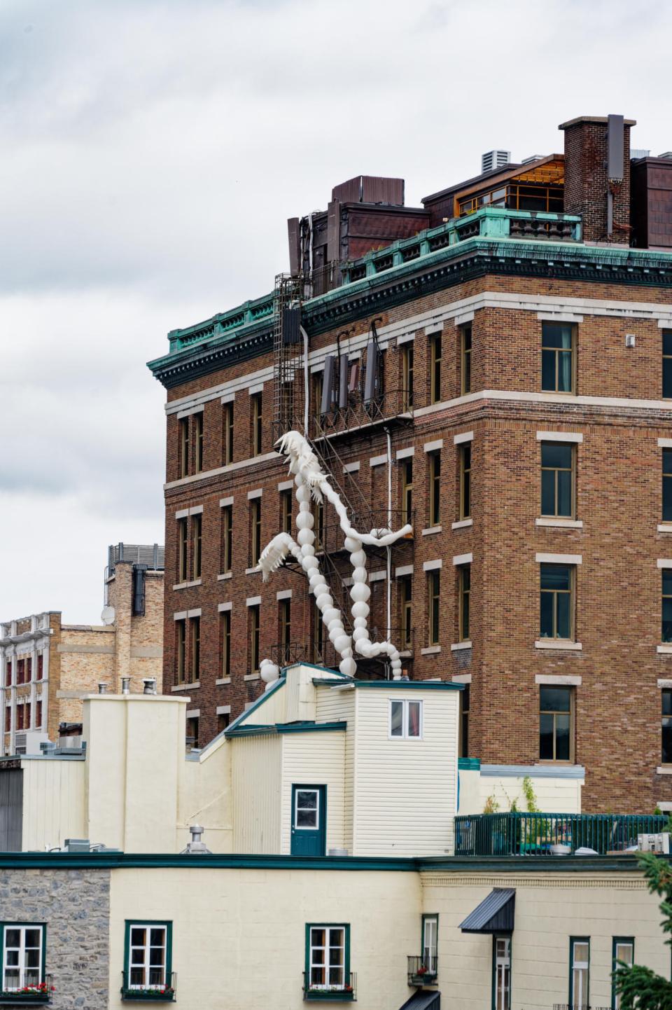
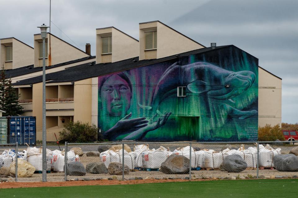
and we managed to catch a couple of grab shots of artwork we hadn’t recorded before


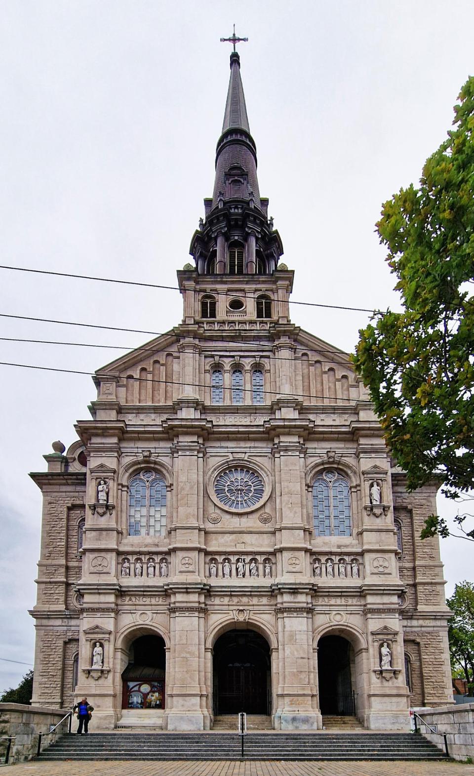
and also an Interesting Church (see our Iceland pages).

And, barring visits to a couple of gift shops, that was that for Churchill. We went to the airport and bade farewell to the guys who had made the last three days so interesting and varied.

We duly arrived into Winnipeg just in time to crash into the hotel’s Sports Bar where the group got together for a final time to consume (in some cases rather inadvisable) quantities of drink. It was a good way to end this section of our holiday which was great fun, excellently guided and shared with some nice people.
Tomorrow is just a travel day – Winnipeg to Halifax, Nova Scotia via Toronto. It’s unlikely that I’ll have anything interesting to report about two flights, so the story is To Be Continued in a couple of days. I hope to see you then; bye for now.