Cami-flage Day 8 – Friday 18th September 2020
Because today’s walk was along local paths, we had the luxury of a leisurely start; so different from our normal holidays, when it seems we have to be up early to be getting on with whatever has been set up for the day. So in our very comfortable and eerily familiar holiday hotel room, drinking the Right Sort Of Tea, we could think about the forthcoming walks and set about important planning activities, i.e. booking pub lunch spots. Just as well we did, as we discovered one pub wouldn’t be open on the day we passed it.
We were also able to check on the weather outlook, both for Surrey and Menorca. Today promised to be sunny in Surrey and cloudy in Menorca (though eight degrees warmer there) and generally speaking the prospects for our part of the UK are more conducive to enjoying the walks. We’ve been lucky so far; let’s hope our luck holds.
Plans laid, breakfast and coffee consumed, we set out on today’s walk. Because it’s close to my home, and close to my heart, this is a long post, but I hope you’ll bear with me for this one.
On this map, the village of Chobham is the cluster of habitations toppish leftish.

We have a pubic footpath going through our front yard (long story, blame the people who owned the place before us) and we really can start the walk from our front door. The path is basically fine, but gets a bit overgrown in places in the summer

and shorts are not a wise clothing choice for this nettle-strewn section. The path goes through a wholesale nursery called Daydawn
which I’m glad to say is recovering after really suffering during the pandemic lockdown. They now have areas with plants waiting to be delivered to other nurseries

but there are also remnants showing how bad it got during the lockdown, which was disastrously timed for the plant industry.

The path then goes through an area called Deep Pool. Here is the eponymous pool, which, despite stern warnings, is not at all deep, largely due to the dry weather we’ve had of late.

By comparison, here’s how it looked after Storm Dennis whistled through in February of this year.

Similarly, just along from the pool is a bridge over the local river Bourne, which looks idyllic on a quiet summer day.

But in the February rains, it was submerged at times. For a long time, the water level was very high, lapping at the bridge spars, as shown in this photo.

The path continues through to Horsell Common, which has borrowed some cattle to mow (moo…?) the lawn.

They can be found at various places in the wide open spaces of the common.

The common is popular among local horse riders

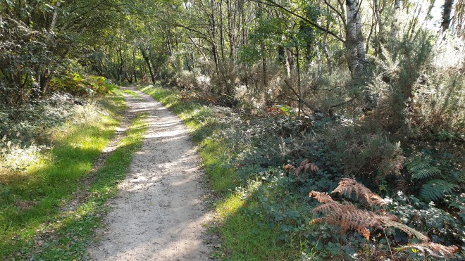
and is generally a nice place to walk, with attractive woodland paths.

This one goes past an example of the shelters which have cropped up on this and Chobham Commons. I don’t know what their provenance is; perhaps the local rangers are practising their forestry skills or something?
Along a bit further, our path took us by a café called Heather Farm, just by some wetlands that are run under the auspices of the Horsell Common Preservation Society. It’s a popular café, but any temptation we might have felt to pop in vanished as we saw the size of the pandemic-mandated queue. “Perhaps later”, we thought.

We crossed the common heading, on well-made paths, for Fairoaks Airport. There are bridges and streams, just made for doggy-paddling on such a lovely summer’s day.


Again, I thought it worth comparing the view from one of the bridges today

with how it looked last February.

As we approach Fairoaks, I’m always amused by a sign that one can just about pick out in the shrubbery

(here is it is, in more detail) .

To quote Michael Flanders, “there’s not much you can do about this. Maybe take your hat off?”
The path goes right by the airport and it’s not unusual to find a couple of plane spotters watching the action, as you are very close to light aircraft going in or out (depending on wind direction). We stopped for some moments to watch the fun as aircraft came in


and take a gin bottle shot.

The route took us onto the western end of the airport and Jane reminded me that there’s a café there. Given my strong feelings about not walking past an open café on a hike, we felt it absolutely essential to make the short detour for tea and cake. The facility is basic,

with commensurate pricing, but it’s a reasonable place to have a cuppa on a sunny day,

admire the view of the distant building work in Woking

and take another bottle shot.

We then crossed the road and headed towards Chobham Common, through an area called Stanyards, mainly because of Stanyards Farm

(which has an orchard with some lovely-looking apples ripening)

and Stanyards Cottage. Very handsome buildings they are, too.

The path carries on for some distance, crossing Gracious Pond Road

which is a reminder that we have reached Chobham Common (you’ll have been paying attention to last Sunday’s post, where we mention that Gracious Pond is a disused and now drained pond, won’t you?). And the far point of the walk is the delightful Fishpool, which you’ll also have admired in that post as well, of course you will.

It really is a delightful place, with young moorhens piping as they dabble about and, quite surprisingly, water lilies still open and thriving.

It is, of course, a good environment for another bottle shot.

and we left with one last look at the peaceful and lovely water (hence the title of this post).

The path carries on back towards Gracious Pond Road past another shelter, this one with real living material as part of it,

and a massive ants’ nest.

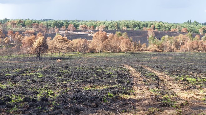
I really like the paths along this part of the common, which have a different character from the typical woodland paths hereabouts.

The route took us back (via a short, but nonetheless very unrewarding, stretch on a main road) towards Chobham, then branching off on a path

which all of a sudden brought us out into the middle of Fairoaks airfield.

I was hoping for some more aircraft action,

but no luck, so we carried on, past a very unusual sign,

to the next stage of the walk: through the parkland setting of the McLaren Technology Centre (McLaren the Formula 1 racing team and upmarket sports car manufacturer). The Centre is a stunning building, which seemed a good backdrop for a bottle shot.

As you can see, McLaren are big on privacy and one can’t get close enough to the main building for a really good photo. Here’s the best I could manage.

The park is quite nicely landscaped, with lakes and areas with picnic tables for people to, well, picnic at.

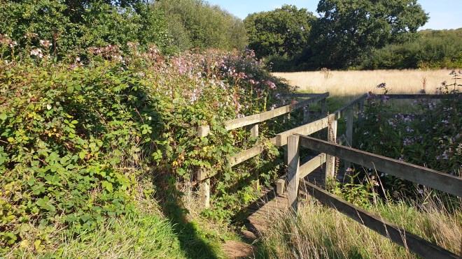
After McLaren Park, the route re-enters Horsell Common beside a couple of houses, one of which has, unusually, a totem pole outside it; this looks as though it is creative re-purposing of the remains of a tree…

We carried on to the main path that leads across this main part of Horsell Common. It’s a long, broad path

which is normally a-buzz with people, but which today was very quiet indeed. Perhaps people’s joy at schools going back means that they can’t be bothered to skive off on a Friday afternoon? Who knows? Anyway, the path is world-famous because it leads past a sand pit. Not just any old sand pit, you understand, but the very one where H. G. Wells’s Martians first landed when they made their bid for Planet Earth!

Off to the side of the long path are some steep drops which are a great attraction (on busier days than today) for kids on mountain bikes who love nothing more than to go plummeting off the edge.

Today, the common was very peaceful. We past a handsome stand of trees in lovely light

which gave me the idea to try an artistic shot with ICM (photographer’s jargon for Intentional Camera Movement). It only took a dozen or so attempts to get something that looked approximately how I wanted it to.

and then we headed off on the rest of our route which happened, goodness gracious, to lead us near to Heather Farm, where we were able to get ourselves a final tea-and-cake refuelling before heading the last mile or so home. Today’s mileage was 10.82, well in excess of the 8.11 of the corresponding Menorca outing. We’re now about 5 miles up on the overall required distance.
We feel very lucky to have such great walking countryside right by where we live; being able to reach it quickly for daily exercise certainly helped make lockdown bearable earlier in the year. As you’ll have noted from the other posts in this series, we’re near Windsor Great Park and the Surrey Hills, both lovely areas for walking in. Tomorrow’s walk is an interesting one in the Surrey Hills, involving gunpowder, so I hope you’ll come back to this blog to Read All About It then.