
Wednesday 23 August 2023 – Long post warning! Two days’ worth!
The forecast for the day was for it to be very hot, later on, but we only had some 10km to cover, so we thought we could treat ourselves to a lie-in and a hotel breakfast. So the alarm went off at 0530, we were first in the breakfast room at 0700 and were on our way at 0730, with the dawn, as ever, behind us.

The walk itself was easy, being almost entirely flat and very short. There was not much shade, so we were grateful for the serendipity that we had been able to break our journey at Viana, rather than being obliged to carry on; in the afternoon temperatures of yesterday, that final 10km would have been horrid.
Not only was it short in distance, but it was short on scenery, too. You can see what we thought was noteworthy along the way in the Relive video.
There were a couple of points of interest as we went along, though.
The route was, like previous days, very much in Wine Country. We noticed a difference between the cultivation of vines, with some, which looked like old vines, having clusters of grapes low down, near the trunk


whereas others were arranged more like we have been used to seeing in the vineyards of other countries.

One can imagine that the former have to be hand picked where the latter might be machine-harvestable. We also saw some very young vines, just bring trained along the wires.

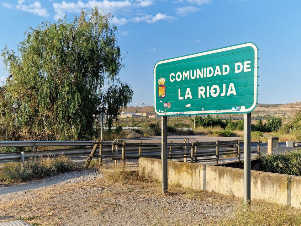
The wine theme was front of mind as we changed provinces, too – we left Navarra and entered the Rioja region, or province.
(Spain is divided into both “autonomous communities” (often referred to as “regions”) and “provinces”. There are 17 autonomous communities and 2 autonomous cities (Ceuta and Melilla). Within the autonomous communities, Spain is further divided into 50 provinces. Broadly speaking, the regions handle the legislation and the provinces the administration. So, for example, Catalunya is a region – and a troublesome one, if you happen to be in the Spanish national government – and Barcelona is a region within Catalunya as well as a city within its own region. Rioja – properly called La Rioja – is both a region and a province.)
I hope you were paying attention as there is a test later…
It’s fairly clear at which point one enters Rioja.
Bottom right of the picture, you can see a stone post, which is quite interesting. It’s the ancient marker of where three regions meet, marked entirely illegibly on the three sides of the triangular post.


Alongside Navarra and Rioja is Pais Vasco, the Basque country.
We passed the Ermita de la Virgen de Cuevas. “Ermita” has a variety of meanings, from “hermitage” to “shrine”, but whichever this is,

it has some nice tiling

and a very striking mural

which Jane considered had no little inspiration from Hieronymus Bosch.

The waymarking was, like the rest of the Camino so far, very clear, with many official marking posts and/or signposts,

some less formal waymarks,

some novel ways of supplementing the official posts

and some nice encouraging ones.

We saw our second matched pair of pilgrims, too.

These were actually identical twins, so a really matched pair. This was on the way into Logroño, which, from a distance, is just this modern-looking town, with a wide sprawl.
It’s not until you get close that one can make out landmarks in the Old Town. As you approach, though, there’s a very charming encounter awaiting the weary pilgrim.

Continuing a tradition started decades ago by a lady called Felisa, there is often someone there to greet the pilgrims with a smile and a stamp for their credencial. Felisa died in 2002 and her daughter Maria apparently carried on in her place but has also since died. I don’t know who greeted us this day, but it was nice to see the tradition respected.

It’s at this point that one can start to make out the Old Town buildings of Logroño.

We crossed the Puente de Pedra to get into the town

with its Information Point – the Punta on the Puente.

and made our way into the old town and to the old main street, Calle Mayor and its eponymous hotel. It was only 10am at this point, and, unsurprisingly, our room wasn’t ready. Fortunately, since we’d only had a short walk, we were in reasonable nick and so it wasn’t too much of a hardship to have to wander around Logroño for a while until the hotel called to tell us the room was ready.
In any case, we had some shopping to do. We needed a pharmacy in order to get some more surgical spirit (for foot maintenance, not thirst quenching, of course) and a supermarket for some fruit and other snacks. We stumbled into the first pharmacy we saw (like a French city, there is a profusion, so it’s not difficult to find one), and it was very attractively laid out. I had plenty of time to take a photo as the pharmacist gossipped endlessly with the lady in front of us in the queue.

The supermarket gave us the opportunity to buy what we needed and also to reflect on how difficult it is to get international branding right.

We were a bit peckish so headed for Calle del Laurel, which a friend had told us was a good place for tapas bars, and again serendipity came to our aid as the first bar, the engaging Taberna del Tio Blas

was open and, furthermore, served an extraordinary range of pintxos – the Basque interpretation of tapas. The name derives from “pincho” a spike, since the ingredients are secured with toothpicks.


As we were munching through our selection, we were hailed through the bar’s open windows by a “Camino family” member from our first days on the Camino; a Canadian lady called Lesley, who had made it to Logroño the day before and was having a rest day. We got chatting over a speciality of the Taberna, a Granita – basically a Rioja-based slush puppy – which both Jane and Lesley thought delicious. I stuck to beer, not because I didn’t like it but because I wanted to stick with what I knew. Lesley confirmed that the final 10km yesterday from Viana was, indeed, brutal, so we were very glad for the way our route had worked out.
Since Lesley and others had made the extra mileage and will now be a stage ahead of us, we wondered if we would now start to build a new “Camino family”. Over the first week, we’d encountered familiar faces on multiple occasions as a cohort moved through the towns and villages. But now these people are likely to be ahead of us and so I suppose we’ll start getting used to a new set of peregrinos.
En route back to the hotel, who had called us to tell us the room was ready, we ducked into a very striking-looking market building, the Mercado San Blas,

where business was brisk.


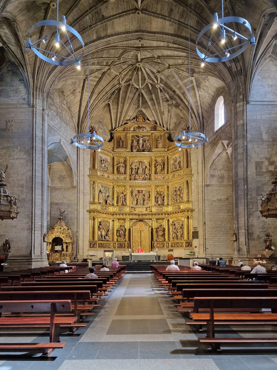
Our route back to the hotel took us past the cathedral

with its extraordinary entrance

and equally extraordinary interior.


It even has a Michelangelo painting – kept in a secure and darkened case.

Regrettably, we did’t have a 50 cent coin to use to turn illumination on for the painting; the above was the best I could do, but once again it demonstrates how good mobile phone camera technology is these days – in real life one could barely make out the painting at all.
The hotel, we discovered, is a four-star hotel. The discerning traveller will know this from various clues: you get two pillows! each!; and the laundry costs a bloody fortune. Oh, how we wished we’d taken up on the offer from Jose in Los Arcos to do our laundry for €1! To do all our necessary items would have cost hundreds, so we ended up handing over only difficult items like shorts and shirts and doing our own knickers and socks.
And so we took our rest in the hotel. Los Arcos to Logroño – a 28km-long stage which our organisers fortunately broke into two bite-sized chunks for us – is number 7 of the so-called “Brierley stages”, named after John Brierley, the author of many popular books about the Camino, one of which is helping us along our way with very useful information and insights. John died in July and Jane noticed that his obituary recently appeared in The Times.
Having rested, we once again fell foul of Spanish dining traditions and Google. We wanted to go out for a decent meal (the hotel may be four-star but it offers neither dinner nor a bar) but it was around 5pm. Google swore that Café Moderno was open and its own website gave us to believe that it served full meals. It was close by – a good thing since the outside temperature was 42°C – so we went there. It’s a great bar, with a nice vibe

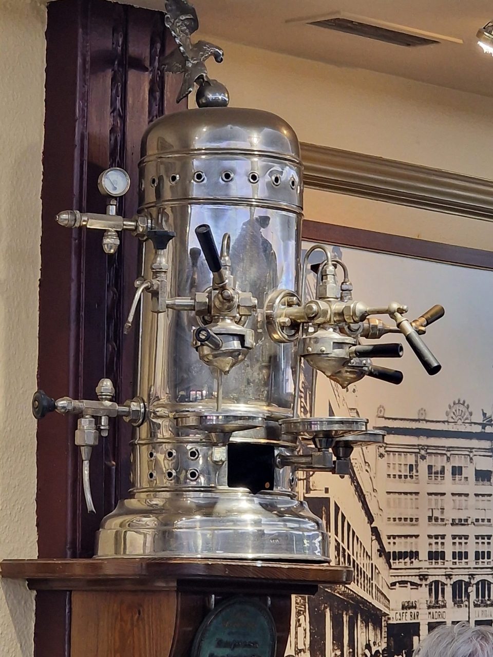
and a wall full of interesting objects,
but all it offered was tapas. We both really wanted a proper meal, with vegetables, so moved on after just a drink. We tried Restarante Iruña, which Google told us was open; but it was so closed it was actually difficult to find. However, it was in Calle Laurel and Good old Tio Blas was open so pintxos it was again.

Thus ended the day, with an early night and the prospect of a rest day spent avoiding the heat. Here’s Accuweather’s assessment.

Thursday 24 August 2023 – When we woke at about 8am, the temperature was 20°C. When we sat down to breakfast at 9.30 it was 25°C. By the time we’d finished breakfast it was 30°C. And when we went out at about 11am it was 35°C. As we came back from wandering about it was 40°C and I for one was very glad to get back into the cool of the hotel. But we covered some ground looking around Logroño old town.
Unsurprisingly, this being a pilgrim route, there are many churches. Unsurprisingly, therefore, lots of photos of churches follow. Just so you know.
The first one was the Church of Santa María de Palacio, which was actually being thoroughly worked on by builders, and so was half screened off, with the Important Bits brought into the working half of the church for services.

There were a couple of lovely stained glass windows


which cast nice light.

We also visited San Bartolome church, the oldest church in Logroño

which has an amazing 13th-century porch.

Inside is not opulently decorated

and features a noted carving of Christ on the cross.

The final church we visited was the church of Santiago el Real.

The pavement outside, popularly known as Plaza de la Oca, displays a representation of the “Game of the Goose“. Pilgrims can “play” the stages of the Camino de Santiago and its most representative monuments. This mosaic game was made in 1991 by Ricardo González, with the collaboration of the sculptors Félix Reyes and Pepe Iglesias. Here’s a fragment of the game as laid out in the plaza.

Beside the plaza is the Santiago fountain, also known as the Pilgrim’s Fountain.

This church also has a magnificent doorway.

We stepped inside, but a service was under way, so I just grabbed a shot and we left as discreetly as we could.
Logroño has another religion besides Christianity – wine. One thing I hadn’t appreciated until very recently is that it’s the capital of the Rioja region. The Camino runs along one road, Calle Ruavieja, which was a centre of small-scale wine production since medieval times, home to several wine cellars, mainly built in the 16th century. Some of the old bodegas are still there, albeit no longer active.

There is a museum on this road called “El Camino del Viño” which gives an engaging insight into the traditional ways of making wine, based around an excavation of one of the buildings, showing the pits where grapes were unloaded, trampled or pressed, turned into wine and stored.

Presses and other equipment from the 18th century are also on display, and across the street an ancient cellar from which hospitality would be offered to the pilgrims of yesteryear.
As we walked around, we saw a lot of street art (among the ubiquitous graffiti).


and there was one very striking mural to be seen,

showing a figure covered in Credencial stamps, including (if you look carefully) Felisa’s.
We’ve seen a lot more and wandered surprisingly far and wide, given that the temperature was 40°C – city walls, pilgrim statues, the Rioja Museum (which is about the history of the region, not the wine), but I feel I’ve regaled you with enough (probably too much, actually) about our time here in Logroño.
We move on tomorrow – a shortish walk of about 13km to Navarrete. Accuweather predicts cooler temperatures – all the way down to 30°C! We’re hoping for a light day to ease us back into the habit of daily walking until our next rest day. I might bring you an update tomorrow, so better get some rest in just in case, eh?


