
Cami-flage Day 7 – Thursday 17th September 2020
We’d been looking forward to this walk with a mixture of anticipation and dread, for a variety of reasons. Firstly, it represents the halfway point of the Cami-Flage project and we had no idea whether we’d still be mobile, far less up for yet another 10-mile walk, at this stage; secondly, it is the most challenging of all of the UK walks we’d planned, and, as I said in yesterday’s post, we are both lighter and fitter than the last time we tried the walk, but there was still a frisson of uncertainty around the day’s exercise, which was to tackle Box Hill (the mountain in today’s title).

Box Hill is probably the best-known area of the Surrey Hills on account of its inclusion as part of the cycle racing at the London 2012 Olympics. It’s a hugely popular area with cyclists and walkers alike, but the cyclists stay mainly on the road and the walkers mainly on tracks so there’s not a lot of conflict.
What there is a lot of, is up and down, as you can see from the profile on the bottom of the picture above and you will also understand from reading on. Given my aversion to walking up steep hills in searing heat, then, I was glad to see that once again Surrey had better weather for the purpose of the day than Menorca.

The Saturday Walkers Club route that we followed officially starts from Westhumble Station. However, bitter experience tells that there is scant parking there, as it’s a tiny station (see later). So we started at the cyclists’ and bikers’ caff nearby, called Ryka’s. It’s a perfectly good caff, and place to park and visit the loo, but one has to be careful of its closing time (see later). Walking from Ryka’s towards the station takes you through a very colourful underpass

past some nice houses to the station itself.

There was actually some parking available today, and we also noticed that the station’s name has changed. It’s now Box Hill and Westhumble.
Crossing the road above the station takes you to a path, through a field

and to the foot of the first (of many) uphill stretches.

The path goes through something engagingly called the Druid’s Grove, although the sign telling us this has now disappeared, possibly consigned to the darkness, I don’t know. Anyway, we pressed on uphill and the path took us past some remarkable yew trees – huge, old and still alive.

(I have some work to do to try to assemble multiple photos into a single gestalt, but I hope the above gives some idea.) After the last of the yews, the path takes another uphill turn

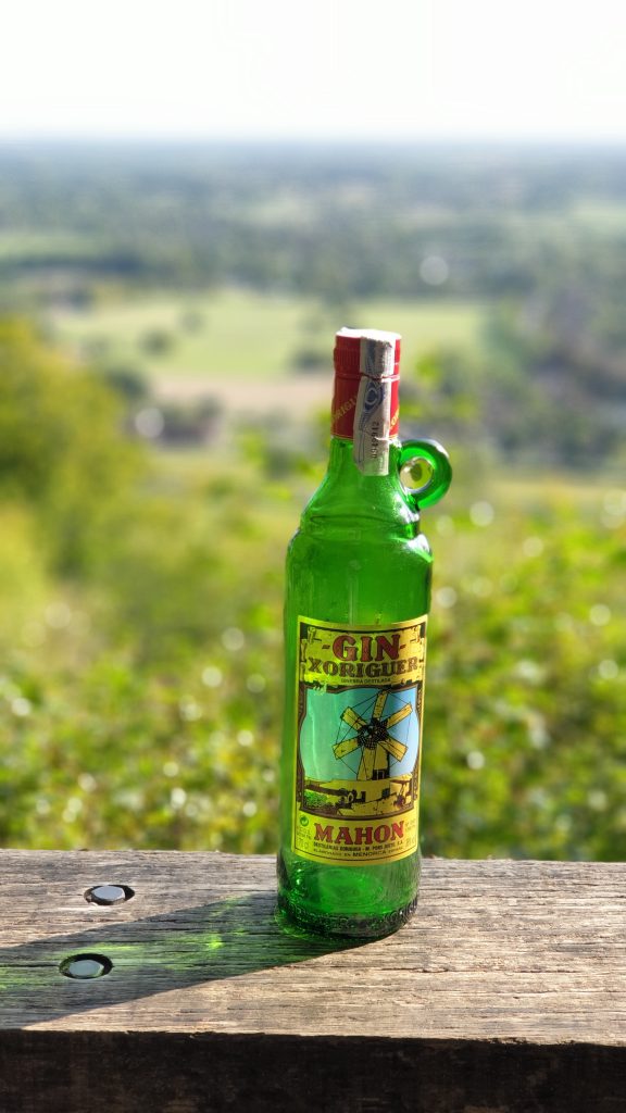
which leads into sunlit uplands with a nice view, the sort of thing that is somewhat enhanced by having a gin bottle in it.

The trail then goes past a Big House called Norbury House; after a short while, you can dive off to another viewpoint, which, again, provided us with a chance to air our gin bottle.

The path then continues beside a sawmill. We were quite surprised to see that an enterprising soul had set up a coffee stall there and seemed to be doing reasonable business.

We didn’t stop for coffee, because we knew that in the village of Mickleham, quite nearby, was a pub (we normally walk past it on this route, so I was overjoyed that today we would have a chance to stop and sample the beer). It’s a walk down into Mickleham and then across to the pub, the King William IV.

Pandemic restrictions means that it currently operates only outside, but we were allocated a spot and decided that a sandwich would help the beer go down well, so declared a lunch break.
After a nice pint (well, a quart, actually), we moved on. The next bit is, would you believe it, uphill.

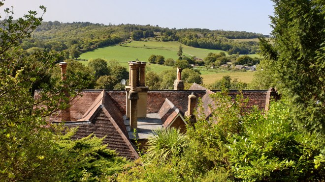
and leads to a level path with one of my favourite views that includes roofs and chimneys
before plunging uphill yet again.

This is the start of quite a long but not too demanding uphill path through woods, and it held something of a shock for us.

A huge and once beautiful beech tree had clearly suffered some significant damage, presumably in one of the various storms since we last passed this way (just over three years ago, for a variety of reasons).
The path leads on and up and then reaches a wide open area called the Gallops.

It’s called that because it’s been used to train racehorses, and one gets the firm impression that riders still use it today.

At the far end, we dived off left into the woods for a steepish downhill plunge to a path where we met yet another surprise – a lady out taking her parrot for a walk.

Our track then joined a National Trust track called the Box Hill Hike, and we stayed with it for quite a distance as it went up

then down

then up

(the steeper bit, natch)

heading, via some lovely views

to the highest point of the walk which is by a residential neighbourhood which is rather dull to walk through

albeit leavened by this outbreak of levity.

After the high point we went, rather unsurprisingly, down, and eventually quite steeply so

as the path joined up with the North Downs Way for a spell

before going, would you believe it, steeply uphill again.

The compensation for panting up the steps was a nice view over Brockham,

a perfect opportunity, as ever, for the participation of our gin bottle.
The path (this is beginning to sound like something by Gerard Hoffnung) goes down again before turning steeply uphill

and up the final, most testing part, which is basically up the steep side of the Box Hill escarpment.

It may not look very steep in the photo. Do Not Be Deceived. I think we were both quite pleased that we were able to get to the top of this without stopping (Jane) or blacking out (me). The reward is a spectacular view from Salomon’s Monument, enhanced, as all the others, by our gin bottle.

The next important landmark on the track is the Box Hill Café,

at which point something like tragedy struck. It should be writ into law that one cannot pass a café on a hike without stopping for tea and cake. But we suddenly realised that time had moved on, as it does, and if we weren’t reasonably swift about things, our car would get locked in to the Ryka caff car park.
So, cakeless and unfortified by Earl Grey’s best infusion, we sped past the fort

and headed down the hill, yomping past the view across to Denbies Wine Estate (that’s part of next Wednesday’s entertainment, stay tuned)

and of our starting point down by the roundabout

and hurried back to our start. We discovered that our mileage (10.63) was a bit down on the Menorca equivalent (11.74), but our elevation gained, at around 600 metres, was roughly double its equivalent, so I hope we’ll be forgiven by posterity; in any case, we’re still some 2¼ miles up overall compared to the Cami route round Menorca at the same stage.
We have now effectively walked from one end of Menorca (Mahon) to the other (Ciutadella) and, I have to say, we’re still quite fresh. All that time exercising during the pandemic lockdown period has paid off.
Tomorrow, we have a 9-mile stretch to cover, but we have the luxury of being able to start from our own front door. There’s no pub, but there is a café (which serves beer as well as tea and cake) so we have a refreshment stop to look forward to as part of the day’s activities. Please drop by to see how we get on – see you later!