
Thursday 23 September 2021 – Actually not Atatürk at all, but this was my mnemonic for Turqueta, which was the mid-point of today’s walk. This is all a bit confusing: the Cami360 team view a beach called Son Saura as the end of their section 12 which starts at Asterix Cap d’Artrutx; however, the formal Cami de Cavalls section 12 actually ends at Turqueta. Luckily in both versions section 13 ends in Cala Galdana, so that was our end point for the day.
Whatever, you can see the tl;dr Relive version of today here.
So, prompt at 0845, Maria turned up to take us to the start of today’s walking. She actually set us down a kilometre or so further along the trail than we left off yesterday; but since that would only have been paved walking, I think we can gloss over that minor detail without thinking we cheated in any way.
So, off we went


bidding Cala en Bosc a fond farewell.

We passed a beach where only a couple of keen beans had stirred themselves to get to a sunlounger

along a path which showed evidence of the hard rain we’d had over the last days.

Largely speaking, the section to Turqueta consisted of grinding along the same rocky type of path that we’d had since Cala Morell; but because it hadn’t rained hugely, at least the mud was easy to avoid (most of the time).
We were a little concerned about the weather. The Met Office had forecast a 40% chance of light showers for much of the day and I had optimistically opted to wear running shoes rather than walking boots. But whilst the weather ahead of us looked OK

what was behind us looked considerably more ominous.

In the end, showers over took us, so we hastily put rain covers on the backpacks and scrambled into our shower-resistant jackets. Of course the weather gods toyed with us for a few kilometres; the rain stopped, so we took off the jackets because it was warm and sweaty with them on; so the rain started again and we put on our jackets. After a bit, we decided that it wasn’t going to rain at all hard and stayed jacketless; fortunately this was the right choice.
There wasn’t a huge variety of interesting views as we ground our way along the rocky path; just a few things to note as we went by:
Some steps down a tunnel to a cave in a cove;


the “remarkable” cove at Son Saura. Well, the Cami360 booklet called it that, but it’s just this cove, really;


some interesting rock formations jutting into the sea;

and some blockhouses, used to guard places where enemy forces could land – the holes are to enable aiming weapons at the enemy. Some of these blockhouses date from the 18th Century (France v. England) and others from the Spanish Civil War (1936-9). (This information courtesy of the excellent Sunflower Landscapes book on Menorca.)


We reached Son Saura, (the Cami360 version of the end of a stage; I hope you’re keeping up, here)

which has a beach with a lifeguard station (not manned today, hence, I suppose, the red flag).

It also – praise be! – has a longish section of boardwalk which relieves the tired Walker from the tedium of wading through sand.

It was quite colourful

as was another cove we passed on our way.

The next point of interest was Atatürk Cala Turqueta (the formal end of stage 12) which is a very popular beach.


From here, the terrain changes somewhat, from coastal rocks to scrub and pine forest.

The trail rises and falls as it leads through ravines (Barrancs)


and eventually arrives at another very popular beach, Cala Macarella.

An important distinguishing feature of this beach is that it features a refreshment stop.

We only had another 5km to go to get to Cala Galdana, so a major break in the walk wasn’t on the cards, but all the same I’m very proud that I restricted myself to an ice cream and didn’t insist on having a beer. We found an improvised seat for our ice creams

and, slightly cooler, set off on the final leg of the day’s walk. The way up from Macarella is quite steep and punters are offered a choice between the Old Way, which is the Cami track, and the New Way, which is steps.

We (of course) took the trail, but it doesn’t make much difference, as they come together at the top.

There follows a mostly gentle descent into Cala Galdana, which you first catch sight of from the path.

I’ve artfully tried to hide it behind trees, but on the left you can see an extraordinary excrescence, which is a fucking great Meliá hotel block. I don’t know how much they paid to get the planning permission through for this, but its existence is a sin against all that is good in this world.
Cala Galdana is another fairly substantial tourist area, but a bit less in yer face about it than Cala en Bosc, for example. As you approach, there’s a bridge which, it has to be said, has seen better days

but the town itself is not unattractive.

Our accommodation was an apartment in Alta Galdana Playa. We spotted a supermarket en route as we walked towards it, and so headed there to get essentials, but mainly milk for a Nice Cup Of Tea once we’d arrived (since tonight and tomorrow night are both in apartments, it made sense to buy supplies for two days). The Cami360 people had done a good job of putting our baggage in the apartment and telling us how to get the key, so we were inside the apartment quickly and outside a cup of tea even more quickly.
Stats for the day:
- 11.15 miles, according to Garmin
- 177 metres climbed, almost all in the last section from Turqueta
So our cumulative mileage is now up at 94.52 miles, which is 152km. The Garmin mileage is slightly inflated compared to Relive and OutdoorActive, though why this should be when they’re all using the same GPS engine (my phone) is a mystery to me.
(We have 7 more stages to do over 4 days – 61.77km/38.4 miles – before we can spend a couple of days relaxing back in Ciutadella. The weather is looking hot and not rainy, according to the weather forecast.)
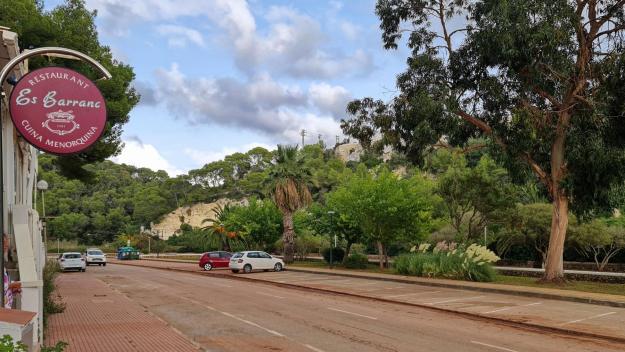
Our apartment was fine – it had a kettle for making tea and a fridge for storing the milk; we didn’t feel the need for much else when we arrived – and also is a very short walk from a restaurant called Es Barranc (The Ravine). You can see why they chose the name.
So, after a couple of mugs of tea and a quick hose-down, we headed there for a Nice Lunch. It was very quiet, but this is late season and we were there late afternoon. It’s highly rated on tripadvisor if you regard that as being any guide, and we can certainly vouch that the food was very good and the service very pleasant.
We tottered back to the apartment and had a relaxing evening respectively blogging and catching up on the details of tomorrow’s walk. This runs for 11.5km/7 miles from Cala Galdana to Sant Tomas and is billed as having the most elevation gain of the southern half of the Cami de Cavalls – 241m. This, though short, is quite sharp, as we’re somewhat out of practice at this Going Uphill lark; and the Met Office forecast is for a hot sunny afternoon (28°C), so we may well get moving quite promptly in the morning. Tune in tomorrow to find out how we got on, why don’t you?