Tag Archives: Holiday travel

Rocky Mountain Hire Car

Tuesday 6 September 2022 – We had a simple task today: transfer from Banff to our next hotel, the Fairmont Chateau Lake Louise, some 38 miles away along the Trans-Canada Highway.  Mode of transport – hire car; Google maps estimates the journey time as just a smidge under three quarters of an hour.

It took us all day. It included some two hours of walking. Obviously.

This is not, I should say, because we had any significant problems, although the guys at Avis increased the  chaos level of the start by initially handing us the keys to The Wrong Car; it was because Jane found us Interesting Things To Do On The Way.  The combination of Jane’s organisational skills and Google Maps’ dispensing of local knowledge is truly a thing to wonder at.

So, no, we didn’t drive directly the Lake Louise and sink gratefully into a hot bath or a cold cocktail.  We wouldn’t even have started out on the Trans-Canada Highway (Highway 1) had a section of the alternative Bow Falls Parkway (Highway 1A) not been closed.  However, closed it was, so we took Highway 1 until the relevant exit and backtracked in order to get to our first Interesting Thing To Do – Johnston Canyon.

Almost immediately we left the main road, a photo opportunity arose around a bridge, a river and a mountain.

The bridge has no name and is simply in a photogenic location rather than being itself a thing of beauty; but it does have an osprey’s nest in it.  The river is the Bow River, whose eponymous Falls we had seen in Banff and which was still a very fetching shade of glacial blue. The mountain is Castle Mountain, which you may recognise (because you have been paying attention, haven’t you?)  from photos from different viewpoints in previous blogs. It was once renamed Eisenhower mountain in recognition of the enduring legacy of Dwight D. Eisenhower’s impact on North America.  Reportedly, he was such a humble man that he never really saw the need for this recognition; and in any case there was something of a backlash from the locals who hadn’t been consulted on the name change. So its original name was restored, but the peak on the right hand side is called Eisenhower Peak.

This was the first digression, but we were soon at the attraction which Jane had planned we should visit.

(I find the French naming of these things amusing.) This canyon features a largely paved walkway beside the river which carved it out in the first place

and shows its glacial origins by its colour.  The walkway leads to Lower Falls and Upper Falls, and is a popular family day out – the walkway was quite, but not intolerably, congested. (We had to park in the overflow car park, which was about a quarter full. Gawd alone knows how packed the walkway would have been on a busy day.)

There is a bridge over the Lower Falls which leads to a small cavern giving a special viewpoint but which can only accommodate about two people at a time; this was obviously a popular activity, with a slow-moving queue.

We took a look at the falls, which are very attractive, although any Icelander would look at this and think (in Icelandic) “Hah! Making a foss about that?” *

We couldn’t be bothered to investigate the possibilities offered by the small cavern, so headed towards the Upper Falls.

Not very far, as it happens. The route thither was closed for “construction work”.  Never mind, we enjoyed the digression overall.

The overflow car park I mentioned had decent washroom facilities

which I schoolboyishly decided meant you could only pee on the left and poo on the right.

Our continuing journey took us back on to the main Highway 1, which rather nicely features wildlife corridors every 10 km or so, enabling animals to cross safely.

The scenery was quite striking, with lumpy bits and glaciers becoming more common.

Our next Interesting Thing To Do was, indeed, very interesting indeed; something that Jane had learned about on the Rocky Mountaineer whilst I was absent taking photos out of earshot of the commentary – the Spiral Tunnels.  Near a town called Field are two tunnels, completed in 1909, which twist trains back on themselves as a way of enabling transit without an unacceptably steep gradient – the steeper gradient had been tried but fatal derailments and runaway trains rendered a different solution necessary.  The link above explains how the tunnels work, but the practical upshot is that a train going through the lower tunnel twists back such that you can see it both coming and going, as it were.  We were fortunate that a long freight train was indeed going through it as we passed, so I tried to convey what goes on with a video.

The carriages barely visible through the trees in the foreground are towards the rear of the train; the middle of the train can be seen entering the tunnel in the background; and in the middle is the front of the train, having gone through the tunnel and turned through 270° before exiting, so now apparently moving in the opposite direction to the other parts.

Helpfully, there is an information board

and a model.

I hope that’s clear, then?

Field itself, although an unprepossessing town, is noteworthy for its proximity to the Burgess Shale – fossil formation containing remarkably detailed traces of soft-bodied biota of the Middle Cambrian Epoch (520 to 512 million years ago), and presumably discovered by an archeologist on a Field trip.  Thank you.  Thank you for reading my joke.

Our next stop was at a thing called the Natural Bridge.  I had no idea what this translates to, but it sounded intriguing and there were signposts, which made it easy to find and gives it credibility as an Interesting Thing To Do (ITTD).  Near it, Jane found a signpost which amused her.

I should point out that part of the Burgess Shale is the Mount Stephen Trilobite Fossil Bed. So, there.

The Natural Bridge is quite a sight (and sound).

and the colour of the water shows that it’s glacial in origin, although the silt level is very high, giving it a grey, milky appearance.

Google Maps asserts that there are Lower Falls a short way along a trail, and indeed there are, but getting a decent photo of them required determination, courage and mountaineering equipment.  Jane clung on to a tree whilst hanging out over a chasm to bring you this image

which is not at all bad, but it doesn’t do it real justice.  No matter; we had seen what a Natural Bridge looks like.

Our route to our final ITTD went by some more striking scenery.

(The Rocky Mountains really does this sort of thing rather well, wouldn’t you say?)

Paula and Sandrine, friends we had met at Farewell Harbour Lodge, had told us that their itinerary included staying at the Emerald Lake Lodge, and this sounds like it has definite possibilities as an ITTD, so we headed there.  Its ITTD cred was boosted by a car park full to bursting, so we had to park half a mile away along the side of the road.  As we walked towards it, I was wondering what we might see, when, through the trees I glimpsed something that gave me a bit of a clue.

It’s a lake whose glacial waters give it a green colour

although Jane asserts that it’s more turquoise than emerald, and who am I to argue? Anyway, the lake is very scenic; beside it is the Lodge, which consists of some equally photogenic accommodation.

Here are some more of the lakeside scenes.  I’m particularly fond of the last image.

The Emerald Lake was the last on today’s ITTD list, and anyway it was past earliest check-in time at the hotel, the Fairmont Chateau Lake Louise, so we headed there next.  Everything about it is huge

including the queue for someone to park your car for you – I wasn’t going to try it for fear of getting lost for days in the underground car park.

That’s how a 38 mile car journey can take all day and involve walking for a couple of hours.

Having heard that everything gets booked up here, we had in advance booked an early dinner in the Lakeview Lounge, which is quite aptly named.

and we enjoyed a very decent dinner which would have been dietetically blameless except for the gins.  But it was Gunpowder gin, which we’d first tasted through the good offices of friends, and so it would have been rude not to indulge ourselves.

After such an active and Interesting day, one might have thought we would retire quietly to our room and take things gently for the evening.  So we went for a walk. Obviously.  Well, the lakeside looked so pretty, we couldn’t resist.  And it was very scenic, walking along the north shore of the lake taking photos as the sun set.  The light was very interesting at times

and we managed to avoid the crowds of people who imagine that their presence in a photo improves the scene – there were a lot of these.

The hotel itself provides some nice framing opportunities

but the walk along the north shore, in dead calm conditions gave some lovely images.

And so, as the light finally faded

it was time for bed, as we had to set the alarm for 0500 in order not to miss tomorrow’s first ITTD.  You’ll have to come back tomorrow to find out what that was…..see you then.

*Foss is Icelandic for waterfall.

Rocky Mountain – Higher

Monday 5 September 2022 – We only had one item on the plan for the day, which was to travel on the Banff Gondola. The bottom station is a little way outside town, but there’s a shuttle bus and a kind soul at the hotel reception had provided us with passes that meant we could travel there for free. The bus stop was conveniently directly outside the hotel; we climbed aboard and were wafted electrically through the town and out the other side to Sulphur Mountain. The last hundred metres or so were rather slow, the reason being traffic congestion for this popular attraction, but we arrived well before our appointed departure time, wondering how they were going to manage the logistics.

As it happens, they didn’t. The queue for those who had tickets (we did) was very short

and they were happy to let us through early. I infer that the “departure time” idea is simply a matter of attempting to manage the flow of punters; there are ticket desks beside the entry queue and if it becomes popular, I suppose that ad hoc ticket purchasers will be given a later time and simply have to wait to board.

The setup is very familiar to anyone who has ridden a gondola elsewhere in the world. The Banff setup has 40 cabins each of which can seat up to four people; the cabins come round slowly to make it easy to board and then, once aboard, they whoosh down a rail to get up to cable speed and off you go. The only difference from other gondolas I have ridden was that the cabins were manhandled around (mostly by Australians, it seemed) at top and bottom instead of being moved along by machinery.

The ride up is fast and smooth, and small open windows allowed me to poke a lens out and get some nice photos of downtown Banff as we were whisked upwards.

If you know where to look (top right) you can even see our hotel.

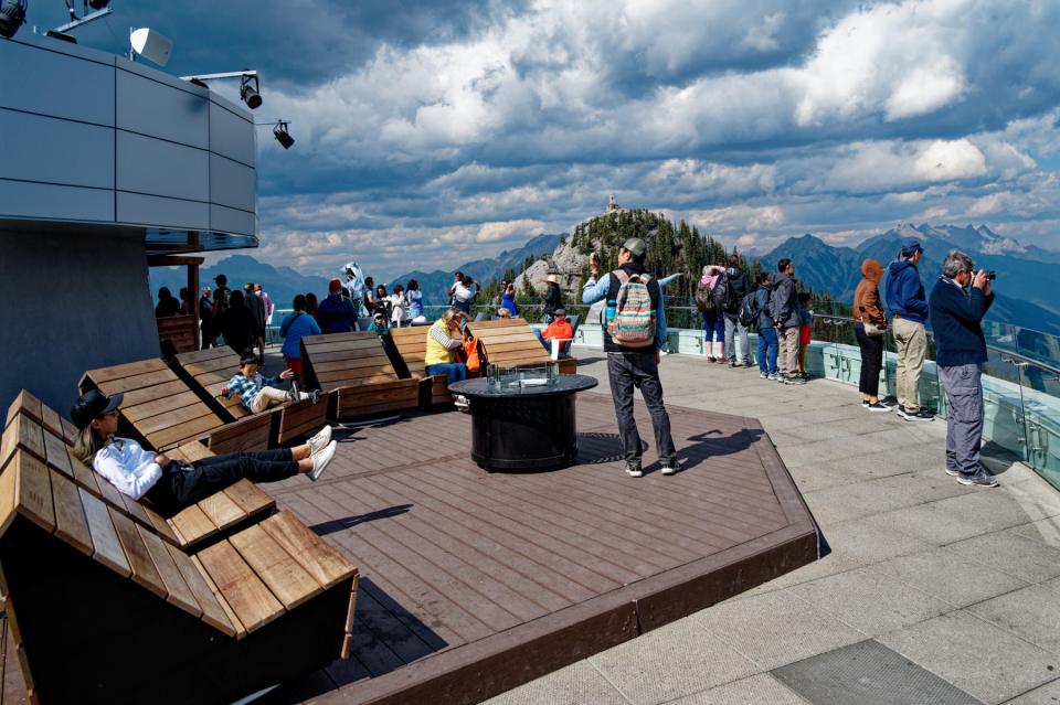
The top station is a very substantial 4-level building, offering coffee stops, a restaurant, a patio/observation deck and

a gift shop. Your exit on to the observation deck is greeted by a grizzly bear statue.

The observation deck is understandably popular

and the view from the top is wonderful, as one might expect.

There is a one km boardwalk leading to an adjacent peak

which has 83 steps down and 296 steps up; from that peak you also get some great views, including back to the top station itself.

On the walk over, we were joined by some wildlife which didn’t seem to mind humans much at all.

I’m not sure what the first bird is (maybe a Black-Capped Chickadee), but the second is a Grey or Canada Jay, unofficially Canada’s National Bird.

We also think we saw a Clark’s Nutcracker, which we’d learned about yesterday with Geoff. It has a fascinating partnership with the Whitebark Pine; it has learned how to eat the seeds from the tree’s pine cones – even to the extent of developing a special sublingual pouch where it can store dozens of seeds – and in a mast year there are too many seeds for the bird to eat, so the uneaten ones germinate and the trees spread. Much like the relationship between our Jay and Oak trees in the UK…

There was some great light playing across the views to bolster my photographic day.

After a short while and a coffee break, we headed down again. As we went, I wondered where this gondola fitted in to the skiing setup of Banff. From later research, the only conclusion I can come to is “not at all”; there are no obvious pistes leading down from the top station – just a walking trail for those of a hardy disposition – and all the ski maps I can find for Banff are of other places. So the Banff Gondola is not a skiing installation, but a tourist attraction. This explains the gift shops at top and bottom, which are rare in my experience of European ski lifts.

Back at the bottom, we caught the shuttle towards town, but got off a few stops early to have a look at the Cascade Gardens. These surround the National Parks administration building, itself quite an imposing edifice

from which decent views back over the town are available.

The gardens were originally developed in the 1930s and have since attracted some investment from China, which makes them popular with Chinese visitors, of which there are plenty. To get the photo above, I had to quickly dash in to the viewpoint where there is a perpetual queue of people taking photos of each other.

This urge to believe that an image of some pretty or impressive place can be improved by having oneself in it is something that I find difficult not to get enraged about, but then I’m just a grumpy old man. People doing selfies made it difficult to get decent pictures of the rest of the gardens, but we persevered and got one or two.

After the gardens, it was getting towards time for our late lunch, or, as they call it here, “dinner”. We dropped in to the rental place whence we should pick up a car tomorrow to chat, but there was no-one there except a customer sitting on the floor awaiting the return of staff with a car for him. To pass the time we set out to wander about a bit and ended up heading towards the Banff City Sign. This is A Thing, apparently – we’d had someone ask us where it was the day before, so we thought it might be worth going to. We did get there, and saw that it was crowded with people getting their photo beside it,

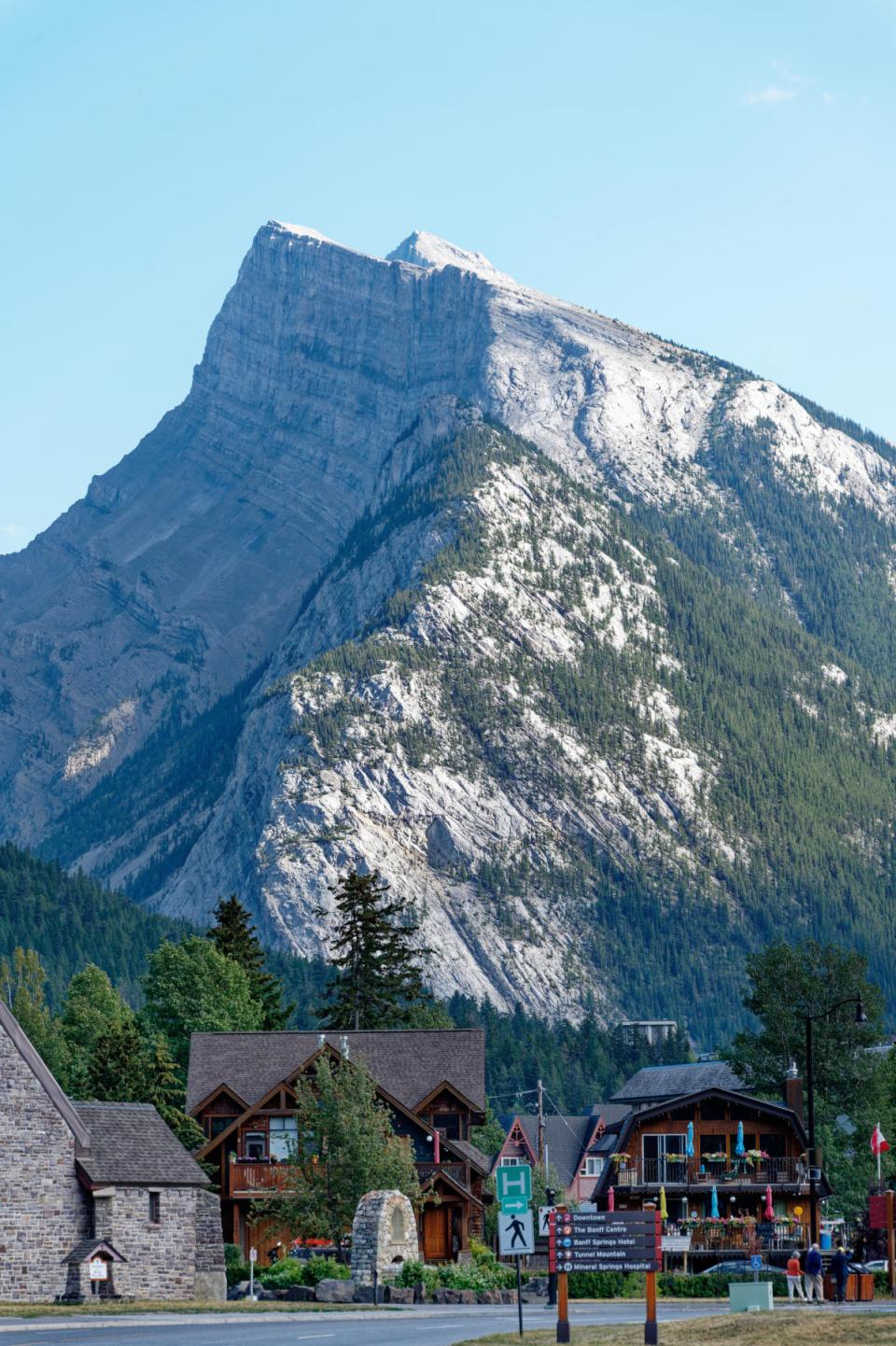
so I simply got a photo of the “ffnaB” sign and we turned back towards the town. There was still some great light on the mountainous backdrop to town buildings.

The chat with the car hire desk chappie was very brief as he was still dealing with the customer we’d seen earlier, so we just headed to the Maple Leaf restaurant – a recommendation from Geoff the guide – where we were eventually permitted to have a very nice lunch/dinner (delete as your culture dictates). They didn’t start serving food until 5pm, so we had to wait a while, but we bore this burdensome setback with heroic stoicism, a seat outside and a cocktail each.

After the meal we walked back to the hotel and indulged in further wedded bliss, with me writing this blog entry and Jane doing a bit of ironing from yesterday’s laundry, accompanied by Nice Cups Of Tea. Tomorrow we leave Banff for nearby Lake Louise, or at least we will if all goes well at the Avis desk; the journey there is short, which leaves time for some diversions on the way. I believe Jane has a plan for this. Come back tomorrow, and find out if I was right, eh?

Rocky Mountain, Hi!

Sunday 4 September 2022 – While we have made it a rule almost everywhere we’ve visited to go for an unstructured wander to explore (sorry, Kamloops – apparently you’re quite interesting after all), today was different in that the wandering would be structured – we were Going Hiking.  With A Guide.

Of course, he wanted to make an early start, so once again we had to tear ourselves from the arms of Morpheus slightly earlier than we might have liked; however, since the day was forecast to be a fairly hot one, an early start was probably best.  We met our guide, Geoff, in the hotel lobby and headed out to find the rest of the group he was leading on the hike. There were supposed to be five others; in the end, there were only four because he actually refused to take one lady on – she was, in his view, totally unprepared – wrong shoes, no backpack, no water. If it was the lady I thought I saw him talking to, he might also have assessed her as being physically the wrong shape to be taking on the hike.

Whatever, the group ended up as being just the six of us – Jane and me and two couples from Boulder, Colorado; Andrea and Dave, Susan and Scott.  Geoff took us about half an hour out of Banff to the trailhead of the Stanley Glacier Trail in East Kootenay, dispensing some wisdom, safety guidelines and information about what we’d let ourselves in for.  He described it as an eight km hike (four out and four back) of moderate toughness, which didn’t sound too daunting; but all the same he spent time making sure we had at least a litre of water each, and provided us with lunch packs.  The schedule for the hike seemed very leisurely – starting before 9am and expecting to be done by about 2 or 2.30pm.

We started up the trail

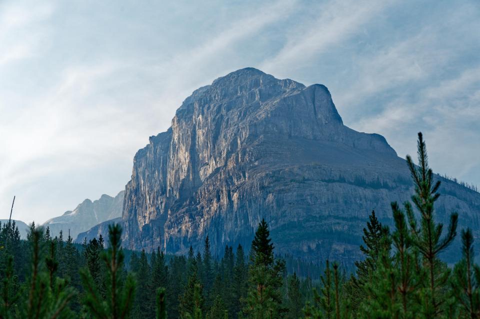
which shows, in the distance the Stanley Head Wall, a face of Mount Stanley (yes, the same Stanley that the Vancouver Park is named for).  The views as we went along were quite striking

but very hazy in places.  Much of the haze is due to wildfire smoke, as wildfires are an important part of the cycle of nature in the Banff national Park as in other parks.  The haze lightened as the day went on but it was, photographically speaking, a challenging day; allow me a geeky photo-type digression, here.

— START OF DIGRESSION: I SHAN’T BE OFFENDED IF YOU SKIP IT —

While modern cameras do a good job of extracting pleasing images from their sensors and presenting them to be viewed on a computer screen, they have to make editorial decisions about the data from the sensor in order to create such an image – so, for example, the .jpg file you see on your mobile phone screen has been extensively edited by the phone.  When I take my Big Camera (Nikon Z6) with me to Take Serious Photos, I decline to have the camera make these decisions for me, as I want a greater degree of control, so I shoot in a format called RAW, which creates an image not immediately readable by a computer without specialist software (DxO Photolab is my go-to) but which has very much more data from the sensor available for the photographer to play with in creating a final image. (In the good old days, one played with bits of cardboard and an enlarger projection on to paper; digital life is much easier.)

The practical upshot is that in challenging conditions such as today, the camera will suggest this as an image with a lot of haze in the background:


whereas I know (because I was there) that there’s much more to the scene than this image shows.  Once I’ve finished tinkering with the RAW file, the image looks like this:

Actually, the processed image is a little clearer than the reality as seen by the human eye; but I’m OK with this – what I’m after is not necessarily a recreation of that reality, but something that  may be more striking.

The net of this rambling is to let you know that I have tinkered with virtually all of the images from the hike to bring out specific elements of the image that I consider important; they are not necessarily a representation of what I saw, but I hope that they go towards telling the story of the hike.

— END OF DIGRESSION —

Geoff

is a very experienced guide, as well as a writer and scientist, and has a wide and detailed knowledge of matters to do with the National Parks of North America;  Yellowstone was the first to be established and Banff was the second. He said that the theme of the hike was “Wildfires and the Forest”, and it was very interesting to hear his perspective on forests, wilderness and managed ecologies.  His philosophy is well expressed by work published in 1995 by one William Cronon called “The Trouble with Wilderness; or, Getting Back to the Wrong Nature.” Cronon said that it was time to rethink wilderness: that the the idea of wilderness as being a place that stands apart from humanity is wrong; and that wilderness – as an area that has no humans in it – is quite profoundly a human creation.

Geoff made a striking assertion: “The forest is doomed”.  A forest is not a permanent entity; bits of it will die from logging, fire or disease.  The cutting back or burning of forests saves the trees from dying of diseases caused by overcrowding and allows the forest to support a wider range of life.  The indigenous peoples that have been in the area for tens of thousands of years knew this, and effectively managed the forests to improve their lives – a greater selection of wildlife which is easier to hunt.  Fire was an important part of this management.

When Europeans came to the area and forced the indigenous peoples out, they lost sight of this; wildfires were regarded as something to be avoided or restricted – absence of wildfires was seen as a success. The result has been overcrowded, diseased forests with a paucity of wildlife, and only now has this realisation sunk in to the extent that proper action is being taken – or, at least, would be, were political will up to the task, which often it isn’t.  A very interesting and counter-intuitive philosophy.

Anyhoo…

We passed some nice scenes of forest and creek

with plentiful evidence of previous forest fires.

Above, you can see the red colours of the fireweed that is first to grow back after a fire.

We met a grouse, unconcernedly pecking away at the path

until disturbed by some people who passed us with a couple of noisy dogs, when it flew up into a nearby tree and posed for us again.

We passed buffalo berry plants

which are prime fodder for grizzly bears.  (Their other mainstay apparently is dandelions – dandelions – not much meat or fish in these here parts). The berries are, apparently, oily but I’m still astonished that berries can sustain an animal as big as a grizzly.  Another name for the berries is soap berries, and if you taste one – carefully, just a little of the juice rather than a whole berry – you can understand why; they have overtones of bitter grapefruit juice and detergent.

After a while, the path got steeper

and we ended up, some 1,000 feet higher than the start, at our lunch spot.  We were first there, but this trail is a popular one and so we were soon joined by others.

This is a big landscape.

In the distance, at the foot of the vertical bit of the Stanley Head Wall, were some climbers.

You can just make out some dots of colour near the white boulder at the bottom of the picture, with two red dots also visible some feet up the wall.  I tried to give some idea of just how big this landscape is.

The distances are deceptive.  For example, the patch of greenery towards the bottom of the picture above doesn’t look that far away,

but, on closer examination, actually has people in it

which are difficult to pick out with the naked eye (well, with my naked eye, anyway).

I tried taking photos of the glacier

and the waterfall caused by its melting

but, as I burbled about above, the light is extremely challenging, and it has taken quite a bit of fiddling to get images that I’m happy with.  I just want you to know that I suffer for my art.

After an hour resting at the top, we retraced our footsteps down the trail.  At the bottom, a stream we had crossed at the start of the trail was showing some lovely glacial blue colour in the water.

And that was it for the hike, which had been a really nice morning – an agreeable temperature, slightly demanding without being ridiculous and giving an opportunity to listen to Geoff’s wisdom about wildlife, ecology and forests.

My Garmin thingy told me, on returning to the hotel and a source of internettery, that we’d expended some 1,300 calories in the course of the hike, which is quite a lot, and could be interpreted as justification for taking it easy for the rest of the day.

So we went for a walk. Obviously.

Geoff had mentioned an area called Bow Falls, which is about half an hour’s walk from downtown Banff.  We needed something to eat anyway, so we headed the 15 minutes to downtown, ate a decent, cheerfully served, early dinner at The Keg, and then headed out along the path towards the falls.

Downtown Banff was busy, probably more than usual because we were here over a Labor Day weekend

but the lower part of the main street has a pedestrian area and is attractive, particularly with the mountains as backdrop.

The path to the falls is a riverside walk, and one has to decide which side of the Bow River to walk on; there’s a pedestrian bridge to help when you’ve made the decision.

We went along the north shore towards the Surprise Corner viewpoint, passing some lovely bits of real estate

almost certainly worth a fortune. At the falls, one gets a pretty spectacular view

part of which is the Fairmont Banff Springs Hotel.

Given that we’ve stayed in Fairmonts in most other places, I assume that this one was full because of the holiday weekend.  Anyway, the sight of the hotel we didn’t stay in complements the splendid view rather well.

We retraced our steps to our hotel.  Along the path is a variety of artworks

including one which is some glass bats in a tree, which is a rather fetching idea.

Banff town itself is quite an attractive place, in a sort of American take on Swiss skiing town way.

And so ended a very pleasant, sunny day, with quite a few miles under our boot vibram and shoe leather.  All that remained was an evening of wedded domestic bliss – me writing the blog and Jane doing the laundry, because These Things Are Important, You Know.

The morrow brings the promise of a ride up the Banff gondola and it will be interesting to see how the logistics of that works – it’s a holiday weekend, so it’ll likely be crowded.  I’ll report back, of course, and I hope you’ll come back to see how it all went.